Low Prices, Lasting Value: Bid on Land!
Low Prices, Lasting Value: Bid on Land!
See Special Terms for additional fees
Description
13,000+ 5-Star Proxibid Reviews
Trusted by Buyers Nationwide for Over a Decade
Why do thousands of buyers choose Land of Land? Experience, transparency, and trust. Every auction is backed by an experienced team that professionally prepares and processes your deed transfer while providing responsive customer support throughout the transaction. Bid with confidence knowing you're buying from one of Proxibid's most established and highly reviewed land sellers.


 x Cancel
94 Acres Bordering Canada in Limestone, Maine!
Map/Lot: 016-005-B
Legal Description: Beginning at a point on the international boundary line between the State of Maine and the Province of New Brunswick a distance of exactly 2,765 feet south 190 west of the north east corner of Lot No. 2 in Section 12 according to Eddy's survey of the Township of Limestone..
Acres: 94
State: Maine
County: Aroostook
Taxes: Under $20 per month
Approximate Coordinates: 46°55'45.4"N 67°47'40.9"W
Aroostook County is the northernmost region and the largest county in wild, rugged, and deeply beautiful Maine. Bordering the provinces of Quebec and New Brunswick, Canada, the county is larger than the states of Rhode Island and Connecticut combined. Known simply as "The County" or the "Crown of Maine," this region blends old-world charm with modern amenities, quaint villages, and long-standing local cultures.
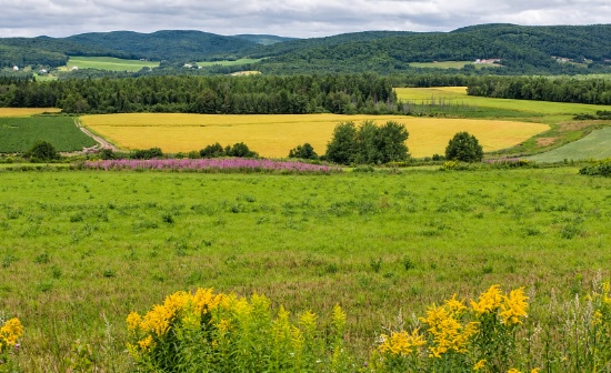
This 94-acre wooded parcel is located in Limestone and sits directly on the Canadian border. The land fronts on a private road with deeded access, reached from Grand Falls Rd (Hwy 229). Electric and telephone lines run along the public road and could be extended to serve this land. The property is mostly deciduous and mixed forest with gently rolling terrain.
The region is a water utopia, home to thousands of miles of rivers, including the 92-mile Allagash Wilderness Waterway, and more than 2,000 lakes, streams, and ponds. Hiking, camping, and bird and wildlife watching are available year-round, and winter brings 2,300 miles of groomed snowmobile trails, family skiing, and snow tubing, with over 100 inches of snow in an average season.
With friendly local folks, rich history, storybook towns, and breathtaking outdoor amenities, Aroostook County is a peaceful borderland where time passes slower. Step back into the way Maine used to be and take a deep breath of fresh pine and balsam-heavy air.
Bid now so you do not lose this terrific property!
Build Near Lake Huron in Presque Isle Harbor!
Parcel ID: 122-210-000-184-00
Legal Description: NORTHLAND HEIGHTS LOT 184.
Acre: 0.33
State: Michigan
County: Presque Isle
Taxes: Under $3 per month
Approximate Coordinates: 45°19'02.8"N 83°28'53.5"W
Welcome to Presque Isle Harbor, a picturesque waterfront community nestled along the Sunrise Coast of Lake Huron in Presque Isle County, Michigan. This peaceful, naturally protected harbor is managed by the State of Michigan and the Presque Isle Harbor Association, offering residents and visitors access to a state marina, sandy beaches, and exceptional recreational amenities.
This beautifully wooded property on Northland Heights Drive is ideally situated near Lake Esau, Grand Lake, and the crystal-clear waters of Lake Huron, providing the perfect setting for those who appreciate nature, privacy, and outdoor recreation.
Residents enjoy an impressive array of amenities through the Presque Isle Harbor Association, including a clubhouse featuring an indoor swimming pool, fitness center, activity room, game areas, and meeting spaces. Additional community features include two beach houses, three beautiful beaches (including one with boat rentals), boat launch facilities on both Grand Lake and Lake Huron, a full-service campground, and a camper pavilion.
Known as a true "diamond in the rough," Presque Isle Harbor offers a rare opportunity to experience the natural beauty, tranquility, and year-round recreation of Michigan's northeastern Lake Huron shoreline!
NOTE: The 2026 Association dues are $313. Water fees are $75.75 per quarter for a lot with a water hook-up, and $45.25 without hook-up. The buyer will be responsible for payment of the amount of the annual assessment for the fiscal year of the parcel purchase.
NOTE: The bidder is responsible for determining from the county planning department whether or not a suitable structure can be constructed on the lot. Every dwelling shall have a minimum of 1000 square feet of enclosed living space exclusive of porches, breezeways, carports, patios, pool areas, garages and other accessory uses. Please see all Restrictive Covenants.
Own 0.23 Acres of Cherokee Village by Lake Chanute!
Parcel ID: 315-18170-000
Legal Description: Subdivision: Sandia Lot: 16 Block: 5
Acre: 0.23
State: Arkansas
County: Fulton
Taxes: Under $12 per month
Property Address: 4 Chelsea Trce, Cherokee Village, AR 72529
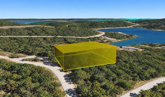
Welcome to Cherokee Village, Arkansas! This wooded, residential lot with paved road access is in walking distance to Lake Chanute providing great opportunity to enjoy the outdoors.
Whether you're considering retirement, a fresh start, a part-time retreat, or a future investment, Cherokee Village offers small-town charm, affordability, and outstanding outdoor recreation. Enjoy low property taxes, a low cost of living, and affordable housing. Airbnb rentals are also permitted, and the community already has several successful short-term rentals. The registration process is straightforward and costs less than $40.
Beyond the community amenities, the surrounding Arkansas Ozarks offer year-round opportunities for hiking, floating, fishing, and exploring. The nearby South Fork and Spring Rivers are among the region's most popular destinations for kayaking, canoeing, and trout fishing, making Cherokee Village an excellent base for enjoying the outdoors.
Don't miss your chance to own a piece of this hidden gem in the heart of the Arkansas Ozarks!
NOTE: Real estate taxes are current. The buyer will be responsible for all real estate taxes billed on March 1, 2027 that will be due October 15, 2027.
NOTE: The bidder is responsible for determining from the county planning department whether or not a suitable structure can be constructed on the lot. A home may be constructed on this lot as long as the house size is a minimum of 1,000 square feet and complies with the zoning set forth in Cherokee Village Zoning "Bill of Assurance" Sandia Addition.
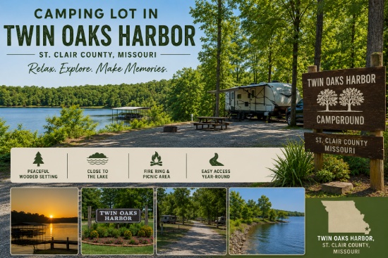
Camp Under the Stars in Twin Oaks Harbor, Missouri!
Parcel ID: 07-9.0-29-002-008-035.01
Legal Description: Lots 10-11, Blk 19, Plat 5, TOH
Acre: 0.17
State: Missouri
County: St. Clair
Taxes: Under $3 per month
Approximate Coordinates: 38°06'42.1"N 93°35'32.6"W
This double lot is located in Twin Oaks Harbor, a gated community in Jackson Township, St. Clair County, Missouri, about 100 miles southwest of Kansas City. The area is known for its peaceful rural setting and easy access to outdoor recreation at nearby Truman Lake, where you can enjoy boating, fishing, hunting, hiking, biking, and camping.
Twin Oaks Harbor offers great amenities including a stocked fishing lake, in-ground pool, playground, bath houses with showers, and maintained roads. ATVs and golf carts are permitted on community roads.
This camping lot is for recreational use, but is NOT permitted to be used as a permanent residence. Campers are allowed, but no other structures are permitted on this lot.
Whether you're looking for a peaceful weekend retreat or a convenient base for enjoying Truman Lake recreation, this affordable camping lot offers a great opportunity to relax and enjoy the outdoors!
NOTE: Twin Oaks Harbor Property Owners Association imposes an annual fee of $351.00 for these two lots, covering its fiscal year of May 1 - April 30. The 2026 dues are paid through April 2027. The buyer will be responsible for 2027-2028 fiscal year dues. A copy of the Covenants & Restrictions is available upon request.
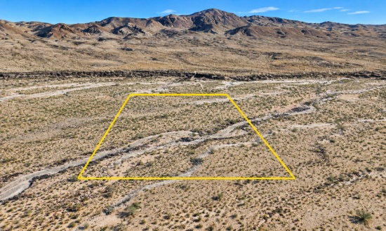
West Texas: 20 Acres in Hudspeth County! 3.9% Financing Available, All Buyers Prequalify!
Parcel ID: 72939
Legal Description: 67 TSP 10 SEC 24 T & P S1/2SW1/4NW1/4 (20.00 ACRES)
Acres: 20
State: Texas
County: Hudspeth
Taxes: Under $6 per month
Approximate Coordinates: 30°50'54.0"N 104°56'21.0"W
Hudspeth County, Texas offers a rare blend of wide-open landscapes, rugged natural beauty, and peaceful rural living in the heart of the Trans-Pecos region. Situated in far-west Texas, bordering New Mexico to the north and Mexico to the south, this expansive county spans over 4,500 square miles of desert plains, distant mountain ranges, and dramatic high-desert vistas. With one of the lowest population densities in the state, Hudspeth County appeals to those seeking space, privacy, and an authentic West Texas lifestyle.
For outdoor enthusiasts or nature lovers, portions of the Guadalupe Mountains National Park lie within the county's boundaries, offering opportunities for hiking, wildlife observation, and exploration against a backdrop of dramatic terrain. The arid climate brings hot, sunny summers and mild winters, perfect for year-round enjoyment of the outdoors.
Whether you're looking for acreage, a quiet retreat from urban life, or a long-term investment in West Texas land, this parcel delivers unmatched space and serenity!
NOTE: This lot qualifies for seller financing at 3.9% interest. Minimum down payment requirement is 10% of the full purchase price. Every buyer is approved, with payment terms up to 18 months available. View a specimen financing contract here. Reach out for more information.
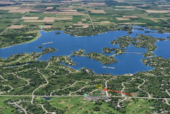
Secure Buildable Land Between a Lake and Golf Course!
Parcel ID: 060-110-000-206-00
Legal Description: 20 1W HUNTINGTON REALM SUB LOT 206.
Acre: 0.38
State: Michigan
County: Gladwin
Taxes: Under $9 per month
Approximate Coordinates: 44°07'47.3"N 84°26'43.3"W
This 0.38-acre lot is located on Worthington Court in the Sugar Springs Recreational Community, less than five miles from both Sugar Springs and Lakeside Golf Courses and under 10 minutes from Berkshire Beach on Lake Lancer.
Sugar Springs offers outstanding amenities, including two golf courses, private lakes with boating, kayaking, fishing, swimming beaches, a clubhouse, restaurant, fitness center, pool, pickleball, tennis, bocce ball, nature trails, and more. Camping is permitted on most lots from the first weekend in April through November 30.
Surrounded by the scenic beauty of Butman Township, you'll enjoy easy access to forests, lakes, nearby Gladwin's shops and parks, as well as local attractions like Fruitful Orchard & Cider Mill and Merry-Hearted Cidery.
NOTE: The Sugar Springs Property Owners Association (POA) manages this community. The 2026 general assessment fee for this lot is $475, and the lake assessment fee is $60. The buyer will be responsible for all dues beginning on January 1, 2027, as well as a one-time $15 transfer fee upon purchase of the property.
NOTE: The bidder is responsible for determining from the county planning department whether or not a suitable structure can be constructed on the lot. Information about lot construction can be found here.
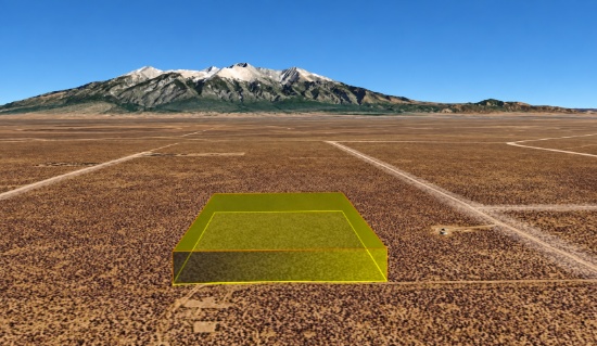
Build on Nearly Five Acres of Off-Grid Colorado Land!
Parcel ID: 70365440
Legal Description: SLVR Unit 20 Blk 42 Lot 2
Acres: 4.7
State: Colorado
County: Costilla
Taxes: Under $10 per month
Approximate Coordinates: 37°25'57.0"N 105°38'46.8"W
Own nearly five acres in the San Luis Valley Ranches subdivision of Costilla County, Colorado, surrounded by stunning high-desert scenery and expansive views of the Sangre de Cristo Mountains.
This residential-zoned property offers multiple housing options. Build a home of at least 600 square feet, or bring a qualifying mobile home (1976 or newer) or manufactured home that meets 2018 IRC Building Standards.
With wide-open skies, rugged mountain views, and a peaceful rural setting, the San Luis Valley offers the perfect backdrop for your Colorado retreat. Secure your piece of Colorado and bring your property vision to life!
NOTE: Please note that tiny homes and shipping container homes are not permitted. Buyers should independently verify zoning, building requirements, permitting, utilities, access, and all other applicable regulations with the appropriate county or local authorities prior to purchase.
Recreation Awaits in Michigan's Canadian Lakes!
Parcel ID: 11 186 027 000
Legal Description: SEC 29 T14N R08W LOT 27 CANADIAN LAKES PINES #1
Acre: 0.41
State: Michigan
County: Mecosta
Taxes: Under $3 per month
Property Address: 7637 W Lake Dr, Stanwood, MI 49346
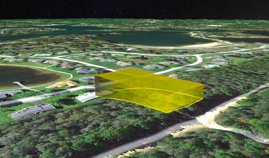
Build your seasonal retreat in Canadian Lakes, a private recreational community in northern Michigan's Mecosta County! This prime lot is located on Lakeview Drive, in between the golf course and numerous lakes.
Owners have inclusive use of remarkable amenities, including over 730 acres of waterways for all types of water sports, six beaches, sports venues, two 9-hole and one 18-hole golf courses, outdoor and indoor swimming pools, fitness area, hot tub, sauna, snow tubing tow, cross-country skiing, outdoor ice rink, campground, and more!
Explore numerous trails for hiking and biking, snowshoeing or snowmobiling, or enjoy the abundant land and lakes for hunting and fishing. Enjoy over 100 lakes and streams and, of course, the mighty Muskegon River. All are perfect for fishing, tubing, canoeing, kayaking, boating, and water-skiing.
Don't miss this opportunity to build your seasonal getaway retreat. Place your bid today!
NOTE: The Canadian Lakes Property Owners Corporation (POC) manages this community. The annual fee for 2026 is $898.82. The buyer, upon purchase, is responsible for directly paying all outstanding fees up to $3,700 to the POC.
NOTE: To maintain this beautiful community, Canadian Lakes requires owners to obtain the prior written approval of the Architectural Control Committee (ACC) for any exterior alteration or addition to the property. Deed Restrictions and the application forms for ACC approval are available upon request.
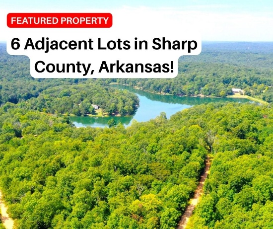
6 Adjacent Lots in Sharp County, Arkansas!
Parcel ID/Legal Description: See Photo for Property Details
Acres: 1.54 in total
State: Arkansas
County: Sharp
Taxes: Under $50 per month total
Approximate Coordinates: View All Six Lots Here >>
Discover a rare land opportunity in the Ozarks!
- Scenic setting in the beautiful Ozark Mountains
- Surrounded by wooded landscapes and rolling hills
- Ideal for a homesite, vacation getaway, or private retreat off of Kimberly Drive
- Flexibility to build, develop, or hold for the future
- Located within an established community
- Convenient access to local amenities and outdoor recreation
- Within walking distance to Ozark Acres Clubhouse and Vagabond Lake
- Great opportunity for buyers and land investors
Don't miss this rare opportunity to own six buildable lots and a piece of the beautiful Ozarks!
NOTE: The bidder is responsible for determining from the county planning department whether or not a suitable structure can be constructed on the Lots. A home may be constructed on these lots as long as the house size complies with the zoning set forth in Ozark Acres Bill of Assurance: Lake Terrace Addition.
NOTE: Real estate taxes are current. The buyer will be responsible for all real estate taxes billed on March 1, 2027 that will be due October 15, 2027.
Our Best Seller! Invest in New Mexico!
Parcel ID: 1020035235045000280
Legal Description: RIO DEL ORO Lot: 28 Block: 77 Unit: 24
Acre: 0.25
State: New Mexico
County: Valencia
Taxes: Under $5 per month
Approximate Coordinates: 34°45'13.2"N 106°32'56.0"W
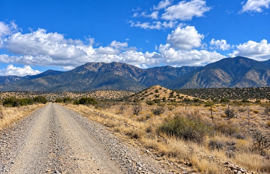
Welcome to the Land of Enchantment! This Rio Del Oro subdivision lot is located near the intersection of Monterey Boulevard and the Rio Del Oro Loop.
One-of-a-Kind Nevada Parcel!
Parcel ID: 010-320-08
Legal Description: Township 32 North, Range 46 East, M.D.B &M. Section 19: NW4SW4/NE4SW4/SW4SW4/NW4SE4
Acres: 156.7
State: Nevada
County: Lander
Taxes: Under $16 per month
Approximate Coordinates: 40°37'49.6"N 116°50'15.6"W
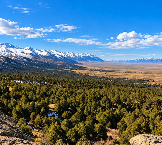
Discover 156.7 acres of wide-open Nevada land in scenic Lander County, surrounded by rugged mountain ranges, rolling terrain, expansive views, and abundant wildlife. Located within driving distance to the South Fork Recreation Area, you will witness a scenic wonderland with a stunning backdrop and more wildlife than you ever imagined the state of Nevada could hold. This property also offers acres and acres of a remote high-desert while remaining within reach of Crescent Valley and Battle Mountain for shopping, dining, and other amenities.
Did you know this area is known for its rich gold-mining history and incredible outdoor recreation. Enjoy nearby opportunities for hunting, fishing, hiking, mountain biking, off-highway vehicle adventures, and stargazing beneath Nevada’s clear, open skies. The Humboldt River runs through the valley to the north, while attractions such as Spencer Hot Springs and the Copper Basin Mountain Bike Trail add even more ways to explore the surrounding landscape.
Increase your land portfolio with this massive Nevada parcel! It's rare and one of a kind!
Double Lot with Private Lake Access in Michigan!
Parcel ID: 004-230-465-00
Legal Description: LOTS 465 & 466 HONEYMOON HEIGHTS NO 3.
Acre: 0.33
State: Michigan
County: Montcalm
Taxes: Under $14 per month
Approximate Coordinates: 43°27'53.6"N 85°12'43.9"W
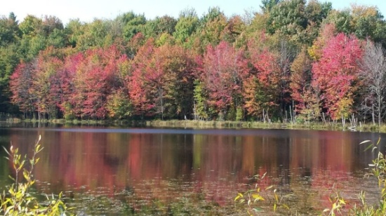
Located in Cato Township, Montcalm County, this 0.33-acre double lot offers peaceful rural living surrounded by farmland, forests, and small lakes. Situated on Cherry Drive within the Honeymoon Heights Owners Association, owners enjoy access to the community lake, clubhouse, parks, and newly installed docks.
The area is ideal for outdoor enthusiasts, with excellent opportunities for hiking, hunting, fishing, and wildlife viewing. Nearby Lakeview provides shopping, dining, healthcare, and other everyday conveniences, while Grand Rapids is about an hour away.
If you plan to build, homes must have a minimum of 750 square feet and will require a well and septic system. A recreational trailer, motor home, or camper may be used on the property for up to 14 consecutive days per calendar year. An RV can be parked on your lot for up to three months while a home is under construction.
Overall, this area is an idyllic community offers peaceful rural living with scenic landscapes, affordable living, and easy access to lakes and outdoor recreation.
NOTE: Honeymoon Heights Owners Association's annual dues are just around $25 per lot. An additional $100 of outstanding dues will become the buyers responsibility. As of the June Annual Meeting, dues for all owners in HHOA will be raised to $40 per lot starting January 1st, 2027.
NOTE: The bidder is responsible for determining from the county planning department whether or not a suitable structure can be constructed on the Lot. For more details about restrictions, please see the following link: Honeymoon Heights Zoning Restrictions.

Add 10 Texas Acres to your Land Portfolio!
Parcel ID: 10 Acre Northwest Quarter of Tract 155-32
Legal Description: Being a ten acre tract in the Northwest Quarter of land out of Section 23, Block 3, TexMex RR Company Survey, Presidio County, Texas
Acres: 10
State: Texas
County: Presidio
Taxes: Under $3 per month
Approximate Coordinates: 29°42'50.0"N 104°27'42.2"W
This 10-acre property is located in Presidio County, Texas, within the rugged Trans-Pecos of far West Texas. With lots of space and wide-open desert landscapes surrounding the area, this is an opportunity to own a larger piece of land in a remote part of the state.
Presidio County stretches along the Rio Grande and is known for its desert mountains, expansive ranchland, historic border communities, and some of the darkest night skies in the country. This part of West Texas is also home to well-known destinations including Big Bend National Park, Big Bend Ranch State Park, and the Davis Mountains.
Whether you're looking to hold land for the future or simply want to own a larger piece of West Texas, this property gives you the chance to own land in one of the state's most distinctive desert regions.
NOTE: Unincorporated Presidio County does not have county zoning, providing greater flexibility for potential land uses. Buyers should verify their intended use with the county to determine any applicable permits or other requirements prior to development.
Experience Northern California!
Parcel ID: 035-051-012-000
Legal Description: Lot 13, Block 41, California Pines Unit 1, a subdivision of the County of Modoc according to the official amended Plat thereof, filed in Book 2 of Maps in Modoc County Records.
Acres: 1.37
State: California
County: Modoc
Taxes: Under $24 per month
Approximate Coordinates: 41°20'10.4"N 120°43'53.0"W
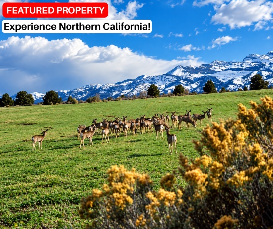
Escape the hustle and bustle of "life" to the peace and natural beauty of California Pines with this lot in the Hill Unit 1 community. Surrounded by forests, mountains, and lakes, this property offers a great opportunity to enjoy a quiet rural retreat.
- Encompasses approximately 15,000 acres and is surrounded by two million acres of Modoc National Forest
- Known for its remote, uncrowded setting, bordering Oregon to the north and Nevada to the east
- Community amenities include a Lodge and a 4,400-foot airstrip
- Less than a half-mile from paved County Road 71 (Cal Pines Blvd)
- 10 miles from the mountain peak Hermit Butte
- About 30 minutes to Alturas
Don't miss your chance to own a piece of beautiful Northern California and enjoy the peaceful, natural surroundings of California Pines!
NOTE: The bidder is responsible for determining from the county planning department whether or not a suitable structure can be constructed on the Lot. If you are considering constructing a home, please note that the living space must be no less than 500 square feet. Construction will require a private well and septic system. If electricity is nearby, it can usually be extended to the lot through Surprise Valley Electric. Solar panels and wind turbines are also permitted for off-grid living options. Building Restrictions can be found here: Hill Unit 1. RVs and camping are also permissible for up to 30 days of a calendar year.
NOTE: The California Pines Property Owners Association maintains common areas for the benefit of the property owners, residents and the general public. The 2026 annual POA fee is $105 and will become the responsibility of the buyer.
Your Chance to Own Land Near the Jersey Shore!
Parcel ID: 0504_85_4
Legal Description: Being known as Tax Lot 4 in Tax Block 85 on the Official Tax Map of the Township of Dennis, Cape May County, New Jersey
Acre: 0.75
State: New Jersey
County: Cape May
Taxes: Under $4 per month
Approximate Coordinates: 39°09'37.8"N 74°49'01.7"W
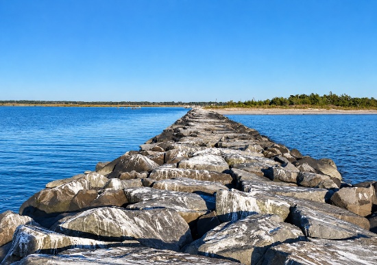
Cape May County is the southernmost county in New Jersey, forming part of the Atlantic coastal plain with the Atlantic Ocean to the east and Delaware Bay to the west. The county includes barrier islands and a peninsula that hosts many of its coastal towns and beaches.
Dennis Township is one of the four townships in Cape May County and is known for its rural character and natural landscapes rather than being a typical shore resort community. Located inland but close to both the Delaware Bay and the Atlantic coast, making it a convenient base for nature-based activities.
Nearby amenities include the Dennis Township Recreation Center, Shore Gate Golf Club, Thousand Trails Lake & Shore, along with several campgrounds and public parks. Plus, Sea Isle City and the Atlantic Ocean are just about ten miles away.
This property is ideal for those who value privacy, nature, and minimal congestion compared to shore towns.
Owning land in Dennis Township offers a rare blend of affordability, privacy, and proximity to New Jersey’s coast, with strong appeal for nature lovers, long-term investors, and anyone looking to secure land in a protected, desirable region of South Jersey.
Place your bid today!
Endless Possibilities with 20 Lots in Arkansas!
Parcel IDs/Legal Descriptions: See Photo for Property Details
Acres: 5.11 in total
State: Arkansas
County: Fulton
Taxes: Under $240 per month (approximately $12 per lot)
Link to Properties: 20 Lots in Fulton County, Arkansas
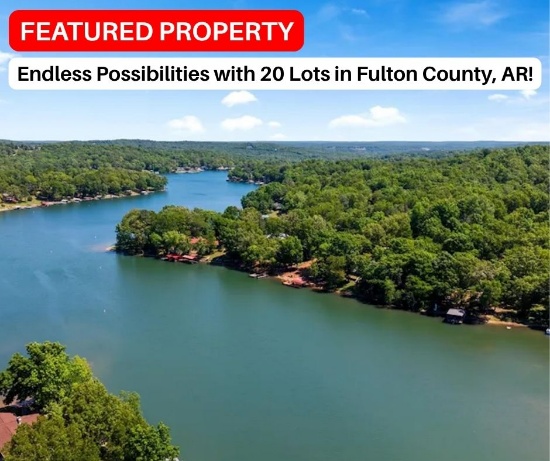
Unlock a rare development opportunity with this 20-lot package located in Cherokee Village, a scenic resort-style community in Arkansas. Whether you're a builder, investor, or developer, this portfolio offers exceptional flexibility for vacation homes, rental properties, or long-term appreciation.
Cherokee Village is a peaceful Ozark community centered around lakes and golf, ideal for those who value natural surroundings, a relaxed pace of life, and a low cost of living. Founded in 1954 as Arkansas’ first resort-town development, it remains a well-established master-planned recreational community in the Ozark Foothills, featuring:
- Two 18-hole golf courses
- Seven Lakes
- South Fork River
- Multiple Parks
- Swimming Pools
- Tennis Courts
- Pickleball Courts
- Walking and Hiking Trails
This offering presents a unique chance to secure land in a proven recreational market with multiple exit strategies—build, hold, or develop. As demand continues to grow for affordable resort-style living, this property stands out as a strong opportunity for both seasoned investors and lifestyle buyers seeking long-term value and growth potential.
Opportunities like this don’t come often, secure your place in one of Arkansas’ most established resort-style communities while availability lasts.
NOTE: Real estate taxes are current. The buyer will be responsible for all real estate taxes billed on March 1, 2027 that will be due October 15, 2027.
NOTE: The bidder is responsible for determining from the county planning department whether or not a suitable structure can be constructed on these lots. A home may be constructed on each of these lots as long as the house size is a minimum of 1,000 square feet and complies with the zoning set forth in Cherokee Village Zoning "Bill of Assurance". These lots are all located in the following subdivision: NUMAKIKI ADDITION.
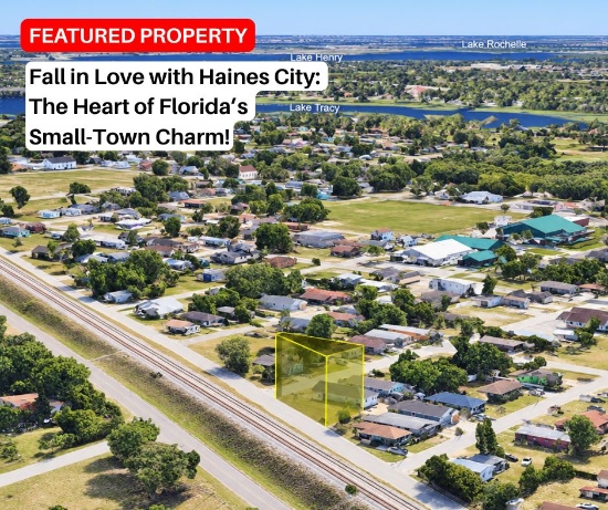
Fall in Love with Haines City: The Heart of Florida's Small-Town Charm!
Parcel ID: 272721753500013150
Legal Description: LOCKHART & SMITHS RESUB PB 6 PG 9 BLK M LOT 15
Acre: 0.08
State: Florida
County: Polk
Taxes: Under $10 per month
Approximate Coordinates: 28°07'17.5"N 81°37'11.8"W
This buildable, corner lot is just minutes from the center of Haines City offering the perfect balance of peace and convenience located on Avenue F and Railroad Ave. Whether you're looking to build a permanent home or invest in a growing Central Florida community, this location delivers.
You’ll be close to everyday essentials like Publix, Lake Eva Community Park, and Haines City Senior High School. Just a short drive away, you'll find shopping, dining, and entertainment at Haines City Mall.
For nature lovers and weekend explorers, you're less than 45 minutes from favorites like Saddle Creek Park, Lake Parker, Lake Ariana, and Schalamar Creek Golf & Country Club.
Don't miss your chance to claim a piece of Central Florida real estate with easy access to both urban amenities and outdoor recreation!
NOTE: Property needs to be upkept. There may be lawn cutting fees assumed by the buyer.
NOTE: The bidder is responsible for determining from the county planning department whether or not a suitable structure can be constructed on the lot. According to the City of Haines City, if the proposed house meets the minimum home size, garage size, and setback requirements of the R-2 zoning district, a home may be permitted on this lot.
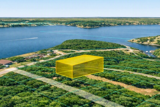
Oklahoma Tiny & Modular Home Friendly Lot. 3.9% Financing Available, All Buyers Prequalified!
Parcel ID: 29851
Legal Description: Lot 9, Block 8, Alberts Walnut Grove
Acre: 0.11
State: Oklahoma
County: Delaware
Taxes: Under $3 per month
Approximate Coordinates: 36°39'37.4"N 94°46'38.9"W
Delaware County sits in the far northeast corner of Oklahoma, bordered on the east by McDonald County, Missouri, and Benton County, Arkansas. It’s one of the state’s most scenic and recreation-driven counties, anchored by lake life, tourism, and a steady base of retirees and second-home owners.
The county’s identity revolves around Grand Lake o' the Cherokees, with over 46,500 acres of water-filled fun and one of Oklahoma’s premier recreational lakes for boating and fishing. It is a destination for weekenders, retirees and short-term rental investors.
Albert’s Walnut Grove is a lake-access subdivision near Grove, Oklahoma. The community offers an affordable entry point for vacation homes; cabins and short-term rentals.
This lot sits on E 247th Lane and is a short stroll to the Neosho River, a tributary of Grand Lake. The buyer of this lot can access the lake through a private boat ramp available for $140 per year. In addition, there are multiple free, public boat ramps located a few miles from this area.
A modular or tiny home with a self-contained sewage tank system would be the recommended use. All lots have access to water, electricity and gas.
Vacationers love the charming town of Grove, the “capital” of Grand Lake—a small town with outsized importance because it anchors one of the Midwest’s most active recreational lake markets. Grove provides the perfect backdrop for Grove's many attractions, shops, restaurants and festivals.
NOTE: The bidder is responsible for determining from the county planning department whether or not a suitable structure can be constructed on the lot.
NOTE: This lot qualifies for seller financing at 3.9% interest. Minimum down payment requirement is 10% of the full purchase price. Every buyer is approved, with payment terms up to 12 months available. View a specimen financing contract here. Reach out for more information.
Buildable Wooded Lot Near Pencil Lake in Otsego County, Michigan!
Parcel ID: 072-280-000-456-00
Legal Description: LOT 456 PENCIL LAKE NORTH SEC 31 T30N R4W
Acre: 0.40
State: Michigan
County: Otsego
Taxes: Under $3 per month
Approximate Coordinates: 44°57'23.5"N 84°50'03.3"W
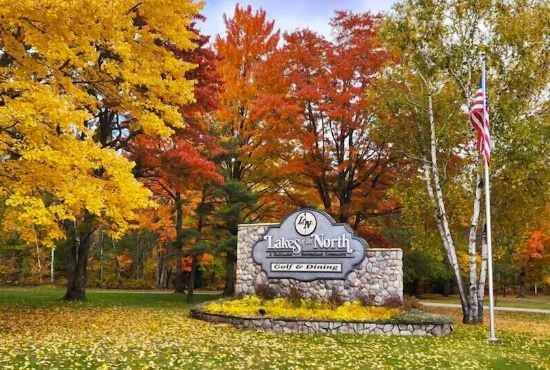
Lakes of the North is one of Michigan's largest private residential associations, encompassing more than 10,000 acres across Antrim and Otsego Counties. Home to more than 8,000 privately owned lots, the community is surrounded by pristine forests, scenic trails, and beautiful inland lakes, offering residents the best of Northern Michigan's natural beauty and year-round outdoor recreation just southwest of Gaylord.
This 0.40-acre lot is located Northwood Drive, less than a mile from Pencil Lake and Buhl Lakes.
Residents enjoy an impressive selection of four-season amenities, including an 18-hole championship golf course, a private airport, restaurant and tavern, indoor pool and fitness center, private beaches, sports courts, winter recreation facilities, and miles of trails for hiking, biking, snowmobiling, and cross-country skiing. Combining exceptional recreational opportunities with remarkably affordable assessments, Lakes of the North offers outstanding value in one of Northern Michigan's most desirable locations, just a short drive from Boyne Mountain, Shanty Creek, Torch Lake, and Lake Michigan.
NOTE: The Association's 2026 annual assessment is $387.50 for the primary lot. As an Annual Assessment Property Owners Association, Lakes of the North is maintained through shared ownership, with every property owner contributing equally to the upkeep of the community, its infrastructure, and its amenities. Annual assessments apply to all lots, regardless of whether they are developed or whether the owner uses the community amenities. The 2026 assessment covers the period from April 1, 2026, through March 31, 2027. The buyer is responsible for payment of the annual assessment for the fiscal year in which the deed is recorded and must register with the Association as a property owner by completing the required registration form, which will be provided with the recorded deed.
NOTE: The bidder is responsible for determining from the county planning department whether or not a suitable structure can be constructed on the lot. All building plans need approval by the association's Architectural Control Committee. Lots do not have water, septic, or electricity. Construction would require a private well and sewage disposal system. If there is electricity in the area, it can be extended to your lot. Building restrictions include a minimum square footage that varies by subdivision. Mobile homes, trailers, camping and storage are prohibited on all vacant lots. For complete building information, please see Lakes of the North - Restrictive Covenants.
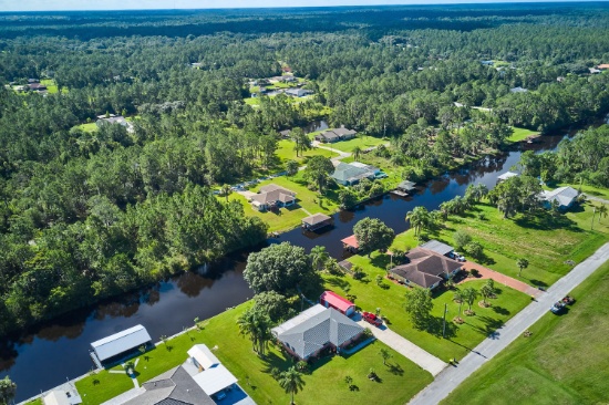
Your Property, Your Vision in This Desirable Florida Community!
Parcel ID: 303107994050020909
Legal Description: INDIAN LAKE ESTS UNIT 5 SEC 7 31 30 PB 39 PG 31 BLK 209 LOT 9
Acre: 0.50
State: Florida
County: Polk
Taxes: Under $16 per month
Approximate Coordinates: 27°47'32.3"N 81°21'54.4"W
Seize the opportunity to experience the best of Florida living! Build & retire on this beautiful 0.50-acre lot on Alamanda Drive in Indian Lake Estates, the peaceful, amenity-rich golfing, fishing, and boating enclave in central Florida. This serene, gated neighborhood offers the ideal blend of country living and resort-style recreation.
The community is nestled along the shores of Lake Weohyakapka (also known as Lake Walk-In-Water), a 7,500-acre freshwater lake nationally known for trophy Largemouth Bass fishing, boating, and water sports. The lake features a marina, boat slips, a beach area, and Florida's longest freshwater fishing pier.
Golf enthusiasts will enjoy access to an 18-hole championship golf course, a 9-hole par-3 course, catering to all skill levels - and a pro shop, practice facilities, and a clubhouse restaurant.
Check out their Event Calendar! to learn all about this month's events!
NOTE: Indian Lake Estates, a Chapter 617 non-profit rather than an HOA, manages the community and charges an annual license fee of $396.27 per lot. In addition, new owners are required to pay a one-time Transfer Fee of $50.00.
NOTE: The bidder is responsible for determining from the county planning department whether or not a suitable structure can be constructed on the lot. All new construction requires submission of the Residential Construction Application, building plans, and county permit for board review. A $250 application fee and $2,000 impact fee apply.
NOTE: Buyer is responsible for well and septic installation. Electric is available in the community but has not been extended to each individual lot. Electricity can be extended through Peace River Electric Company. More information can be found here.
Smart Investing Starts Here in New Mexico!
Parcel ID: 1021034225312100300
Legal Description: RIO DEL ORO Lot: 30 Block: 34 Unit: 24
Acre: 0.25
State: New Mexico
County: Valencia
Taxes: Under $5 per month
Approximate Coordinates: 34°44'53.5"N 106°31'52.1"W
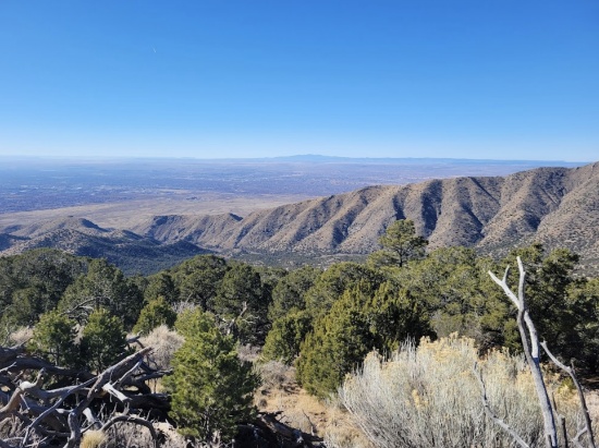
Rio Del Oro is a sprawling subdivision East of Belen and Los Lunas in Valencia County, New Mexico, covering roughly 47,000 acres, from I-25/Rio Grande all the way to the Manzano Mountains. This scenic area offers wide-open high desert landscapes, wild grasses, seasonal wildflowers, and panoramic views of the Manzano Mountains. With its low land prices and long-term development prospects, Rio Del Oro is ideal for both budget-conscious investors, nature lovers and off-grid enthusiasts.
Meta (formerly Facebook) opened its Los Lunas Data Center in 2019 and continues to expand rapidly. In January 2025, Meta announced a major new phase: the addition of two buildings on its 750-acre campus, part of an $800 million initiative to support next-generation AI technologies. Once fully built out, the facility is expected to support 350-400 permanent jobs and drive significant construction employment.
Overall, Valencia County combines low-cost land, strategic positioning near Albuquerque, rich outdoor amenities, and a major economic driver in the form of Meta’s expanding data campus, backed by sustainable energy growth, offering a rare blend of affordability and growth potential in New Mexico!
NOTE: Approximately $160 in back taxes will become the responsibility of the buyer.
Michigan Thumb Region Land in Tuscola County!
Parcel ID: 005-013-512-2000-00
Legal Description: SEC 13 T11N R10E LOT 220 SHAY LAKE SUB.
Acre: 0.12
State: Michigan
County: Tuscola
Taxes: Under $3 per month
Approximate Coordinates: 43°22'31.9"N 83°14'23.8"W
Tuscola County is one of five counties in the Thumb Region of Michigan. Like the rest of the Thumb, Tuscola County enjoys seasonal tourism. This county is known for its small towns, farmland, and outdoor recreation. While the area offers a quieter pace of life, Saginaw, Flint, and Bay City are all less than an hour away. The beaches, parks, and shoreline of Lake Huron are also within an easy drive.
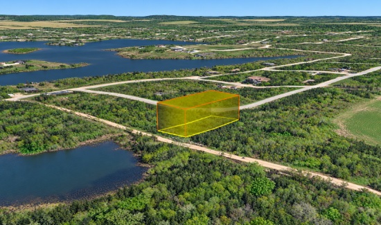
This 0.12-acre lot is located in the Shay Lake Subdivision on Jaywood Drive. Set within an established neighborhood just a short distance from the 45-acre Shay Lake, this property offers an affordable opportunity to own land near one of the area's largest recreational lakes.
It is a popular spot for boating, fishing, and spending time outdoors. Campgrounds, parks, golf courses, and local marinas can all be found throughout the surrounding area, giving you plenty of ways to enjoy Michigan's warmer months.
Looking for a lifestyle escape from the city? Tuscola County has what you are looking for. Bid now!
This Missouri Lot is Calling All Camping Enthusiasts!
Parcel ID: 07-9.0-29-001-006-001.00
Legal Description: Lot 70, Blk 57, Plat 14, TOH
Acre: 0.10
State: Missouri
County: St. Clair
Taxes: Under $3 per month
Approximate Coordinates: 38°06'54.4"N 93°34'48.0"W
Welcome to Twin Oaks Harbor!
- Located in rural St. Clair County, Missouri, about 100 miles southeast of Kansas City and 10 miles east of Lowry City
- Peaceful, gated community near scenic Truman Lake
- Community amenities include:
- Stocked fishing lake (non-gas-powered boats permitted)
- Seasonal swimming pool and two bathhouses with hot showers
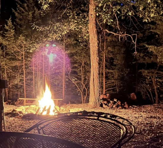
- Playground, pavilion, horseshoe pits, fire pit and basketball court
- Recreation room with full kitchen and electricity
- ATVs and golf carts are permitted on common roads
- Choctaw Drive lot is not permitted for residential use
- Campers are allowed; no other structures are permitted
- Truman Lake offers boating, fishing, hunting, camping, hiking and biking across 259 square miles
Enjoy a peaceful getaway surrounded by nature and outdoor adventure. Bid today!
NOTE: Twin Oaks Harbor Property Owners Association imposes an annual fee of $282.00 for a single lot covering its fiscal year of May 1 – April 30. The annual POA dues are paid through April 2027. The buyer will be responsible for 2027-2028 fiscal year dues.
Nearly a Quarter Acre in the Rolling California Hills of Imperial County!
Parcel ID: 017-380-032-000
Legal Description: LOT 148 DESERT HILLS TRACT NO 1 T11S R10E
Acre: 0.22
State: California
County: Imperial
Taxes: Under $3 per month
Approximate Coordinates: 33°10'36.2"N 115°56'32.2"W
Your California off-road adventure starts here!
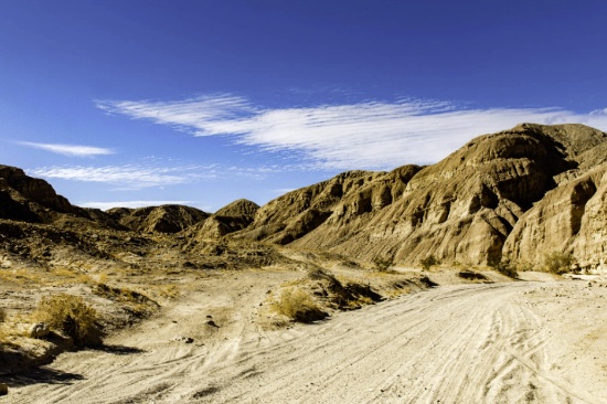
Located in the heart of southeastern Imperial County, this vacant lot offers a true desert escape surrounded by the rugged beauty of the Sonoran landscape. Just minutes from the renowned Ocotillo Wells State Vehicular Recreation Area, the area is a haven for outdoor enthusiasts, with endless opportunities for off-roading, dirt biking, and exploring scenic trails like the nearby Gas Domes Trail.
Ocotillo Wells State Vehicular Recreation Area (SVRA) is a public off-highway vehicle (OHV) park in the California desert. Managed by the California Department of Parks and Recreation, it provides thousands of acres of open desert for off-road driving, camping, and exploration. It is a major destination for OHV enthusiasts in Southern California.
Unique natural features such as Shell Reef and Devil’s Slide add to the dramatic desert scenery, making this an ideal spot for weekend adventures, camping, or a private off-grid retreat. With wide-open space, peaceful surroundings, and convenient access from Ocotillo Wells, this property is perfect for those seeking recreation, relaxation, or a long-term land investment in one of Southern California’s most popular off-road destinations.
Located about 30 minutes from the Salton Sea and just over an hour from Bombay Beach, now transformed into a colorful, off-grid artist haven, you’ll be close to it all. Bring your RV and camp out at Salt Creek, a popular camping area right on the water.
Whether you’re looking to explore, unwind, or invest, this property offers a rare opportunity to own your own piece of Southern California’s wide-open desert.
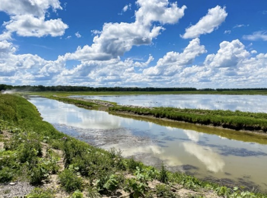
Central Michigan Land Next to Creek in Shiawassee County!
Parcel ID: 008-08-200-002
Legal Description: SEC 8, T7N, R4E COM ON N LN OF SEC 373 FT W OF NE COR OF SEC, S27*39'E 107 FT TO N'LY LN OF ONION CREEK DRAIN, N54*24'E 181.30 FT ALG DRAIN, W 204 FT TO BEG
Acre: 0.23
State: Michigan
County: Shiawassee
Taxes: Under $1 per month
Approximate Coordinates: 43°01'41.8"N 84°00'28.4"W
Located in Shiawassee County, Michigan, this 0.23-acre parcel sits just off Shipman Road, with Onion Creek bordering the southern end of the property. This is a great opportunity for investors or Michigan locals already in the area. It offers a peaceful rural setting while remaining conveniently accessible to surrounding communities.
Shiawassee County is known for its natural beauty, outdoor recreation, historic sites, and small-town charm. Local attractions include the Shiawassee National Wildlife Refuge, Curwood Castle Museum, Shiawassee Arts Center, Lake Ovid, and Durand Union Station. Residents and visitors enjoy fishing, boating, hiking, biking, parks, festivals, and historic downtown shopping and dining.
Major highways including I-69 and M-52 provide convenient regional access, while Lansing Capital Region International Airport offers nearby air travel options.
Don’t miss this opportunity to own a piece of Michigan property surrounded by natural beauty, local history, and recreational opportunities.
