Stocking Stuffer Land Liquidation!
Stocking Stuffer Land Liquidation!
See Special Terms for additional fees
Description


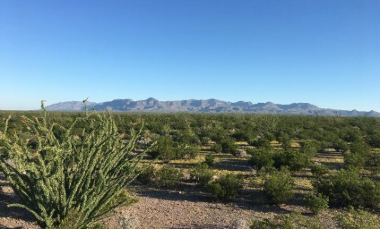
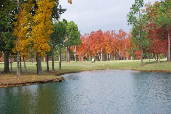
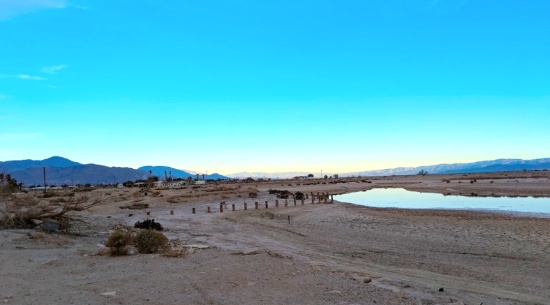
Camp on Your Picturesque 40-Acre West Texas Ranch!
Camp out under the stars! Enjoy the beauty of a large ranch in a growing and prosperous state. The prairies, mountains, desert, and river give Presidio County an unusual beauty. In the north and west, clay and sandy loams cover the rolling plains known as the Marfa Plateau and the Highland Country, providing good ranges of grama grasses for the widely acclaimed Highland Herefords. In the central, far western, and southeastern areas of the county some of the highest mountain ranges in Texas are found.
This property has been identified by Helios Energy as part of their "Area of Interest," and Helios has been issued drilling permits by Presidio County, Texas.
Note: This property includes surface rights, not mineral rights. Surface activity may still generate easement revenue should the drilling activity disturb the surface. The mineral rights have already been leased to the oil company!
Legal Description: Tract Number 1, Section 3, Block 5, Texas-Mexico Railway Company, Abstract 5712
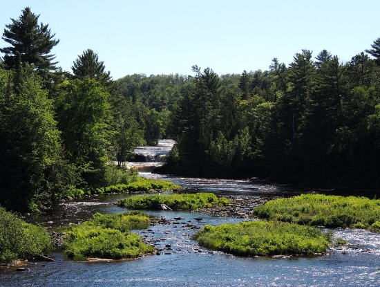
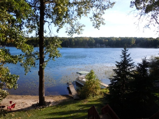
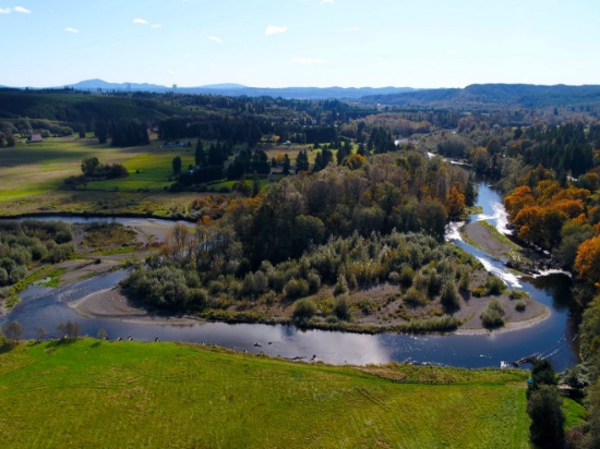
Over 17 Acres with 1,400 Foot River Frontage in Michigan's Eastern Upper Peninsula!
Luce County, located in Michigan’s Eastern Upper Peninsula, is a four season recreational mecca. It has 300,000 acres of public access land, 15,000 acres of inland lakes, 658 miles of rivers and streams including Hemingway’s Big Two Hearted River, 32 miles of Lake Superior shoreline, the Crisp Point Lighthouse and the Tahquamenon Falls.
Newberry, the county seat, was designated as the “Moose Capital” of Michigan by the state legislature.
Scenes from the Eastern Upper Peninsula >>
Visit The Eastern Upper Peninsula’s Top Attractions >>
This vacant parcel stretches for 1,400 feet along the Tahquamenon River within McMillian Township. It is accessible via floating the Tahquamenon River or possibly by driving from the nearest county-maintained road via five miles of dirt roads.
The property is nearly level with seasonally wet soils. Camping is an approved use. The lot is a conforming lot according to the Luce County Code Administrator. Zoning requires that structures be built at least 100 ft from the river’s high water mark. In addition, vegetation within 100 ft of the streams edge must be left in a natural condition. Prospective bidders should contact the county and township for a determination of whether or not a desired structure can be built on the property.
Things to do in the Upper Peninsula >>
There are more than 300 waterfalls in Michigan, and all but one of them is in the Upper Peninsula. The largest, and arguably most spectacular, is Tahquamenon Falls, about 75 miles northwest of Sault Ste. Marie. Contained within Tahquamenon State Park, the falls actually consist of two separate portions, the Upper and Lower Falls. The Upper Falls, about 200 feet across, is the largest waterfall east of the Mississippi, and cascades down nearly 50 feet into the Tahquamenon River.
Legal Description: Government Lot 3
Approximate Coordinates: 46°23'43.4"N 85°16'54.1"W
53 Acres with Road Frontage and Two Brooks in Maine!
This 53.3 acre parcel is located in the Connor Plantation, sitting right on U.S Route 1, and has electric, telephone and internet available! This beautiful property has two brooks, Halfway and Picard Brook, running through the lot. It is less than 2 miles away from Acadia and Little Madawaska River!
Aroostook County is the northernmost region and the largest county in wild, rugged, and deeply beautiful Maine. The state is 90 percent forest, with a coastline that, if stretched out, would reach to California. Bordering the provinces of Quebec and New Brunswick, Canada, the county is larger than the states of Rhode Island and Connecticut combined. Known simply as “The County” or “Crown," life in this northernmost region is a grandiose fusion of old-world charm blended to perfection with contemporary appeal. Enjoy amenities that are every bit present-day, while exploring quaint villages and years-old cultures that make it seem as if you have stepped back in time.
From friendly local folks, rich history, storybook towns, sumptuous restaurants, shopping destinations and breathtaking outdoor amenities, Aroostook County is a peaceful borderland where time passes slower, refreshing evening breezes linger longer and sunsets sizzle for endless stretches. Step back into the way Maine used to be and take a deep breath of fresh pine and balsam-heavy air. It’s a place for rejuvenating and reconnecting with life's simple pleasures.
Welcome to Aroostook County >>
Things to Do, Places to Go in Aroostook >>
The region is a water utopia, home to more than 7,000 miles of flowing rivers, including the 92-mile Allagash Wilderness Waterway, and more than 2,000 lakes, streams, and ponds.
If water is not on your to-do list, hiking, camping, bird and wildlife watching, and other recreational and sports opportunities abound as you descend upon smaller mountains, endless four-season camping areas and more.
Don’t miss out on Aroostook County's 2,300 miles of groomed snowmobile trails and family skiing and snow tubing facilities. In an average season, experience over 10 feet of snow!
Bid now so you don’t lose this terrific property!
Map/Lot: Map AR 105 Plan 05 Lot 51 53
Legal Description: Being a certain lot or parcel of land situated on the westerly side of U.S. Route One and being part of the north half of Lot 74 and possibly part of Lot 73, Township K, Range 2, now Connor Plantation, Aroostook County, Maine...
Approximate Coordinates: 47°00'13.1"N 68°01'31.7"W
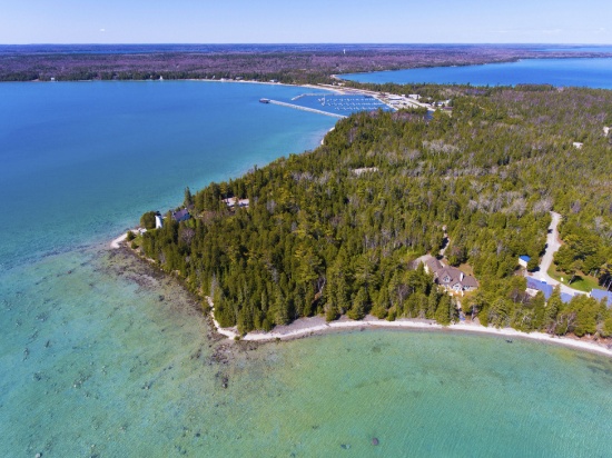
Own a Lot on the Olympic Peninsula in Washington!
Grays Harbor County, Washington is located on the southwest corner of the Olympic Peninsula along the Pacific Ocean. In no other county can you stick your toe in the Pacific Ocean at a beautiful beach one hour, and the next hour be in the lush rain forest.
Explore Grays Harbor County >>
This beautiful county is the Gateway to the Pacific Ocean and Washington's scenic coastal wonderlands. It is located on the southwest corner of the Olympic Peninsula along the Pacific Ocean.
This wooded lot is about a mile from the Chehalis River leading right into the Pacific Ocean! A quick 10 minute drive can get you to Makarenko Park, Highland Golf Course, many local restaurants and shops. Pioneer Park is about an hour away and would be a great day trip!
Grays Harbor is home to seven bodies of water: harbors, lakes, streams, channels, canals, rivers and of course, the Pacific. Aquatic activities galore, and then some! If water isn't what you want to experience, then hike into the enchanted forests to witness wildlife in their natural habitat. Or experience the Quinault Rain Forest, one of only two temperate rain forests in the Northern Hemisphere. Camp, kayak, walk, hike, you name it, Grays Harbor is untouched and waiting for you to explore.
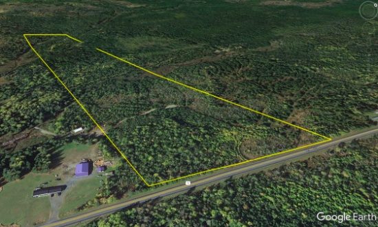
Note: Property is part of the yellow rectangle in the picture.
Legal Description: Lots 5 and 6, Block 48, Union Pacific Addition to Aberdeen, as per plat recorded in Volume 4 of Plats, page 1, records of Grays Harbor County; Situate in the County of Grays Harbor, State of Washington.
Approximate Coordinates: 46°57'27.5"N 123°47'31.0"W
2.64 Acres in Los Angeles County, California!
The County of Los Angeles is the most populous county in the United States with nearly 10 million residents covering 4,083 square miles. Its population is greater than that of 40 individual U.S. states. It is one of the most ethnically diverse counties in the United States.
The county is divided west-to-east by the San Gabriel Mountains, where most of the county's highest peaks are located. Several lower mountains are in the northern, western, and southwestern parts of the county, including the San Emigdio Mountains, the southernmost part of Tehachapi Mountains and the Sierra Pelona Mountains.
Most of the population of Los Angeles County resides in the south and southwest, with major population centers in the Los Angeles Basin, San Fernando Valley, and San Gabriel Valley.
The closest city is Lancaster where you can spend the day visiting the Museum of Art and History, Antelope Valley California Poppy Fields, or Elizabeth Lake. This lot is surrounded by many Wildlife Sanctuaries including Phacelia Wildlife Sanctuary, Alpine Butte Wildlife Sanctuary, and Carl O Gehardy Wildlife Sanctuary among others. Los Angeles county is the home to many parks including Branch Memorial Park, Saddleback Butte State Park, and Stephen Sorensen Park.
Legal Description: SE 1/4 OF NE 1/4 OF SE 1/4 OF NW 1/4 OF SEC 9 T 7N R 8W
Approximate Coordinates: 34°42'51.8"N 117°43'48.0"W
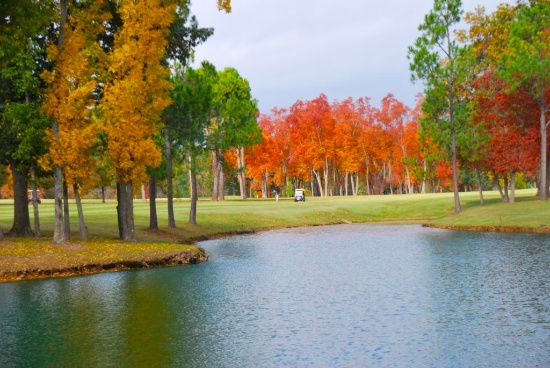
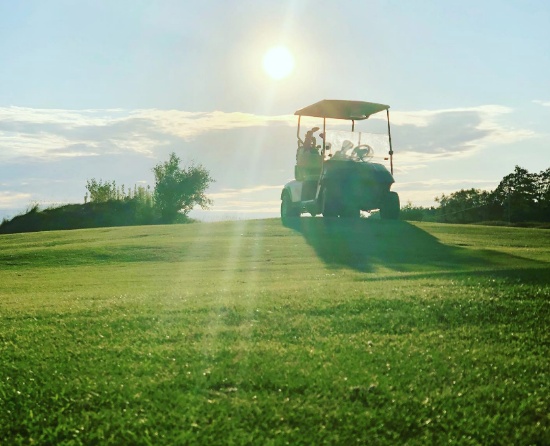
Build on this Floridian Half-Acre Lot in Indian Lake Estates!
Build your dream home on this half-acre lot in the Indian Lake Estates Community!
The possibilities are endless in this golfing and fishing community. Indian Lakes Golf and Country Club boasts a 18-hole golf course which offers a full service pro-shop, practice course, and restaurant. Enjoy food, drinks and a day of golfing in the sunshine state!
Indian Lake Estates Golf Course >>
Lake Weohyakapka, the largest lake in Polk County, offers boating, fishing, water skiing, and other water sports. Polk County residents say this is the best kept fishing secret of Polk County, as this large lake is known for Largemouth Bass!
Between the lakes, recreational activities, golfing and fishing opportunities, you will always have something to do at this beautiful sunny location!
This lot is located less than 70 miles south of Disney World. Home sizes are required to be a minimum of 1,250 square feet. No manufactured homes or campers are permitted.
Indian Lake Estates manages the community and charges an annual “license fee” of $345.05 per lot. In addition, new owners are required to pay a one-time Transfer Fee of $50.00
Note: Buyer is responsible for well and septic installation. Electric is available in the community but has not been extended to each individual lot. Electric can be extended through Peace Village Electric Company.
Note: This property is located in the vicinity of the Avon Park Air Force Range Military Training Facility and may be subject to potential day and night low level aircraft overflight and military training noise during training exercises.
Legal Description: INDIAN LAKE EST UNIT 13 PB 40 PG 20 BLK 362 LOT 3 SEC 17 31 30
Approximate Coordinates: 27°47'16.8"N 81°20'34.8"W
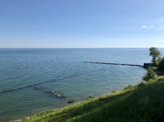
Land in this Lake Erie North Shores Community, Monroe County, Michigan!
Monroe County is a historical and beautiful community set in the southeastern corner of Michigan, bordering Ohio to the south and Lake Erie to the east.
This lot is five miles south of the city of Monroe in La Salle Township, that borders the Lake Erie shore. It is in the North Shores community, a few minute stroll to the shore. Park your RV and take advantage of the lake shore, nearby cities, parks and a multitude of recreational activities.
The city of Monroe has impressive parks and recreation land – around 300 acres, in addition to the non-motorized River Raisin Heritage Trail. Parks contain a wide variety of recreation amenities, including picnic facilities, hiking, athletic fields, concert venues, war memorials, fishing, kayaking, boat launch, open space, and historical sites.
A Tour of the City of Monroe >>
There are activities for everyone in Monroe County!
What to Do and See in Monroe County >>
The River Raisin Battlefield, Sterling State Park, Cabela's, and many other areas of interest make Monroe County a great place to live. Monroe’s location on the shore of Lake Erie provides opportunities for swimming, boating, and fishing.
Explore the county’s numerous parks, trails, and recreational facilities.
Sterling State Park is the only Michigan park on Lake Erie. The park’s 1,300 acres include more than a mile of sandy beach, boating and shore fishing, a fishing lagoon, lakefront camping, wildlife viewing and seven miles of trails.
Pointe Mouillee State Game Area is one of the most respected waterfowl locations in Michigan. Consisting of over 4,000 acres, it offers exceptional waterfowl hunting. And, its numerous bird species and habitat diversity make it an important birding site for Bald Eagles, Black Billed Plovers, Glossy Ibises, Osprey, and Whimbrels.
Things to Do in Pointe Mouillee >>
Don’t miss this opportunity to enjoy Monroe County, the cornerstone of Michigan!
Legal Description: NORTH SHORES PLAT NO. 1 LOT 96
Approximate Coordinates: 41°50'04.0"N 83°24'47.0"W
20 Buildable Lot Package in Cherokee Village, Arkansas! BIDDING IS PER LOT!
Quantity: 20
Imagine life in this beautiful four-seasons serene location in the Arkansas Ozarks!
This package of 20 lots is available in Sharp County, Arkansas. The lots are scattered throughout Cherokee Village and are not contiguous.
As the owner of these lots, the possibilities are endless. Hold them as-is as long-term investments. Build to rent or to resell. This is a great community for a part-time retreat or a full-time residence, or for those considering retirement, a new start for their family, or just ready for a change! Cherokee Village offers small town charm, first-class outdoor recreation amenities and affordability. Take advantage of the low taxes, low cost of living and low housing costs. Your housing dollars stretch further here.
A home may be constructed on these lots so long as the house size is a minimum of 800 square feet and complies with the zoning set forth in Cherokee Village Zoning "Bill of Assurance".
Experience Cherokee Village >>
Cherokee Village Information >>
Cherokee Village is the perfect backdrop for your next adventure. Come enjoy the lakes, river, golf courses, parks, trails, RV and campground. With more than 13,000 acres set among the rolling hills and pristine natural beauty of the Arkansas Ozarks, Cherokee Village has something to offer all ages.
Cherokee Village, Arkansas - Retreat, Rest and Renew >>
Soak up the sun on our seven lakes, hit the links on our two private 18-hole golf courses, jump right into any of our six swimming pools, go RVing and camping, take a swing at pickleball and tennis, spend the day fishing, walk any of our nature trails, workout at our fitness center, meet some new friends at our senior center, cycling and hiking or just relax in a hammock.
Boat, fish and play on our seven lakes. Enjoy the year-round spring-fed South Fork River that flows into neighboring Spring River. Both rivers rank among the Ozark region’s most popular destinations for floating and trout and walleye fishing.
BIDDING IS PER LOT FOR A CASH PURCHASE!
TOTAL BID PRICE = BID PER LOT x 20 LOTS.
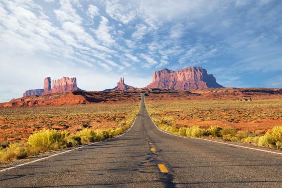
Explore Picturesque Navajo County, Arizona!
Settle down on a piece of land that once served one of the greatest Native American tribes, the Navajo Nation. Immerse yourself in the beauty of this one of a kind, diverse culture.
This state has some of the most breathtaking views in all the United States, bringing in visitors from all over the country, to view some of the world's most recognized landscapes, such as Monument Valley and the brilliant blue waters of Lake Powell.
You can easily get lost in the history, beauty, and culture of this wondrous city. From star gazing, hiking trails, campgrounds, national monuments, historical parks, museums, trading posts, and the Twin Arrows Casino Resort, there is definitely something for everyone!
This property is just a 30 minute drive to the Petrified Forest National Park! In its south, the Rainbow Forest is full of colorful petrified wood. It’s home to the Rainbow Forest Museum, with its paleontology exhibits and many trail access points. In the park's center are the petroglyphs of Newspaper Rock and the ruined village of Puerco Pueblo. To the north, the Painted Desert Inn, a 1930s adobe building, is a museum with Hopi murals.
Things to do Petrified Forest National Park >>
Don't miss out on the opportunity to own property in this peaceful town.
Legal Description: Vein Of Gold Unit 7 Lot 85
Approximate Coordinates: 34°59'11.6"N 110°00'23.6"W
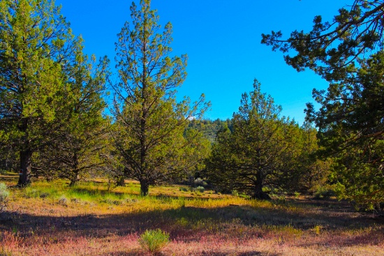
Camp or Build in this Pine Forest in Peaceful & Uncrowded Northern California!
Modoc County, located in the far northeast corner of California, is often called the “place where the west still lives” and is frequently compared to the beautiful expanses of Montana.
The warm, dry summers encourage camping, hiking, fishing, and water sports against the backdrop of the uniquely beautiful Warner Mountains, with their clear alpine streams and a high desert dotted with serene lakes. An ideal habitat for diverse wildlife, the area is home to bald eagles, peregrine falcons, goshawks, golden eagles, Rocky Mountain mule deer and elk, wild horses, burros and pronghorn antelope.
What to Do and See in Modoc County >>
This lot is located in the California Pines, a beautiful community located just 10 miles southwest of the City of Alturas. California Pines covers 15,000 acres surrounded by 2 million acres of the Modoc National Forest.
California Pines is a peaceful and uncrowded retreat with green meadows, towering pines and trickling streams. It's a place to escape and become part of a tranquil and laid-back community, then come to California Pines and escape to this outdoor paradise.
The Lake Units are located at an elevation of 4,300 feet in mostly meadow pastureland type of property. The California Pines Lake is 256 acres and next to it sits the California Pines Lodge, a 4,400 foot airstrip, and campground.
Escape to California Pines! Camp or build a getaway in this paradise!
The California Pines Property Owners Association maintains common areas for the benefit of the property owners, residents and the general public. The annual POA fee of $95 is the responsibility of the buyer.
The California Pines Lodge sits on a small peninsula surrounded by California Pines Lake, right next to Donavan Reservoir, which is a haven for Canadian Snow Geese, White Pelicans, Cranes, and many other wild birds and animals of all kinds. The 8,000 square foot lodge features guest rooms, a restaurant, lounge, banquet room and activity room. The grounds of the lodge include a swimming pool and two paddle-tennis courts.
See the California Pines Lodge >>
Don’t let this opportunity pass you by!!
Legal Description: Lot 28, Block 12, California Pines Unit Lake 2, a subdivision of the County of Modoc according to the official Plat thereof, filed in Book 2 of Maps in Modoc County Records.
Approximate Coordinates: 41°24'47.4"N 120°37'43.9"W
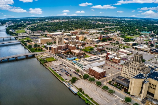
Build Your Home a Half Mile from Michigan's Saginaw River!
Build in this established neighborhood in Saginaw, Michigan! This lot is located near parks and less than a mile from the Saginaw River! Along with Bay City and Midland, Saginaw forms the tri-city area.
Saginaw has a good balance of services and facilities for a city of its size and profile, including technology, higher education, healthcare, air service, cultural amenities, as well as being rich in history.
This is Saginaw. We Build Opportunity!
Saginaw is the gateway to recreational areas in northern Michigan. There is a small Old Town entertainment district across the Saginaw River and there are many interesting things to do there.
15 Best Things to do in Saginaw >>
This diverse city has opportunities in abundance for both outdoor and indoor adventures. From iconic locales to theaters and museums, there are plenty of things to do in Saginaw, including catching a show at the Dow Event Center or the Temple Theatre, viewing artwork at the Saginaw Art Museum, or spending the day at the Children's Zoo and much more.
Legal Description: WLY.50 FT.OF LOT 1ELY.20 FT.OF LOT 2LOT 3EXC.WLY.100 FT. BLK.8EMERSONS ADDITION.WLY.50 FT.OF LOT 8BLK.10FISHPHELON & REMINGTONS ADDITION
Property Address: 810 Atwater St, Saginaw, MI 48601
Own an Island in White Lake, Michigan!
White Lake Charter Township in Oakland County, Michigan offers residents a suburban rural mix feel. It is located in southeastern Michigan about 30 miles northwest of Detroit and 30 miles northeast of Ann Arbor. There are recreational activities for all within White Lake and in the various county parks:
This wooded lot is located in southern White Lake on an island of a tributary of Round Lake, accessible only by water. Camping is permitted there.
This four-seasons township is home to 21 scenic lakes with terrific boating and fishing opportunities. There, you can also hit the slopes, or tee off on top-notch golf courses:
See Alpine Valley Ski Resort Video >>
White Lakes Oaks Golf Course >>
Don’t miss your opportunity to own land in White Lake!
Legal Description: T3N R8E SEC 35 ROUND LAKE OVERLOOK NO 3 LOT 244
Approximate Coordinates: 42°36'56.1"N 83°28'24.8"W
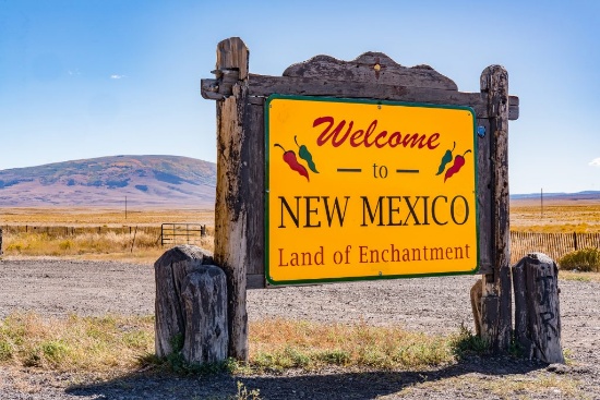
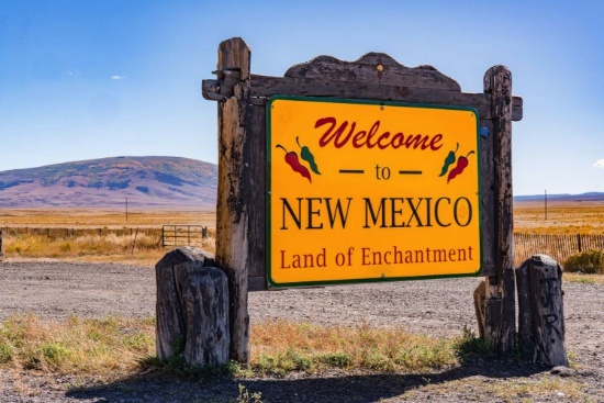
20-Lot Package in the Heart of New Mexico! BIDDING IS PER LOT!
Quantity: 20
Great Things Happening in Valencia County, New Mexico! >>
This package of 20 lots is available in beautiful Valencia County, New Mexico. The lots are scattered throughout the Rio Del Oro subdivision and are not contiguous. You'll get 5 total acres of land to immerse yourself in the excitement and sizzling hot investment activity of Los Lunas and Valencia County! This area is experiencing tremendous economic growth with a new Facebook data facility, manufacturing hub, and pipeline project.
Rail Park in Los Lunas to bring 5,000 jobs to the area! >>
You can also enjoy numerous hiking and exploring opportunities nearby including the Whitfield Wildlife Conservation Area, Cibola National Forest, and the Manzano Mountains State Park. And you'll be only an hour away from Albuquerque International Airport (ABQ).
Valencia County, New Mexico Desert Mountains! >>
Check out Manzano Mountains! >>
In mid-March of 2021, Facebook announced a doubling of its Data Center, adding six additional buildings totaling over two million square feet by 2023. Los Lunas’ government will provide nearly $40 billion in industrial revenue bonds and other economic development funding!
LATEST UPDATE: Facebook announces $800M expansion plan for Los Lunas Data Center
Facebook Los Lunas Data Center! >>
BIDDING IS PER LOT FOR A CASH PURCHASE!
TOTAL BID PRICE = BID PER LOT x NUMBER OF LOTS.
Note: Back taxes of up to $300 per lot will be the responsibility of the buyer.
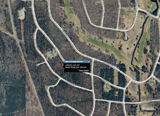
Welcome to the Lakewood Shores Community in Michigan's Lower Peninsula!
Welcome to Lakewood Shores, an active community in Iosco County, Michigan, located in the northeast quarter of Michigan’s lower peninsula! Set peacefully along the shores of beautiful Lake Huron and the mighty Au Sable River, large portions of the county are forested and/or held in public ownership as national or state forest lands.
This homesite is wooded with beautiful white birches, pines and hardwoods. Looking for a new primary home or a place to get away seasonally throughout the year? Do you enjoy year-round recreational activities such as water sports, camping, fishing, hunting, cross country skiing, snowmobiling and more? Look no further!
This community is 5.5 miles north of Oscoda Township, Michigan’s fastest growing community, with shopping malls, churches, medical services, education and recreation, just minutes away! And lovers of history and the outdoors alike know Oscoda as the home of the famous Lumberman's Monument located in the Lake Huron National Forest.
Lakewood Shores is bordered on the east by Lake Huron and on the west by the Alpena State Forest. In the center, you can find Cedar Lake creating a water enthusiasts paradise! From canoeing to sunbathing, the community provides activities for water enthusiasts of all varieties.
The fun doesn’t stop there! Lakewood Shores has so much more to offer, including a beach club, a clubhouse, white sandy beaches of cedar lake, marina causeway, docks, racquet club, tennis courts, locker rooms, snack bar, shuffle boards, 9 total beaches, 12 picnic areas, BBQ pits, fishing ponds, ball parks, basketball courts, badminton courts, and a playground.
Community Informational Brochure >>
Members may also take advantage of the Lakewood Shores Golf Resort Courses: the Serradella, Blackshire and The Gailes. These courses are among the finest in Northeast Michigan!
You do not want to miss this opportunity!
Note: The Lakewood Shores Property Owner's Association (POA) manages this community. Buyers, upon purchase, are responsible for directly paying outstanding fees to the POA. The annual fee for 2022 will be $230, due upon transfer of property.
Legal Description: LAKEWOOD SHORES GOLF & COUNTRY CLUB NO. 3 LOT 343
Approximate Coordinates: 44°29'22.7"N 83°20'55.9"W
Walking Distance to Greers Ferry Lake in Van Buren County, Arkansas!
Van Buren County is naturally blessed with an idyllic medley of rolling highlands, lake & riverfront shores, and the beautifully forested lands of the Ozark Plateau. Experience the unique beauty of the Ozark Mountains, with its waterfalls, natural bridges, and underground caverns. Here, the city-weary can savor the fresh mountain air and unwind by exploring quaint shops and delightful restaurants.
Indian Falls & Burnt Rock at Fairfield Bay >
This wooded lot is located in Indian Rock Township, walking distance to Greers Ferry Lake. Plenty of boating, fishing, golfing, hiking and other activities nearby. This lot is near many trail heads and other activities unique to this part of Van Buren County.
Learn More about Greers Ferry Lake >>
Adventure Destination: the Greers Ferry Lake Area >>
The Gulf Mountain Wildlife Management Area lures hunters, stream fishermen, nature lovers and campers. The Brock, the Driver Creek, and the Little Red River areas offer hunting and camping. Greers Ferry Lake's 40,000-acres is a mecca for boating, water skiing, swimming, fishing and hunting.
The popular Sugar Loaf Mountain is an uninhabited island refuge for plant and animal life. An award-winning hiking trail winds its way from the water’s edge to the mountain summit.
Learn More about Sugarloaf Mountain >>
Clinton is the county seat, located on the Highway 65 route to Branson, MO. The five-lane highway draws visitors for more than just a passing visit; restaurants and boutiques vie for attention, framed by a breathtaking vista that leads into the historic downtown and a spectacular Riverwalk & nature park on the newly-restored Upper Little Red River.
Great American Highway 65 Road Trip >>
Many smaller, unincorporated communities dot the landscape, beckoning your inner adventurer on a hiking/floating trek, or a journey through its unique historical sites.
Celebrated events such as the National Championship Chuckwagon Races bring thousands of visitors to the area each Labor Day, along with popular attractions including the Natural Bridge.
Legal Description: Lot/Block: 114/8 Subdivision: CHELSEA GLADE
Approximate Coordinates: 35°35'07.8"N 92°16'18.0"W
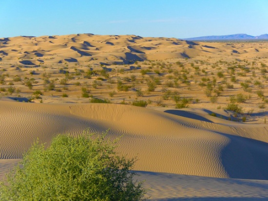
Park your RV on this Southern California Outdoor Adventurer Paradise!
Imperial County shares borders with Mexico to the south, Riverside County to the north, San Diego County to the west, and the State of Arizona to its east.
This lot, about half mile from the Salton Sea, is an ideal location for a RV. With its level desert landscape as a background, enjoy the variety of outdoor dune buggy driving excursions and other adventures.
To return to small city life, head 40 miles south to the city of Brawley, ranked in the top 10 fastest growing cities in California.
For more adventure, continue east another 25 miles on Highway 78 to the Imperial Sand Dunes Recreation Area, the largest dune complex in California. The sand dunes extend more than 40 miles along the eastern edge of the Imperial Valley, split by Highway 78. Off-road vehicles are permitted. To the north, (the green section on the map), you are free to walk but there's no sign and no trailhead.
See the Algodones Sand Dunes >>
Legal Description: LOT 17 01 BLK 18 TRACT 679 FM 7 54
Approximate Coordinates: 33°17'44.0"N 115°55'31.5"W
Almost Half-Acre Buildable Lot in Michigan's Beautiful Canadian Lakes Community!
Welcome to Canadian Lakes: a Home, a retreat, a lifestyle!
Build your dream home near the Lake of the Clouds in Canadian Lakes, a private recreational community in northern Michigan!
Owners have inclusive use of remarkable amenities, including over 730 acres of waterways for all types of water sports, six beaches, sports venues, two 9-hole and one 18-hole golf courses, outdoor and indoor swimming pools, fitness area, hot tub, sauna, snow tubing tow, cross-country skiing, outdoor ice rink, campground, and more!
Canadian Lakes is located in Mecosta County, truly "The County for Every Season!" Escape for an afternoon excursion in the county.
Explore the Big Rapids Region >>
Explore numerous trails for hiking and biking, snowshoeing or snowmobiling, or enjoy the abundant land and lakes for hunting and fishing. Enjoy over 100 lakes and streams and, of course, the mighty Muskegon River. All are perfect for fishing, tubing, canoeing, kayaking, boating, and water-skiing.
Take in the wonder of wildlife and scenic views. You'll be surrounded by numerous festivals, events, and unique hometown shops. Excite your taste buds at nearby tasty dining venues, breweries, and wineries.
Don't miss this GOOD LIFE!!
Please Note: The Canadian Lakes Property Owner's Corporation (POC) manages this community. The annual fee for 2022 is $759.54. Buyers, upon purchase, are responsible for directly paying all outstanding fees up to $1,200 to the POC.
Legal Description: SEC 19 T14N R8W LOT 45 HIDDEN VALLEY ESTATES #1.
Property Address: 11252 Birwood Dr, Stanwood, MI 49346
Prime Lot Near the Golf Course & South Fork Spring River in Cherokee Village, Arkansas!
Cherokee Village: The Hidden Gem!
Imagine living in this beautiful four seasons serene location in the Arkansas Ozarks!
A home may be constructed on this lot so long as the house size is a minimum of 800 square feet and complies with the zoning set forth in Cherokee Village Zoning "Bill of Assurance": Crow 2nd Addition.pdf
Considering retirement, a new start for your family, just ready for a change, or looking for a part-time retreat? Cherokee Village offers small town charm, first-class outdoor recreation amenities and affordability. Take advantage of the low taxes, low cost of living and low housing costs. Your housing dollars stretch further here.
Experience Cherokee Village >>
This lot sits on S Walla Walla Drive, less than a half mile North of Cherokee Village North Golf Course and South Fork Spring River!
Play at Cherokee Village North Course >>
Cherokee Village is the perfect backdrop for your next adventure. Come enjoy the lakes, river, golf courses, parks, trails, RV and campground. With more than 13,000 acres set among the rolling hills and pristine natural beauty of the Arkansas Ozarks, Cherokee Village has something to offer all ages.
Soak up the sun on the private beach, seven lakes & six swimming pools, hit the links on the two private 18-hole golf courses, go RVing and camping, take a swing at pickleball and tennis, cycling and hiking or just relax in a hammock. Also enjoy the recreation centers, fitness center, senior center, horseshoe pits, and three nature trails.
Boat, fish and play on our seven lakes. Enjoy the year-round spring-fed South Fork River that flows into neighboring Spring River. Both rivers rank among the Ozark region's most popular destinations for floating and trout and walleye fishing.
Legal Description: Subdivision: CROW SECOND Lot: 30 Block: 8
Approximate Coordinates: 36°19'07.6"N 91°32'43.7"W
Just Steps Away from Lake Erie in Monroe County, Michigan!
Prime Lot in Monroe County, just Steps away from Great Lake Erie!
Monroe County is a historical and beautiful community set in the southeastern corner of Michigan, bordering Ohio to the south and Lake Erie to the east.
This lot is located on Center St. just steps away from Great Lake Erie! Enjoy Swan Boat Club, Big Al's Greens & Grille golf course, several community parks and tons of recreational activites!
The city of Monroe has impressive parks and recreation land – around 300 acres, in addition to the non-motorized River Raisin Heritage Trail. Parks contain a wide variety of recreation amenities, including picnic facilities, hiking, athletic fields, concert venues, war memorials, fishing, kayaking, boat launch, open space, and historical sites.
A Tour of the City of Monroe >>
There are activities for everyone in Monroe County:
What to Do and See in Monroe County >>
The River Raisin Battlefield, Sterling State Park, Cabela's, and many other areas of interest make Monroe County a great place to live. Monroe’s location on the shore of Lake Erie provide opportunities for swimming, boating, and fishing.
Explore the county’s numerous parks, trails, and recreational facilities.
Sterling State Park is the only Michigan park on Lake Erie. The park’s 1,300 acres include more than a mile of sandy beach, boating and shore fishing, a fishing lagoon, lakefront camping, wildlife viewing and seven miles of trails.
Pointe Mouillee State Game Area is one of the most respected waterfowl locations in Michigan. Consisting of over 4,000 acres, it offers exceptional waterfowl hunting. And, its numerous bird species and habitat diversity make it an important birding site for Bald Eagles, Black Billed Plovers, Glossy Ibises, Osprey, and Whimbrels.
Things to Do in Pointe Mouillee >>
Don’t miss this opportunity to enjoy Monroe County, the cornerstone of Michigan!
Legal Description: STEVENS ESTRAL SUBDIVISION W 60 FT OF THE E 120 FT OF LOT 136
Approximate Coordinates: 41°59'03.8"N 83°14'30.1"W
Own Land on the Washington's Pacific Northwest Olympic Peninsula!
Grays Harbor County, Washington is located on the southwest corner of the Olympic Peninsula along the Pacific Ocean. In no other county can you stick your toe in the Pacific Ocean at a beautiful beach one hour, and the next hour be in the lush rain forest.
Explore Grays Harbor County >>
50 Things To Do in Grays Harbor!
This beautiful county is the "Gateway to the Pacific Ocean" and Washington's scenic coastal wonderlands. It is located on the southwest corner of the Olympic Peninsula along the Pacific Ocean.
This wooded lot is located less than a mile from Hoquiam River and less than 10 minutes from Hoquiam River RV Park. This centrally-located Hoquiam River RV Park is a gateway to the Olympic Peninsula. This RV park provides a sheltered base to explore the beaches of Ocean Shores and Westport. This Good Sam RV park is open all year for both short and long term stays.
Also nearby, you can find several parks, shopping malls, and coffee shops. Head down to the beach with just about a 40-minute drive to the Pacific Ocean. There is something here for everyone!
Grays Harbor is home to seven bodies of water: harbors, lakes, streams, channels, canals, rivers and of course, the Pacific. Aquatic activities galore, and then some! If water isn't what you want to experience, then hike into the enchanted forests to witness wildlife in their natural habitat. Or experience the Quinault Rain Forest, one of only two temperate rain forests in the Northern Hemisphere. Camp, kayak, walk, hike, you name it, Grays Harbor is untouched and waiting for you to explore.
Please Note: You are bidding only on lot 2. This lot is the second lot from the right and specified in the photos. Adjacent Lot 3 may be available, please inquire within.
Legal Description: Lot 2 Block 102, Beacon Hill Addition to the City of Hoquiam, as per plat recorded in Volume 5 of Plats, page 23, records of Grays Harbor County, TOGETHER WITH that portion of vacated Ontario Street that would attach thereto by City Ordinance No. 2077, recorded February 27, 1959 as Auditors File No. 44649, records of Grays Harbor County; Situate in the County of Grays Harbor, State of Washington.
Approximate Coordinates: 46°58'42.7"N 123°51'45.9"W
Enjoy the Amenities in the Presque Isle Harbor Community, Michigan!
Welcome to Presque Isle, located in the Lower Peninsula of Michigan, an unspoiled environment of woods, water and other natural resources. This beautiful four seasons recreational community includes many amenities for owners to enjoy. It is located about a mile from Lake Huron, and just a short walk to Grand Lake! It is the home of two Lighthouses, the Range Light Beach, Lake Esau, Barnum Park, and of course the Harbor!
This community is managed by the Presque Isle Harbor Association, with numerous amenities. The amenities include the Clubhouse with gyms, game room, conference room, locker rooms, spa and an indoor pool. The amenities also include private campgrounds for residents! Association dues, due on April 1st, are $272.00 annually. Water fees are $62.75 per quarter for a lot with a water hook-up, and $33.25 without hook-up. The buyer will be responsible for payment of the year's annual dues and water fees.
Presque Isle Harbor Association >>
Thompson Harbor is situated along seven and a half miles of Lake Huron shoreline, this undeveloped park provides a rustic retreat for hikers exploring the park's six miles of trails. The park trails are open year-round for biking, hiking, cross-country skiing and snowshoeing. Bring your binoculars for wildlife viewing. Winter camping is available in the rustic cabins.
You can't beat this beautiful location!
Legal Description: LOT 219 NORTH BAY HEIGHTS SUBD SEC 18 T34N R8E
Approximate Coordinates: 45°20'07.0"N 83°30'41.1"W
Minutes from the Expressway in Valencia County, New Mexico!
Own land and be close to the activity of everyday life! This lot is in an ideal location! Just minutes from the Manzano Expressway! Walmart Supercenter & fast food options are less than 20 minutes away! And if golfing is your thing, Tierra Del Sol Golf Club is just 10 minutes away!
Great Things Happening in Valencia County, New Mexico! >>
Valencia County is a central location to the major populated counties. The county has a rich diversity, including professionals, writers, artists, families and friendly citizens.
In addition to being rich in culture and a great place to raise a family, Valencia County is experiencing an economic prosperity boom. Exciting things are happening to this already-charming location.
Under 20 minutes from the Rio Del Oro Loop >>
In mid-March of 2021, Facebook announced a doubling of its Data Center (just 25 minutes away), adding six additional buildings totaling over two million square feet by 2023. Los Lunas’ government will provide nearly $40 billion in industrial revenue bonds and other economic development funding! Immerse yourself in the excitement and sizzling hot investment activity of Los Lunas and Valencia County!
LATEST UPDATE: Facebook announces $800M expansion plan for Los Lunas Data Center >>
Los Lunas Facebook Data Center >>
You can also enjoy numerous hiking and exploring opportunities within driving distance, including the Whitfield Wildlife Conservation Area, Cibola National Forest, Meadow Lake and the Manzano Mountains. Other Valencia County Attractions include: Harvey House Museum, Los Lunas Museum of Heritage & Arts, Tome Hill Park, Balloon Fiesta Park, Enchanted Trails RV Park, and more!
Note: Back taxes of up to $100 will be the responsibility of the buyer.
Legal Description: RIO DEL ORO Lot: 31 Block: 95 Unit: 13 .25 AC
Approximate Coordinates: 34°39'52.9"N 106°40'59.8"W
If You Like Adventure, these 2.5 Acres in Southern California are for You!
If you like adventure, then this property is for you!
Imperial County shares borders with Mexico to the south, Riverside County to the north, San Diego County to the west, and the State of Arizona to its east.
Bring your dune buggy or other off-road vehicle to explore the diverse surroundings in Southern California.
This remote 2.5-acre parcel is located in the rolling hills of Imperial County, located between the city of Brawley, about 70 miles to the west; the Colorado River and the Cibola National Wildlife Refuge about 40 miles to the east; and the Algodones Sand Dunes about 40 miles to the south.
The Imperial Sand Dunes Recreation Area, the largest dune complex in California, extends more than 40 miles along the eastern edge of the Imperial Valley, split by Highway 78. Off-road vehicles are permitted. To the north (the green section on the map), you are free to walk but there are no signs and no trailhead.
See the Algodones Sand Dunes >>
Cibola National Wildlife Refuge straddles the border of California and Arizona. It has an abundance of wildlife watching and nature trail opportunities. Take the Canada Goose Drive for an excellent opportunity for wildlife viewing and photography. On the accessible walking trail, you might see song birds, bobcats, quail, and mule deer. Anglers can fish for largemouth bass, smallmouth bass, striped bass, channel catfish, flathead catfish, crappie, sunfish, tilapia, and common carp. Public hunting on Cibola National Wildlife Refuge is permitted in specified areas.
Experience the Cibola National Wildlife Refuge >>
Head to the city of Brawley, ranked in the top 10 fastest growing cities in California, for provisions, food and entertainments!
Learn about the City of Brawley >>
Explore your adventurous spirit!
Legal Description: SE4 OF SW4 OF NW4 OF NE4 SEC 35 T9S-R18E 2.50AC
Approximate Coordinates: 33°21'06.2"N 115°03'06.2"W
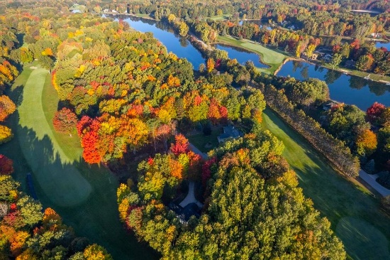
Over an Acre, Close to Lakes & Golf Clubs, in Polk County, Florida!
This 1.10 acre plat is located in a peaceful, wooded area in southeastern Polk County, and is surrounded by so much to do!
With over 2,000 square miles of land and water, Polk County is the fourth largest county in the state. Located in the geographic center of Florida and along Central Florida’s I-4 corridor, it’s less than an hour from Tampa and less than 30 minutes from Orlando!!
This lot is close to Sweet Hill Road. It's about a 15 minute drive to Polk City. In under 30 minutes, you will find Davenport City offering several golf courses and country clubs, shopping malls, grocery stores, restaurants, parks, and more!
Deer Creek RV Golf and Country Club >>
If fishing is your sport, you'll have an abundance of lakes to choose from!
There's so much to do in this beautiful, sunny location!
Note: County does not permit living in RVs at any time unless a house has been constructed on the lot.
Legal Description: S 200 FT OF N 1399 FT OF W 273 FT OF E 4362 FT OF SEC LESS E 33 FT FOR RD R/W BEING LOT 199 UNIT C OF UNREC GROVELAND RANCH ACRES
Approximate Coordinates: 28°15'00.1"N 81°43'51.6"W
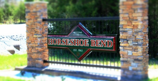
Join This Resort Retirement Community, in Horseshoe Bend, Arkansas!
Enjoy the natural Ozark beauty in the rugged hill country of Izard County, in north central Arkansas. The White River forms the southwestern border and provides recreation and fishing. A world-famous trout fishing river, the White, brings cold water from the depths of Bull Shoals and Norfork lakes, gradually warming near Batesville. The Strawberry River is a good stream for floaters and on this river is located the city of Horseshoe Bend. Two highways, No. 9 and No. 58, offer scenic beauty. The quaint town of Calico Rock sits on the bluffs above the White River and offers small-town charm.
This lot is located in the city of Horseshoe Bend, a resort retirement community featuring lakes, a golf course, health spa, tennis facilities, and a shopping center. Nestled in the Ozark Mountains, close to the Strawberry River, Horseshoe Bend is easily accessible to Arkansas' most scenic highways. RVs are not permitted until a house has been constructed.
The city is located within three hours of Little Rock, Memphis and Springfield and is the perfect springboard location for visits to many popular attractions! Izard County's largest city covers over 14,000 acres and sports a population of 2,180 residents.
Live the Good Life in Horseshoe Bend
Learn All About the City of Horseshoe Bend >>
Come fish or canoe on the river, enjoy boating on one of four lakes, including 640 acre Crown Lake, challenge the state-of-the-art par 3 or the 18-hole championship golf course, bowl a line or two, toss a few horseshoes, play miniature golf, shoot a few hoops, shuffleboard or tennis, swim in one of two indoor pools or take a sunny outdoor swim on Turkey Mountain. The town offers convenient shopping, a library, several restaurants, two resorts, a spa, two music and variety venues, and so much more!
Legal Description: Lot/Block: 147/ Subdivision: GREEN BRIAR
Property Address: 1403 Franklin Dr, Horseshoe Bend, AR 72512
