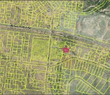
NOTE: Click on the Property Address link below to explore the area on Google Maps. Zoom in for a detailed view of local attractions, roads, etc., or zoom out for a wider perspective of the surrounding region.
Parcel ID: 0010A-00000-302-000
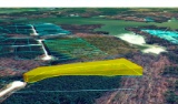
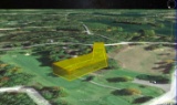
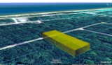
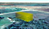
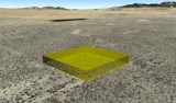
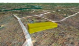
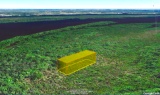
Legal Description: Lot 302 Phase II Stillwater Coves
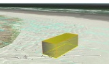
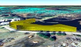
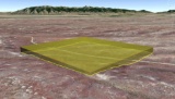
Acres: 3.96
State: Georgia
County: Lincoln
Taxes: Under $55 per year
Property Address: 1190 Hardwood Dr, Tignall, GA 30668
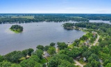
Build your new home on this 3.96 acre property in Stillwater Coves, Lincoln County, Georgia!
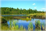
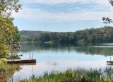
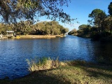
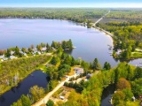
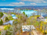
Lincoln County is a small, rural county located in the eastern Piedmont region of Georgia, very close to the South Carolina border. It is situated along the western shore of the Clarks Hill Lake, also known as Lake Thurmond. Lincoln County is known for its tight-knit community, southern hospitality, and small-town charm.
Lincoln County, Georgia >>
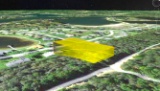
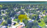
This beautiful property is located in Stillwater Coves, a residential community located in Tignall, on the shores of Lake Thurmond. Tignall embodies the small-town atmosphere, with a strong sense of community, traditional values, and a slower pace of life. The proximity to historical sites and the natural beauty of the region offer potential for tourism, particularly for those interested in Georgia’s history or seeking a peaceful rural getaway.
Stillwater Coves >>
Master Community Site Map >>
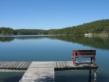
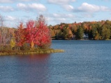
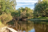
Residents enjoy easy access to boating, fishing, kayaking, and other water sports. The area offers scenic views, outdoor recreational activities, and a tranquil lifestyle, making it appealing for those seeking a lakeside or countryside retreat.
Experience the Georgia River Trails >>
Planned amenities for the community include a landscaped entry way, easy access day docks, boat storage, pool with bath house, walking trails, and a community pavilion complete with a summer kitchen, open fireplace, and a picnic area.
Stillwater Coves' community theme is a neighborhood of Southern summer homes that have a look and feel of the houses reminiscent of early 20th century retreats in the South.
All site work, structures and landscaping are subject to design and aesthetics approval that meet the community’s Design Review Guidelines, Style Book and Covenants (available upon request).
Homes must have a minimum of 1,300 SF of heated space on the main level and a maximum of 5,800 SF in total. All utilities (water, sewer and electricity) are at the curb for home construction.
Besides lake activities, the area around Stillwater Coves offers parks, hiking trails, wildlife management areas and campgrounds, including the popular, nearby campground, Hester's Ferry.
Georgia Freshwater Camping - Hesters Ferry >>
The Richard B. Russell State Park and Clarks Hill Wildlife Management Area are also popular destinations for outdoor enthusiasts.
Explore Richard B. Russell State Park >>
Overall, Stillwater Coves provides a peaceful, nature-oriented lifestyle, perfect for those who enjoy lakeside living in a quiet, rural setting.
Claim this prime property today!
NOTE: This property is located within the Stillwater Coves HOA, managed by Silverleaf Management Company. The annual dues of $700.00 were paid in full in December 2024. Buyer will be responsible for 2025 dues and a $109 initiation fee.