Affordable Land Across the USA - Act Fast!
Affordable Land Across the USA - Act Fast!
See Special Terms for additional fees
Description


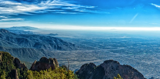
Charlotte County, Florida: Your Gateway to Nature, Golf, and River Serenity!
Top 19 Things To Do in Port Charlotte, Florida! >>
Visit Punta Gorda - Englewood Beach >>
This lot is located in Punta Gorda, perfectly nestled between Deep Creek Golf Course and Peace River!
Immerse yourself in nature's beauty at the area's environmental parks and preserves. Explore the serene pine flatwoods and wetlands at Charlotte Flatwoods, bring your binoculars to spot migratory and wading birds around Lemon Bay, fish for Amberjack, or take a leisurely walk along the hiking trails at Tippecanoe Environmental Park!
Experience a Florida Camping and Canoe Adventure on the Peace River! >>
This location is an outdoor enthusiast's dream! Don’t miss out on this incredible opportunity!
NOTE: County does not permit living in RVs at any time unless a house has been constructed on the lot.

Build Close to the Saginaw River in Saginaw County, Michigan!
Legal Description: LOT 8SUBDIVISION OF OUT LOT NO.22GLASBYGALLAGHER & LITTLES ADDITION
Acre: 0.18
State: Michigan
County: Saginaw
Taxes: Under $6 per month
Property Address: 543 S 12th Street Saginaw, MI 48601
Build in this established neighborhood in Saginaw, Michigan! This lot is located near parks and less than 2 miles from the Saginaw River! Along with Bay City and Midland, Saginaw forms the tri-city area.
Saginaw has a good balance of services and facilities for a city of its size and profile, including technology, higher education, healthcare, air service, cultural amenities, as well as being rich in history.
This is Saginaw. We Build Opportunity! >>
Saginaw is the gateway to recreational areas in northern Michigan. There is a small Old Town entertainment district across the Saginaw River and there are many interesting things to do there.
15 Best Things to do in Saginaw >>
This diverse city has opportunities in abundance for both outdoor and indoor adventures. From iconic locales to theaters and museums, there's plenty of things to do in Saginaw, including catching a show at the Dow Event Center or the Temple Theatre, viewing artwork at the Saginaw Art Museum, or spending the day at the Children's Zoo and much more.
Discover a city steeped in arts & culture — with hidden gems & unexpected delights around each historic, mural-covered street corner.
Spacious LA County Lot! Near Nature, Parks & City Life!
NOTE: Click on the Approximate Coordinates link below to explore the area on Google Maps. Zoom in for a detailed view of local attractions, roads, etc., or zoom out for a wider perspective of the surrounding region.
Parcel ID: 3307004045
Legal Description: TRACT NO 1181 LOT 21 BLK 10
Acre: 0.17
State: California
County: Los Angeles
Taxes: Under $9 per month
Approximate Coordinates: 34°45'39.1"N 117°58'01.1"W
Welcome to LA County!
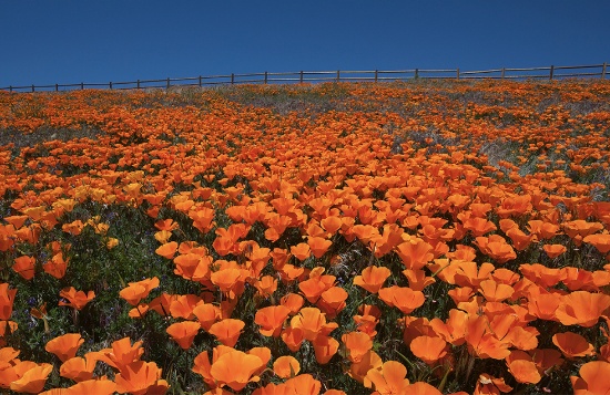
Easily access this lot which is located just slightly North of E Ave E 4 & also close to 90th St E. It's about 15 miles West of Butte Valley Wildflower Sanctuary, and less than 15 miles Northwest of Saddleback Butte State Park and Campground. If you continue a few miles South, you will find Antelope Valley Indian Museum State Historic Park and Lake Los Angeles Community. From there, about 15 minutes West, is the city of Lancaster, where you can spend the day visiting the Museum of Art and History, and the beautiful, Antelope Valley California Poppy Fields.
The County of Los Angeles is the most populous county in the United States with nearly 10 million residents covering 4,083 square miles. Its population is greater than that of 40 individual U.S. states. It is one of the most ethnically diverse counties in the United States.
The county is divided west-to-east by the San Gabriel Mountains, where most of the county's highest peaks are located. Several lower mountains are in the northern, western, and southwestern parts of the county, including the San Emigdio Mountains, the southernmost part of Tehachapi Mountains and the Sierra Pelona Mountains.
Most of the population of Los Angeles County resides in the south and southwest, with major population centers in the Los Angeles Basin, San Fernando Valley, and San Gabriel Valley.
If you like a warm and sunny climate, bid now!
Homosassa Lot in Scenic Citrus County, Florida: A Nature Lover's Paradise!
NOTE: Click on the Approximate Coordinates link below to explore the area on Google Maps. Zoom in for a detailed view of local attractions, roads, etc., or zoom out for a wider perspective of the surrounding region.
Parcel ID: 17E19S340010 00100 0220
Legal Description: VILLA SITE ADD TO HOMOSASSA PB 1 PG 53 LOT 22 BLK 10 DESC IN OR BK 123 PG 171
Acre: 0.15
State: Florida
County: Citrus
Taxes: Under $5 per month
Approximate Coordinates: 28°47'01.0"N 82°34'56.8"W
Discover the essence of Florida in Citrus County, where the warm Gulf waters blend with crystal-clear, spring-fed rivers. Enjoy championship golf courses, charming local shops, a rich historical heritage, and endless opportunities for aquatic adventures. This area is ideal for outdoor enthusiasts, offering kayaking, paddleboarding, fishing, boating, and more.
A Visit to Citrus County Florida >>
This parcel is located in Homosassa, in the Villa Site Addition to Homosassa. Homosassa is a charming, small community in Citrus County, Florida, known for its natural beauty, wildlife, and outdoor recreational activities. Located along the Gulf Coast, it has a rich history and is particularly famous for its springs and as a haven for manatees.
Flowing through the community, the Homosassa River is a popular spot for boat tours, kayaking, and fishing. The river is connected to the Gulf of Mexico and provides access to both freshwater and saltwater fishing.
In addition to the Homosassa River, this property is located close to Bluebird Springs Park, Ellie Schiller Homosassa Springs Wildlife State Park, and several campgrounds and resorts.
Go hiking, swim with the manatees, birdwatch and picnic at Ellie Schiller Homosassa Springs Wildlife State Park!
Homosassa Springs State Park >>
Overall, Homosassa in Citrus County is a laid-back, nature-rich destination that offers visitors a mix of outdoor adventures, wildlife encounters, and a small-town atmosphere.
NOTE: County does not permit living in RVs at any time unless a house has been constructed on the lot.
NOTE: Adjacent Lots may be available, please inquire within.

Build Your Dream Home in Northern California!
NOTE: Click on the Approximate Coordinates link below to explore the area on Google Maps. Zoom in for a detailed view of local attractions, roads, etc., or zoom out for a wider perspective of the surrounding region.
Parcel ID: 036-137-007-000
Legal Description: Lot 7, Block 25, California Pines Unit Lake 2, a subdivision of the County of Modoc according to the official Plat thereof, filed in Book 2 of Maps in Modoc County Records.
Acre: 0.97
State: California
County: Modoc
Taxes: Under $28 per month
Approximate Coordinates: 41°25'05.8"N 120°39'35.8"W
Nestled in the northeastern corner of California, Modoc County is a tranquil and picturesque haven filled with untouched natural beauty and a laid-back, small-town charm. This county boasts rolling meadows, pristine lakes, and towering mountains, offering outdoor enthusiasts a playground for hiking, hunting, fishing, and wildlife observation. Alturas, the commercial center for northeastern California, is less than 15 minutes away
What to Do and See in Modoc County >>
The warm, dry summers encourage camping, hiking, fishing, and water sports against the backdrop of the uniquely beautiful Warner Mountains, with their clear alpine streams and a high desert dotted with serene lakes.
This property is located in Lake Unit 2, at an elevation of 4,300 feet in mostly meadow pasture land.
RVs and camping are permissible for up to 30 days of a calendar year.
If you are considering constructing a home, please note that the living space must be no less than 500 square feet.
Construction will require a private well and septic system. If there is electricity in the area, it can be extended to your lot. Power is obtained through Surprise Valley Electric. Solar & wind turbine are also allowed.
Building in California Pines! >>
The California Pines Property Owners Association maintains common areas for the benefit of the property owners, residents and the general public.
The California Pines Lake is 256 acres and next to it sits the California Pines Lodge, a 4,400 feet airstrip, and campground. The 8,000 square foot lodge features guest rooms, a restaurant, lounge, banquet room and activity room. The grounds of the lodge also include a swimming pool.
See the California Pines Lodge >>
Take advantage of living in this serene and peaceful community!
NOTE: The annual POA fee is $105 and will become the responsibility of the buyer.

Invest in Growth in Valencia County, New Mexico!
NOTE: Click on the Approximate Coordinates link below to explore the area on Google Maps. Zoom in for a detailed view of local attractions, roads, etc., or zoom out for a wider perspective of the surrounding region.
Parcel ID: 1022034178473000000
Legal Description: Subd: RIO DEL ORO Lot: 25-1 Block: 25 Unit: 26 .52 AC 2004 REV
Acre: 0.52
State: New Mexico
County: Valencia
Taxes: Under $5 per month
Approximate Coordinates: 34°45'12.2"N 106°30'52.6"W
Enjoy all that New Mexico has to offer: the great outdoors and economic development!
July 2024 Update: Approval was recently granted to rezone 268 acres of vacant land, primarily located between NM47 and 304, for manufacturing operations. This bodes well for the continued growth of Valencia County. Development usually breeds development, development brings jobs, and jobs bring people, usually families, who need housing!
Drive the Rio Del Oro Loop! >>
Tens of thousands of new jobs are coming to Los Lunas. Facebook (Meta's) new facility opened in 2019 and continues to grow and generate additional economic benefits to the surrounding areas. The White House recently provided a grant to develop infrastructure for a huge new manufacturing facility. A new rail park is also under development.
Of course, more jobs in this sizzling investment area means greater demand for land.
Facebook (Meta) announces $800M expansion plan for Los Lunas Data Center >>
Once the expansion is completed, the Facebook (Meta) Data Center will employ 400 employees and provide significant economic benefits to the local community.
Facebook (Meta) Los Lunas Data Center and Facebook (Meta) Los Lunas Data Center Drone Video >>
New Facebook (Meta) Data Center + Booming Business in Los Lunas >>
In addition, the Cibola National Forest covers more than 1.6 million acres in New Mexico, with elevations ranging from 2,700 feet to over 11,300 feet. If you and your family enjoy picnicking, backpacking, camping, skiing, hiking, wildlife-viewing, star-gazing, horseback-riding, hunting, or mountain biking, Cibola National Forest has plenty to offer you.
See the beautiful mountains of Valencia County >>
Additionally, this property is located one hour from the Albuquerque International Airport (ABQ).
Own land in this growing area today!
NOTE: Approximately $200 in back taxes will be the responsibility of the buyer.

Antrim County: Build in this Quiet Michigan Community!
NOTE: Click on the Approximate Coordinates link below to explore the area on Google Maps. Zoom in for a detailed view of local attractions, roads, etc., or zoom out for a wider perspective of the surrounding region.
Parcel ID: 05-13-275-077-00
Legal Description: LOT 379 NORTHERN HEIGHTS NO. 2.
Acre: 0.70
State: Michigan
County: Antrim
Taxes: Under $3 per month
Approximate Coordinates: 44°57'22.0"N 84°52'20.5"W
Enjoy the four seasons from your new home in the Lakes of the North community in Antrim County. This peaceful and quiet location transforms seasonally from snow-covered white in winter, to spring green, to comfortable summer days, then magnificent shades in fall. The community is located about 20 minutes from Boyne Mountain Resort and Shanty Creek Resort; and 45 minutes from Traverse City or 25 minutes from Gaylord.
Explore Antrim County:
Things to See & Do in Antrim County! >>
Lakes of the North is a group of 19 subdivisions that straddles the Otsego-Antrim county line.
Amenities include an 18-Hole Golf Course, Pro-Shop, full-service Restaurant/Tavern all of which are Open to the Public. Member exclusive areas include Pencil Lake and Harold Lake beach access and beach houses, Activities Clubhouse with a Pool, Whirlpool, Water Slide, along with two outdoor Tennis/Pickleball Courts, Shuffleboard, Horseshoes and playground.
The Winter Sports area has an Ice Rink, Cross Country Ski and Snowshoe trails which serve as hiking trails in the summer.
Campers Village is an all-season facility for members to enjoy with their camper.
Throughout and surrounding Lakes of the North you will find hundreds of miles of ATV/Snowmobile Trails to ride on.
Learn About Lakes of the North Association >>
Each vacant lot in Lakes of the North is buildable and is rural in character. All building plans need approval by the association's Architectural Control Committee. Lots do not have water, septic, or electricity. Construction would require a private well and sewage disposal system. If there is electricity in the area, it can be extended to your lot.
Building restrictions include a minimum square footage that varies by subdivision. Mobile homes, trailers, camping and storage are prohibited on all vacant lots. Commercial use is also prohibited (including for rentals and short-term rentals).
For complete building information, please see Lakes of the North – Restrictive Covenants >>, paying particular attention to Article VI (Architectural Control Committee) and Article VII (Building and Use Limitations).
Lakes of the North is known for its picturesque landscapes, featuring serene lakes surrounded by lush forests and offering a peaceful retreat for residents and visitors alike. Bid now!
NOTE: The Association’s 2024 annual assessments are $332 covering the year from April 1, 2024 to March 31, 2025. The buyer will be responsible for payment of the amount of the annual assessment in the fiscal year when the deed is recorded. The buyer must also register with the Association as a land owner by completing the required document (to be provided along with the recorded deed).

Van Buren County, Michigan: A Lot by the Lake!
NOTE: Click on the Approximate Coordinates link below to explore the area on Google Maps. Zoom in for a detailed view of local attractions, roads, etc., or zoom out for a wider perspective of the surrounding region.
Parcel ID: 80-06-420-705-00
Legal Description: LOTS 5&6 BLOCK 7 SADDLE LAKE SUB.
Acre: 0.14
State: Michigan
County: Van Buren
Taxes: Under $15 per month
Approximate Coordinates: 42°23'02.8"N 86°02'24.9"W
This parcel of land is situated in scenic Van Buren County, conveniently close to Grand Junction and just a minute's drive from the beautiful Saddle Lake. Nestled in the southwest region of Michigan, Van Buren County shares its borders with Lake Michigan, lying between Allegan County to the north and Berrien County to the south.
Established in 1829 and formally organized in 1837, Van Buren County was named in honor of President Martin Van Buren.
Saddle Lake, a mere half-mile away, beckons as a sought-after vacation spot, spanning 298 acres. Anglers will delight in the diverse array of fish species inhabiting its waters, including pumpkinseed sunfish, warmouth, largemouth bass, northern pike, rock bass, bullhead, sucker, pickerel, perch, and bream/bluegill. Whether you're into bait casting or fly fishing, your chances of a successful catch are high.
Van Buren County boasts an abundance of natural trails, picturesque golf courses, and captivating inland lakes, making it a haven for outdoor enthusiasts. Just a brief drive away lies the beloved beachfront and harbor town of South Haven, famous for its iconic lighthouse, Michigan Maritime Museum, and charming downtown area.
Grand Junction, located a stone's throw from Lake Michigan's shores, proudly holds the title of the "Blueberry Capital of the World."
Plenty to do in Van Buren County >>
In close proximity, the delightful village of Paw Paw, serving as the county seat, captivates with its charming lakes and its status as the gateway to the finest wineries in Michigan.
Here, you'll revel in the natural beauty of Saddle Lake, explore lush nature trails, and savor the enchantment of southwestern Michigan.
Don't let this exceptional opportunity slip through your fingers - own this prime piece of Van Buren County land!

Polk County: Invest in Florida's Growth!
NOTE: Click on the Approximate Coordinates link below to explore the area on Google Maps. Zoom in for a detailed view of local attractions, roads, etc., or zoom out for a wider perspective of the surrounding region.
Parcel ID: 313118000000031200
Legal Description: W1/2 OF SW1/4 OF NW1/4 OF NE1/4 OF NW1/4 LESS 1/2; INT IN OIL GAS AND MINERAL RIGHTS
Acre: 1.26
State: Florida
County: Polk
Taxes: Under $2 per month
Approximate Coordinates: 27°47'22.7"N 81°15'48.5"W
Here is your chance to own a piece of Florida!
This 1.26 acre plat of land is located in a peaceful, wooded area in southeastern Polk County, surrounded by Lakes Kissimmee, Weohyakapka, and Arbuckle, among others. It is located about 50 miles south of Orlando and 75 miles east of Tampa.
This parcel does not have frontage on a county maintained road. For this reason, the starting bid is deeply discounted, enhancing the attractiveness of this parcel as a long term investment.
With over 2,000 square miles of land and water, Polk County is Florida’s fourth largest county. Polk County is located in the geographic center of Florida and along Central Florida’s I-4 corridor.
Florida has surpassed New York as the third-largest state in terms of population, going from 18,801,310 residents in 2010 to 22,359,251 (and counting) in 2023. This growth pushes up demand for land needed for additional housing, facilities to serve the growing population, and so on!
See why Polk County is one of the fastest growing counties!
With millions of visitors each year to its beaches, major amusement parks centered around Orlando and cruise ships departing from ports on both coasts, tourism is a major contributor to Florida's robust economy.
Purchasing this piece of Florida will diversify your investment portfolio. Don’t miss this opportunity!
NOTE: Polk County does not permit living in RVs at any time.
NOTE: This property is located in the vicinity of the Avon Park Air Force Range Military Training Facility and may be subject to potential day and night low level aircraft overflight and military training noise during training exercises.

Monroe County, MI: Own a Corner Lot Near Lake Erie!
NOTE: Click on the Approximate Coordinates link below to explore the area on Google Maps. Zoom in for a detailed view of local attractions, roads, etc., or zoom out for a wider perspective of the surrounding region.
A Tour of the City of Monroe >>
There are activities for everyone in Monroe County.
What to Do and See in Monroe County >>
Things to Do in Pointe Mouillee >>

Valencia County: Don't Miss Out on New Mexico's Growth!
NOTE: Click on the Approximate Coordinates link below to explore the area on Google Maps. Zoom in for a detailed view of local attractions, roads, etc., or zoom out for a wider perspective of the surrounding region.
Parcel ID: 1022035260002000000
Legal Description: Subd: RIO DEL ORO Lot: 20-2 Block: 20 Unit: 26 1.02 AC 2004 REV
Acre: 1.02
State: New Mexico
County: Valencia
Taxes: Under $5 per month
Approximate Coordinates: 34°45'18.0"N 106°30'43.4"W
Enjoy all that New Mexico has to offer: the great outdoors and economic development!
July 2024 Update: Approval was recently granted to rezone 268 acres of vacant land, primarily located between NM47 and 304, for manufacturing operations. This bodes well for the continued growth of Valencia County. Development usually breeds development, development brings jobs, and jobs bring people, usually families, who need housing!
Drive the Rio Del Oro Loop! >>
Tens of thousands of new jobs are coming to Los Lunas. Facebook (Meta's) new facility opened in 2019 and continues to grow and generate additional economic benefits to the surrounding areas. The White House recently provided a grant to develop infrastructure for a huge new manufacturing facility. A new rail park is also under development.
Of course, more jobs in this sizzling investment area means greater demand for land.
Facebook (Meta) announces $800M expansion plan for Los Lunas Data Center >>
Once the expansion is completed, the Facebook (Meta) Data Center will employ 400 employees and provide significant economic benefits to the local community.
Facebook (Meta) Los Lunas Data Center and Facebook (Meta) Los Lunas Data Center Drone Video >>
New Facebook (Meta) Data Center + Booming Business in Los Lunas >>
In addition, the Cibola National Forest covers more than 1.6 million acres in New Mexico, with elevations ranging from 2,700 feet to over 11,300 feet. If you and your family enjoy picnicking, backpacking, camping, skiing, hiking, wildlife-viewing, star-gazing, horseback-riding, hunting, or mountain biking, Cibola National Forest has plenty to offer you.
See the beautiful mountains of Valencia County >>
Additionally, this property is located one hour from the Albuquerque International Airport (ABQ).
Own land in this growing area today!
NOTE: Approximately $250 in back taxes will be the responsibility of the buyer.

Grays Harbor: Own Land in Serene Washington!
NOTE: Click on the Approximate Coordinates link below to explore the area on Google Maps. Zoom in for a detailed view of local attractions, roads, etc., or zoom out for a wider perspective of the surrounding region.
Parcel ID: 729501902300
Legal Description: EAST OCOSTA LOT 23 INC BLK 19
Acre: 0.06
State: Washington
County: Grays Harbor
Taxes: Under $2 per month
Approximate Coordinates: 46°54'04.0"N 124°00'25.5"W
Grays Harbor County, Washington is located on the southwest corner of the Olympic Peninsula along the Pacific Ocean. In no other county can you stick your toe in the Pacific Ocean at a beautiful beach one hour, and the next hour be in the lush rain forest.
Explore Grays Harbor County >>
This beautiful county is the Gateway to the Pacific Ocean and Washington's scenic coastal wonderland! It is located on the southwest corner of the Olympic Peninsula along the Pacific Ocean.
This lot is less than a mile from the South Bay leading right into the Pacific Ocean! A quick five-minute drive can get you to Bottle Beach State Park, Johns River State Wildlife Area, Westport Winery Garden Resort, and many local restaurants and shops.
Grays Harbor is home to seven bodies of water: harbors, lakes, streams, channels, canals, rivers and of course, the Pacific. Aquatic activities galore, and then some! If water isn't what you want to experience, then hike into the enchanted forests to witness wildlife in their natural habitat. Or experience the Quinault Rain Forest, one of only two temperate rain forests in the Northern Hemisphere.
Camp, kayak, walk, hike, you name it, Grays Harbor is untouched and waiting for you to explore!
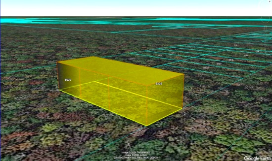
NOTE: You are bidding only on lot 23 highlighted in YELLOW. Grays Harbor County has a tendency to change parcel numbers when properties are sold, so please understand that the property purchased will be the same, but the parcel number might change due to the county's accounting method.

Build Your Dream Home in Fulton County, Arkansas!
NOTE: Click on the Approximate Coordinates link below to explore the area on Google Maps. Zoom in for a detailed view of local attractions, roads, etc., or zoom out for a wider perspective of the surrounding region.
Parcel ID: 240-15368-000
Legal Description: Subdivision: Mohave Lot: 17 Block: 9
Acre: 0.25
State: Arkansas
County: Fulton
Taxes: Under $12 per month
Approximate Coordinates: 36°18'16.5"N 91°36'47.8"W
Imagine living in this beautiful four seasons serene location in the Arkansas Ozarks!
A home may be constructed on this lot as long as the house size is a minimum of 1,000 square feet and complies with the zoning set forth in Cherokee Village Zoning "Bill of Assurance": Mohave Addition
Considering retirement, a new start for your family, just ready for a change, or looking for a part-time retreat? Cherokee Village offers small town charm, first-class outdoor recreation amenities and affordability. Take advantage of the low taxes, low cost of living and low housing costs. Your housing dollars stretch further here.
Experience Cherokee Village >>
This lot sits on Chattanooca Ln, about 3 miles from Cherokee Village South Golf Course and the South Fork Spring River! It is walking distance to Lake Omaha!
Cherokee Village is the perfect backdrop for your next adventure. Come enjoy the lakes, river, golf courses, parks, trails, RV and campground. With more than 13,000 acres set among the rolling hills and pristine natural beauty of the Arkansas Ozarks, Cherokee Village has something to offer all ages.
Soak up the sun on the private beach, hit the links on two private 18-hole golf courses, jump right into any of the six swimming pools, go RVing and camping, take a swing at pickleball and tennis, spend the day fishing, walk any of the nature trails, workout at the fitness center, meet some new friends at the senior center, cycle, hike, or just relax in a hammock!
Boat, fish and play on any of the seven lakes. Enjoy the year-round spring-fed South Fork River that flows into neighboring Spring River. Both rivers rank among the Ozark region’s most popular destinations for floating and trout and walleye fishing.
Don’t miss your chance to own a piece of this hidden gem in the heart of the Arkansas Ozarks!
NOTE: Real estate taxes are current. The buyer will be responsible for all real estate taxes billed on March 1, 2025 that will be due October 15, 2025.

Camping Lot in Twin Oaks Harbor, Missouri!
NOTE: Click on the Approximate Coordinates link below to explore the area on Google Maps. Zoom in for a detailed view of local attractions, roads, etc., or zoom out for a wider perspective of the surrounding region.
Parcel ID:7902900201405600
Legal Description: Lot 9, Blk 37, Plat 9, TOH
Acre: 0.22
State: Missouri
County: St. Clair
Taxes: Under $3 per month
Approximate Coordinates: 38°07'00.8"N 93°35'18.2"W

Charlotte County, Florida Lot Close to the Creek!
NOTE: Click on the Approximate Coordinates link below to explore the area on Google Maps. Zoom in for a detailed view of local attractions, roads, etc., or zoom out for a wider perspective of the surrounding region.
Parcel ID: 402536327001
Legal Description: DEL VERDE SEC O BLK 1 LT 15 DC645/341-350 DC646/1086
Acre: 0.13
State: Florida
County: Charlotte
Taxes: Under $3 per month
Approximate Coordinates: 26°57'10.8"N 81°46'14.8"W
This partially wooded lot is close to Shell Creek, which empties into the Peace River. The river is more than 100 miles long, originating between Tampa and Orlando and emptying into Charlotte Harbor estuary at Punta Gorda in Charlotte County.
Learn about Shell Creek Preserve >>
Charlotte County is a water lover's paradise, kissing the Gulf Coast and delivering an incredible variety of activities for everyone!
Experience a Florida Camping and Canoe Adventure on the Peace River >>
Port Charlotte, FL Video Tour: Affordable Resort - Town Living >>
Top 19 Things To Do in Port Charlotte, Florida >>
Check out Charlotte County Recreation Programs >>
This peaceful location is near the Peace River Nature Preserve and its ample nature trails. Be sure to visit one of the nearby county parks for bird watching.
See the Florida Birding Trail >>
The lot is zoned Agriculture. Homes are a permitted use.
See the Agriculture Zoning District Permitted Uses >>
NOTE: The county does not permit living in RVs at any time unless a house has been constructed on the lot.

Enjoy Life in this Four-Season Community near Gaylord, Michigan!
NOTE: Click on the Approximate Coordinates link below to explore the area on Google Maps. Zoom in for a detailed view of local attractions, roads, etc., or zoom out for a wider perspective of the surrounding region.
Parcel ID: 091-310-000-263-00
Legal Description: LOT 263 MICHAYWE NO. 2 SEC 3 T29N R3W
Acre: 0.39
State: Michigan
County: Otsego
Taxes: Under $3 per month
Approximate Coordinates: 44°55'54.6"N 84°38'50.0"W
Own Land in the Sunshine State!
NOTE: Click on the Approximate Coordinates link below to explore the area on Google Maps. Zoom in for a detailed view of local attractions, roads, etc., or zoom out for a wider perspective of the surrounding region.
Parcel ID: 17E19S220040 01760 0010Legal Description: UNIT 4 OF HOMOSASSA PB 1 PG 46 LOT 9 BLK 176
Acre: 0.14
State: Florida
County: Citrus
Taxes: Under $5 per month
Approximate Coordinates: 28°48'18.2"N 82°34'01.4"W
Discover Florida's soul in Citrus County: warm gulf waters, spring-fed rivers, championship golf, unique shops, abundant history and endless aquatic adventure.
This lot is conveniently located in Homosassa Springs, about one-half mile east of US 98 (S Suncoast Blvd). It has platted legal access from S. Grandmarch Road to W Grover Cleveland Blvd.
Zoning is Medium Density Residential (MDR) with permissible structures including single family construction, modular housing or tiny homes. Utilities are not available at the lot. Recreational vehicles, tent campsites, and recreational resort cabins may not be used as permanent or long-term residences.
There are plenty of shops, restaurants and stores close by! It is just a quick five minute drive to the Homosassa River, where you can enjoy boat tours, waterfront restaurants and fishing. Spend your days lounging, swimming, or kayaking in the Florida sun. If you love nature, this is the perfect place for you!
Go hiking, swim with the manatees, birdwatch and picnic at Ellie Schiller Homosassa Springs Wildlife State Park!
Homosassa Springs State Park >>
Meet Unique Wildlife at Homosassa Springs Wildlife Park! >>
Citrus County was recently named the best place in Florida to retire:
The Best Place to Retire in Florida >>
A Visit to Citrus County Florida >>
Citrus County has it all!

Getaway to Michigan's Lake Miramichi Community!
NOTE: Click on the Approximate Coordinates link below to explore the area on Google Maps. Zoom in for a detailed view of local attractions, roads, etc., or zoom out for a wider perspective of the surrounding region.
Parcel ID: 03 384 552 00
Legal Description:LOT 552 LAKE MIRAMICHI SUBD #4
Acre: 0.39
State: Michigan
County: Osceola
Taxes: Under $1 per month
Approximate Coordinates: 43°49'39.6"N 85°16'51.4"W

Invest in Growth in Valencia County, New Mexico!
NOTE: Click on the Approximate Coordinates link below to explore the area on Google Maps. Zoom in for a detailed view of local attractions, roads, etc., or zoom out for a wider perspective of the surrounding region.
Parcel ID: 1013030392257101400
Legal Description: Subd: RIO DEL ORO Lot: 36 Block: 3 Unit: 12 .25 AC +/-
Acres: 0.27
State: New Mexico
County: Valencia
Taxes: Under $5 per month
Approximate Coordinates: 34°41'07.1"N 106°39'54.6"W
Here's your chance to invest in land just minutes from the Manzano Expressway! It's an excellent time to invest in this prime location and the bright future of Valencia County, NM.
July 2024 Update: Approval was recently granted to rezone 268 acres of vacant land, primarily located between NM47 and 304, for manufacturing operations. This bodes well for the continued growth of Valencia County. Development usually breeds development, development brings jobs, and jobs bring people, usually families, who need housing!
Tens of thousands of new jobs are coming to Los Lunas. Facebook (Meta's) new facility opened in 2019 and continues to grow and generate additional economic benefits to the surrounding areas. The White House recently provided a grant to develop infrastructure for a huge new manufacturing facility. A new rail park is also under development.
Of course, more jobs in this sizzling investment area means greater demand for land.
Facebook (Meta) announces $800M expansion plan for Los Lunas Data Center >>
Once the expansion is completed, the Facebook (Meta) Data Center will employ 400 employees and provide significant economic benefits to the local community.
Facebook (Meta) Los Lunas Data Center and Facebook (Meta) Los Lunas Data Center Drone Video >>
New Facebook (Meta) Data Center + Booming Business in Los Lunas >>
In addition, the Cibola National Forest covers more than 1.6 million acres in New Mexico, with elevations ranging from 2,700 feet to over 11,300 feet. If you and your family enjoy picnicking, backpacking, camping, skiing, hiking, wildlife-viewing, star-gazing, horseback-riding, hunting, or mountain biking, Cibola National Forest has plenty to offer you.
See the beautiful mountains of Valencia County >>
Additionally, this property is located about 45 minutes from the Albuquerque International Airport (ABQ).
Invest in the growth of Valencia County today!
NOTE: Approximately $100 in back taxes will be the responsibility of the buyer.

Enjoy Townline Lake from this Michigan Lot in Montcalm County!
NOTE: Click on the Approximate Coordinates link below to explore the area on Google Maps. Zoom in for a detailed view of local attractions, roads, etc., or zoom out for a wider perspective of the surrounding region.
Parcel ID: 004-230-506-00
Legal Description: 639-876 LOTS 506 & 507 HONEYMOON HEIGHTS NO 3.
Acre: 0.33
State: Michigan
County: Montcalm
Taxes: Under $14 per month
Approximate Coordinates: 43°27'41.4"N 85°12'46.8"W
This community is in Cato Township, Montcalm County, Michigan, a small, rural community situated in the west-central part of Michigan's Lower Peninsula.
The township is predominantly rural, with large areas of farmland, forests, and small lakes. Its peaceful, open spaces make it an ideal location for those who appreciate a slower pace of life and a connection to nature.
Home to several small lakes, it provides opportunities for fishing, boating, and other water-related activities. These lakes are popular for both residents and visitors looking for quiet, recreational water experiences.
This lot is on Birch Drive within the Honeymoon Heights Owners Association. Members have access to the lake, clubhouse and parks! Docks at the parks were recently installed in 2023! A recreational trailer, motor home, or camper may be placed on any lot for a period of time not to exceed 14 consecutive days in any one calendar year. If your plan is to build, all residential buildings shall have a minimum ground floor living area of 750 square feet and will require a well and septic system. An RV can be parked on your lot for three months while a structure is being constructed.
For more details about restrictions, please see the following link:
Honeymoon Heights Zoning Restrictions >>
Montcalm County offers various hiking trails and outdoor spaces to enjoy Michigan’s natural beauty and wildlife. This area is a popular spot for hunting and fishing, with local wildlife including deer, turkey, and small game, along with well-stocked lakes for fishing.
The county benefits from proximity to Lakeview, a small village with basic services such as schools, shops, healthcare, and restaurants. Lakeview offers the conveniences of a larger town while maintaining a small-town feel. It is also about an hour's drive from Grand Rapids, one of Michigan’s largest cities, and about 90 minutes from Lansing, Michigan.
Overall, this area is an idyllic rural community that offers the charm of small-town living with a strong connection to nature and agriculture. Its scenic landscapes, affordable cost of living, and proximity to lakes and outdoor activities make it a desirable place for those who enjoy quiet, peaceful living. Whether you’re looking for a place to raise a family, retire, or simply get away from the city, Montcalm County provides a relaxing and inviting rural environment in the heart of Michigan.
NOTE: Honeymoon Heights Owners Association's annual dues are just $25. An additional $50 of outstanding dues will become the buyers responsibility.

California Lot by CA-78, Hwy 86, & the Salton Sea!
NOTE: Click on the Approximate Coordinates link below to explore the area on Google Maps. Zoom in for a detailed view of local attractions, roads, etc., or zoom out for a wider perspective of the surrounding region.
Parcel ID: 017-380-032-000
Legal Description: LOT 148 DESERT HILLS TRACT NO 1 T11S R10E
Acre: 0.22
State: California
County: Imperial
Taxes: Under $3 per month
Approximate Coordinates: 33°10'36.2"N 115°56'32.2"W
This 0.22 acre parcel is located close to both Hwy 86 and CA-78. It is also under 30 minutes from the Salton Sea and Bombay Beach, which has been turned into a beautiful artist hub. Park your RV and camp out at Salt Creek!
Salton Sea Camping at Salt Creek >>
The Imperial Sand Dunes Recreation Area, the largest dune complex in California, extends more than 40 miles along the eastern edge of the Imperial Valley, split by Highway 78. Off-road vehicles are permitted. To the north, (the green section on the map), you are free to walk but there’s no sign or trailhead.
See the Algodones Sand Dunes >>
Cibola National Wildlife Refuge straddles the border of California and Arizona. It has an abundance of wildlife watching and nature trail opportunities. Take the Canada Goose Drive for an excellent opportunity for wildlife viewing and photography. On the accessible walking trail, you might see song birds, bobcats, quail, and mule deer. Anglers can fish for largemouth bass, smallmouth bass, striped bass, channel catfish, flathead catfish, crappie, sunfish, tilapia, and common carp. Public hunting on Cibola National Wildlife Refuge is permitted in specified areas.
Experience the Cibola National Wildlife Refuge >>
Head to the city of Brawley, ranked in the top 10 fastest growing cities in California, for provisions, food and entertainments!
Learn about the City of Brawley >>
Explore your adventurous spirit, here in Imperial County, California!

Missouri Lot in Twin Oaks Harbor POA!
NOTE: Click on the Approximate Coordinates link below to explore the area on Google Maps. Zoom in for a detailed view of local attractions, roads, etc., or zoom out for a wider perspective of the surrounding region.
Parcel ID: 07-9.0-29-002-013-010.00
Legal Description: Lot 9, Blk 31, Plat 7, TOH
Acre: 0.08
State: Missouri
County: St. Clair
Taxes: Under $3 per month
Approximate Coordinates: 38°06'43.2"N 93°35'24.4"W
This camping lot is located off of Falcon View Drive, in Osceola Township, St. Clair County, Missouri. This community features camping lots with favorable rules for camping enthusiasts!
The community is located about 120 miles southeast of Kansas City. St. Clair County is a peaceful, rural, agricultural county with a population of under 10,000 but offers a myriad of outdoor opportunities. Appleton City and Osceola are the largest towns in the county.
Activities in St. Clair County, Missouri >>
The Harry S Truman Reservoir, also known as Truman Lake, offers exceptional outdoor recreational opportunities. It is great for boating, fishing, hunting, camping, hiking/biking and just exploring nature at its finest. Truman Lake encompasses 259 square miles of land and water covering portions of four counties: Benton, Henry, Hickory and St. Clair.
Plenty To Do at Truman Lake >>
Twin Oaks Harbor community amenities include a small lake that is stocked for fishing (boats are allowed as long as they are not gas-powered), an in-ground pool, a playground with new equipment, two bath houses with hot and cold running showers, trash dumpsters and road maintenance. ATVs, golf carts, etc. are permitted on the common roads.
This camping lot is for recreational use but is NOT permitted to be used as a residence (so no one can live there). Campers are allowed. No other structures are permitted on this lot.
Relax, rejuvenate, and reconnect under the stars in the great outdoors!
NOTE: Twin Oaks Harbor Property Owners Association imposes an annual fee of $232.00 for a single lot covering its fiscal year of May 1 – April 30. The 2024 annual POA dues are paid through April 2025. The buyer will be responsible for 2025-2026 fiscal year dues, which are due March 1st, 2025. A copy of the Covenants & Restrictions is available upon request!

Explore California Pines and The Modoc National Forest!
NOTE: Click on the Approximate Coordinates link below to explore the area on Google Maps. Zoom in for a detailed view of local attractions, roads, etc., or zoom out for a wider perspective of the surrounding region.
Parcel ID: 038-102-021-000
Legal Description: Lot 16, Block 14, California Pines Unit 4, a subdivision of the County of Modoc according to the official Plat thereof, filed in Book 2 of Maps in Modoc County Records.
Acres: 1.15
State: California
County: Modoc
Taxes: Under $28 per month
Approximate Coordinates: 41°15'41.4"N 120°44'04.2"W
Tucked in the northeast corner of California, Modoc County borders Oregon to the north and Nevada to the east. It is one of California's least populous but largest counties. This remote & rural county is an attractive, unique destination for those seeking solitude, outdoor adventures, untouched natural beauty & a slower pace of life. Picturesque landscapes, including mountains, forests, and lakes await you here! If you prefer a small-town atmosphere & close-knit community, Modoc County is for you!
Welcome to Modoc County, California >>
The summers (April-September) encourage camping, hunting, hiking, fishing, and water sports against the backdrop of the uniquely beautiful Warner Mountains. An open range habitat for diverse wildlife, the area is home to mountain lions, cattle, mule deer, antelope, coyotes, bald eagles, and other bird species. It is a destination for birdwatching and offers a chance to observe wildlife in their natural habitat. Waterfowl season is huge in Modoc county!
The Modoc National Forest, Lava Beds National Monument, Bly Tunnel Tree, Glass Mountain, Medicine Lake, Lassen Volcanic National Park, Tule Lake National Wildlife Refuge & Modoc National Wildlife Refuge are among the region's popular destinations for outdoor enthusiasts.
What to Do and See in Modoc County >>
Modoc County is relatively isolated, and transportation options are limited. State Route 299 is the primary road connecting the county to the rest of California.
Modoc County is also known for its dark skies, which make it a great place for stargazing. The lack of light pollution in the area offers excellent views of the night sky and celestial events.
This 1.15 lot is located in the Hill Unit #4 of California Pines, an off-the-grid community located about 30 miles southwest of the one square-mile city of Alturas. The hill units are almost all covered with four different kinds of pine trees. The elevation in the hill units varies from 5,000 to 6,400 feet. All the roads are gravel roads.
Specifics about Hill Unit #4 are:
- about 40 minutes to the California Pines Lodge Restaurant
- the road is gravel & gets rocked & graded every few years
- HOA WILL ONLY plow to homes in the winter months
RVs and camping are permissible for up to 30 days of a calendar year. If you are considering constructing a home, please note that the living space must be no less than 500 square feet.
Construction in the hill units will require a private well and septic system. If there is electricity in the area, it can be extended to your lot. Power is obtained through Surprise Valley Electric. Solar & wind turbines are also allowed.

Build on Three Michigan Lots near Pencil & Harold Lakes!
Parcel IDs/Legal Descriptions:
05-13-325-120-00: LOT 127 PLAT OF PINE VIEW NO 1
05-13-325-136-00: LOT 143 PLAT OF PINE VIEW NO 1
05-13-325-157-00: LOT 164 PLAT OF PINE VIEW NO 1
Enjoy the four seasons in the Lakes of the North community in Antrim County. This peaceful and quiet location transforms seasonally from snow-covered white in winter, to spring green, to comfortable summer days, then magnificent shades in fall. The community is located about 20 minutes from Boyne Mountain Resort and Shanty Creek Resort; and 45 minutes from Traverse City or 25 minutes from Gaylord.
Things to See & Do in Antrim County! >>
Lakes of the North is a group of 19 subdivisions that straddles the Otsego-Antrim county line.
Learn About Lakes of the North Association >>
Amenities include an 18-Hole Golf Course, Pro-Shop, full-service Restaurant/Tavern all of which are Open to the Public. Member exclusive areas include Pencil Lake and Harold Lake beach access and beach houses, Activities Clubhouse with a Pool, Whirlpool, Water Slide, along with two outdoor Tennis/Pickleball Courts, Shuffleboard, Horseshoes and playground.
The Winter Sports area has an Ice Rink, Cross Country Ski and Snowshoe trails which serve as hiking trails in the summer.
Campers Village is an all-season facility for members to enjoy with their camper.
Throughout and surrounding Lakes of the North you will find hundreds of miles of ATV/Snowmobile Trails to ride on.
This package of three buildable lots, totaling 0.99 acre, is located in the Pine View No 1 subdivision.
Each vacant lot in Lakes of the North is buildable and is rural in character. All building plans need approval by the association's Architectural Control Committee. Lots do not have water, septic, or electricity. Construction would require a private well and sewage disposal system. If there is electricity in the area, it can be extended to your lot.
Building restrictions include a minimum square footage that varies by subdivision. Mobile homes, trailers, camping and storage are prohibited on all vacant lots. Commercial use is also prohibited (including for rentals and short-term rentals).
For complete building information, please see Lakes of the North Restrictive Covenants, paying particular attention to Article VI (Architectural Control Committee) and Article VII (Building and Use Limitations).
Lakes of the North is known for its picturesque landscapes, featuring serene lakes surrounded by lush forests and offering a peaceful retreat for residents and visitors alike. Bid now!
NOTE: The Association's 2024 annual assessment is $332 covering the year from April 1, 2024 to March 31, 2025. The buyer will be responsible for payment of the amount of the annual assessment in the fiscal year when the deed is recorded. The buyer must also register with the Association as a land owner by completing the required document (to be provided along with the recorded deed).

Scenic Lot in Sharp County, Arkansas!
NOTE: Click on the Approximate Coordinates link below to explore the area on Google Maps. Zoom in for a detailed view of local attractions, roads, etc., or zoom out for a wider perspective of the surrounding region.
Parcel ID: 318-00154-000
Legal Description: Subdivision: Ute Lot: 18 Block: 4
Acre: 0.37
State: Arkansas
County: Sharp
Taxes: Under $12 per month
Approximate Coordinates: 36°16'58.5"N 91°33'40.6"W
Imagine living in this beautiful four seasons serene location in the Arkansas Ozarks!
This lot sits on Anadarka Drive, not far from Lake Chanute, Lake Thunderbird, Navajo Lake, Cherokee Village South Golf Course, and the South Fork Spring River!
A home may be constructed on this lot as long as the house size is a minimum of 800 square feet and complies with the zoning set forth in Cherokee Village Zoning "Bill of Assurance": Ute Addition
An Airbnb is also an acceptable use! In fact, they have some in the community already and the process of registering for the license is simple and costs under $40!
Considering retirement, a new start for your family, just ready for a change, or looking for a part-time retreat? Cherokee Village offers small town charm, first-class outdoor recreation amenities and affordability. Take advantage of the low taxes, low cost of living and low housing costs. Your housing dollars stretch further here.
Experience Cherokee Village >>
Cherokee Village is the perfect backdrop for your next adventure. Come enjoy the lakes, river, golf courses, parks, trails, RV and campground. With more than 13,000 acres set among the rolling hills and pristine natural beauty of the Arkansas Ozarks, Cherokee Village has something to offer all ages.
Soak up the sun on the private beach, hit the links on two private 18-hole golf courses, jump right into any of the six swimming pools, go RVing and camping, take a swing at pickleball and tennis, spend the day fishing, walk any of the nature trails, workout at the fitness center, meet some new friends at the senior center, cycle, hike, or just relax in a hammock!
Boat, fish and play on any of the seven lakes. Enjoy the year-round spring-fed South Fork River that flows into neighboring Spring River. Both rivers rank among the Ozark region’s most popular destinations for floating and trout and walleye fishing.
Don’t miss your chance to own a piece of this hidden gem in the heart of the Arkansas Ozarks!
NOTE: Real estate taxes are current. The buyer will be responsible for all real estate taxes billed on March 1, 2025 that will be due October 15, 2025.
