Beat Inflation with Land!
Beat Inflation with Land!
See Special Terms for additional fees
Description


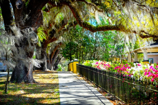
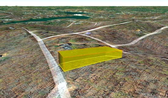
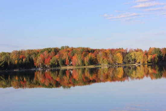
Own a Lot in Sugar Springs, Michigan!
NOTE: Click on the Approximate Coordinates link below to explore the area on Google Maps. Zoom in for a detailed view of local attractions, roads, etc., or zoom out for a wider perspective of the surrounding region.
Parcel ID: 060-090-000-038-00
Legal Description: 20 1W HIGHLANDER REALM LOT 38
Acre: 0.32
State: Michigan
County: Gladwin
Taxes: Under $15 per month
Approximate Coordinates: 44°08'03.0"N 84°27'04.5"W
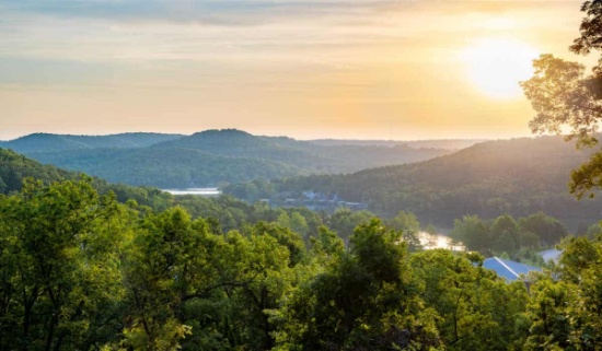
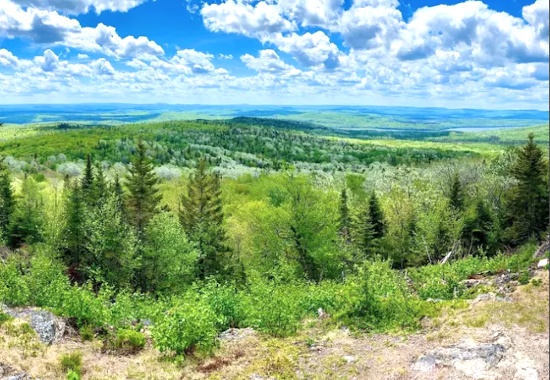
Own a piece of Michigan’s outdoor paradise!
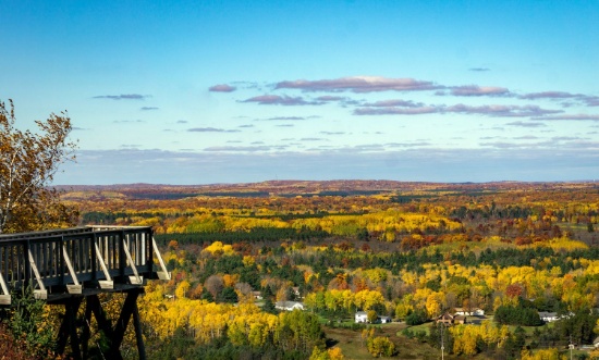
Gladwin County is located in the northeast central section of Michigan’s lower peninsula, approximately 2.5 hours from Detroit and a little over 2 hours from Grand Rapids. It is renowned for its warm and welcoming community. You'll find friendly neighbors, local festivals, farmers' markets, and a strong sense of belonging, making it a wonderful place to raise a family or retire.
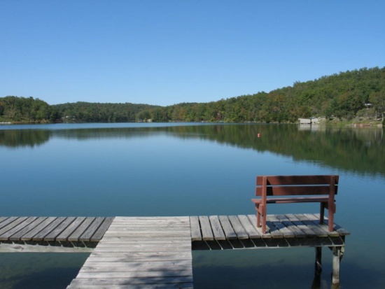
This prime lot is located on Brassie Court in the Sugar Springs community in Gladwin County. There is paved road frontage, as well as sewer, phone, and electric at the road. It's also just a short drive to Sugar Springs Golf Course, Lake Lancelot and Lake Lancer!
This property is surrounded by the pristine beauty of Butman Township, in Gladwin County, known for its picturesque landscapes, lush forests, and numerous lakes. Living here means waking up to stunning natural views, and with the abundance of year-round recreational outdoor activities, you'll have endless opportunities for adventure and exploration. Whether you're into fishing, hiking, hunting, golfing, or snowmobiling, you are sure to find something you will enjoy.
The nearby lakes, including Lake Lancelot and Lake Lancer, offer a water lover's paradise. These lakes are a great place to enjoy boating, fishing, swimming, and paddleboarding. Fishermen can expect Bluegill, Largemouth Bass, Northern Pike, and Rock Bass among the most popular catches. Whether you want to spend the day going for an exciting jet ski ride or going for a sunset cruise, this is a great place to do so.
Gladwin also offers a variety of fun activities ranging from gorgeous gardens to incredible golf courses. The downtown area features quaint shops, cozy cafes and lovely parks perfect for picnics or leisurely strolls. Sugar Springs Resort has a clubhouse, lounge restaurant, campground, pool, and two golf courses, among other activities.
This prime lot is your gateway to a life filled with natural wonder, outdoor adventures, and endless recreational opportunities, making it an ideal place to call home!
This lot won’t last—secure your spot in Gladwin County!
NOTE: The Sugar Springs Property Owners Association (POA) manages this community. The 2025 general assessment fee for this lot is $475, and the lake assessment fee is $60. The buyer will be responsible for all dues beginning on January 1, 2025, as well as a one-time $15 transfer fee upon purchase of the property.
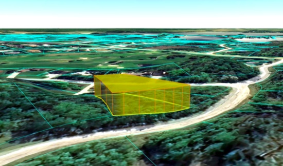
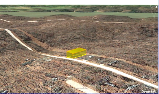
Own Land in Coleman County, Texas!
NOTE: Click on the Approximate Coordinates link below to explore the area on Google Maps. Zoom in for a detailed view of local attractions, roads, etc., or zoom out for a wider perspective of the surrounding region.
Parcel ID: 2830-093-00020-91A
Legal Description: RATHMEL & DANIEL ADDN TOWN NOVICE, BLOCK 93, LOT 7
Acre: 0.143
State: Texas
County: Coleman
Taxes: Under $5 per month
Approximate Coordinates: 31°59'14.3"N 99°37'52.9"W
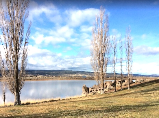
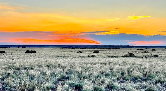
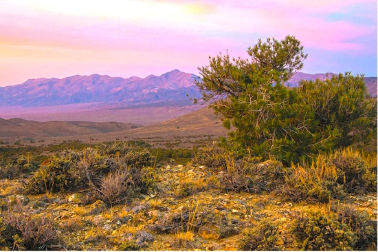
Located in the quiet town of Novice in Coleman County, Texas, this 0.143-acre parcel captures the spirit of rural Texas in its most peaceful form. Set against a backdrop of gently rolling land and open skies, the property sits at an average elevation of around 1,985 feet. Covered entirely in native shrubland, the lot reflects the raw, unpolished beauty of West Texas, wide horizons, soft breezes, and silence that stretches for miles.
Coleman County offers a blend of timeless Texas charm and simplicity. It's the kind of place where you’ll find one-of-a-kind antique shops, honest-to-goodness BBQ joints, and that rare sense of stillness that’s hard to come by. With nearby lakes, scenic roads, and a strong connection to ranching and farming traditions, the area gives you a true taste of small-town Texas living.
Nature quietly thrives here. You might spot jackrabbits bounding through the brush, deer passing nearby at dusk, or hawks circling overhead in the morning light. At night, the stars put on a show, and the hush of the countryside takes over.
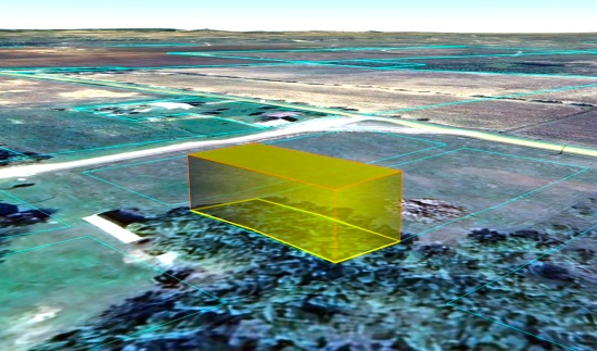
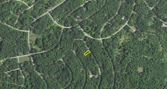
Prime Golf Course Lot in Mecosta County, Michigan!
NOTE: Click on the Approximate Coordinates link below to explore the area on Google Maps. Zoom in for a detailed view of local attractions, roads, etc., or zoom out for a wider perspective of the surrounding region.
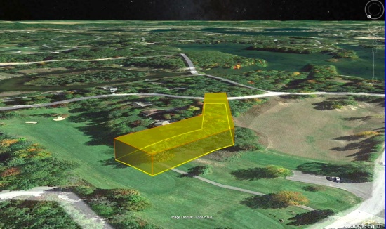
Explore 43 Acres in Aroostook County, Maine!
NOTE: Click on the Approximate Coordinates link below to explore the area on Google Maps. Zoom in for a detailed view of local attractions, roads, etc., or zoom out for a wider perspective of the surrounding region.
Map/Lot: AR105, Plan 05, Lot 43.1
Legal Description: Commencing at a point on the northerly sideline of the Stockholm Road, so-called, said point being the point of intersection of the said Stockholm Road with the West Town Line of the Town of Connor...
Acres: 43.1
State: Maine
County: Aroostook
Taxes: Under $30 per month
Approximate Coordinates: 47°01'12.7"N 68°03'45.7"W
This 43-acre property is located off Stockholm Road, in New Sweden, Maine.
Whether you’re seeking a peaceful retreat or access to abundant outdoor recreational activities, this property provides the perfect balance of tranquility and adventure. It is a popular destination for outdoor recreational activities, including fishing, boating, and swimming during the summer months. In the winter, the lake attracts ice fishermen and snowmobilers who take advantage of the frozen surface. The area's picturesque landscape, characterized by rolling hills, forests, and the pristine lake, offers a serene and tranquil environment.
Aroostook County is the northernmost region and the largest county in wild, rugged, and deeply beautiful Maine. The state is 90 percent forest, with a coastline that, if stretched out, would reach to California. Enjoy amenities that are every bit present-day, while exploring quaint villages and years-old cultures that make it seem as if you have stepped back in time.
Welcome to Aroostook County >>
Things to Do, Places to Go in Aroostook >>
Overall, Maine, provides a scenic retreat for those seeking a peaceful environment and outdoor recreational activities. Its location in Aroostook County offers a taste of rural life in northern Maine, with access to stunning natural beauty and a close-knit community. Bid today!
Own Land in the Ozarks: 20 Buildable Lots in Cherokee Village, AR! BIDDING IS PER LOT!
Quantity: 20
This package of 20 lots is available in Cherokee Village, Arkansas, a beautiful four-seasons serene location in the Arkansas Ozarks! The lots are scattered throughout and are not contiguous.
Cherokee Village is the perfect backdrop for your next adventure. Come enjoy the lakes, river, golf courses, parks, trails, RV and campground. With more than 13,000 acres set among the rolling hills and pristine natural beauty of the Arkansas Ozarks, Cherokee Village has something to offer all ages!
Experience Cherokee Village >>
Cherokee Village Information >>
As the owner of these lots, the possibilities are endless. Hold them as-is as long-term investments. Build to rent or to resell, and so on! This is a great community for a part-time retreat or a full-time residence, for those considering retirement, a new start for their family, or just ready for a change! Cherokee Village offers small town charm, first-class outdoor recreation amenities, and affordability. Take advantage of the low taxes, low cost of living and low housing costs. Your housing dollars stretch further here.
A home may be constructed on these lots as long as the house size is a minimum of 800 square feet (CHOCTAW SECOND, THIRD, or FOURTH ADDITIONS) or 900 square feet (CHOCTAW FIRST ADDITION) and complies with the zoning set forth in Cherokee Village Zoning "Bill of Assurances".
Airbnbs are an acceptable use. In fact, they have some in the community already and the process of registering for the licenses is simple and costs under $40.
Soak up the sun on the private beach, hit the links on two private 18-hole golf courses, jump right into any of the six swimming pools, go RVing and camping, take a swing at pickleball and tennis, spend the day fishing, walk any of the nature trails, workout at the fitness center, meet some new friends at the senior center, cycle, hike, or just relax in a hammock!
Boat, fish and play on any of the seven lakes. Enjoy the year-round spring-fed South Fork River that flows into neighboring Spring River. Both rivers rank among the Ozark region’s most popular destinations for floating and trout and walleye fishing.
Take advantage of this great investment opportunity today!
NOTE: Real estate taxes are current. The buyer will be responsible for all real estate taxes billed on March 1, 2025 that will be due October 15, 2025.
BIDDING IS PER LOT FOR A CASH PURCHASE!
TOTAL BID PRICE = BID PER LOT x 20 LOTS.
Parcel IDs/Legal Descriptions: See Photo for Parcel IDs/Legal Descriptions
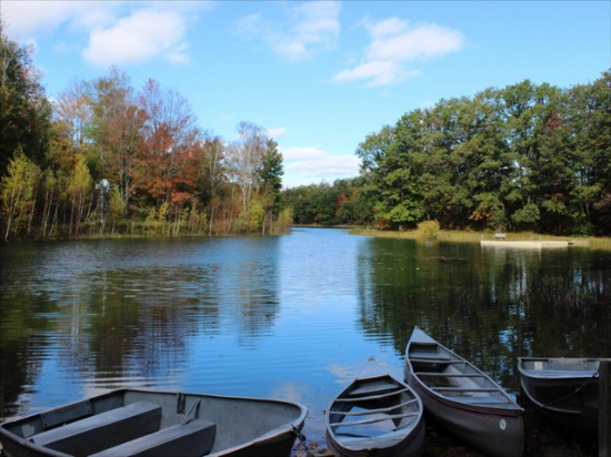
Experience Lakewood Shores in Iosco County: Michigan's Top Destination for Living and Leisure!
Parcel ID: 064-L36-000-522-00
Legal Description: LAKEWOOD SHORES NO. 6 SUB LOTS 522 & 523
Acre: 1.03
State: Michigan
County: Iosco
Taxes: Under $3 per month
Approximate Coordinates: 44°29'03.9"N 83°19'46.1"W
Welcome to Lakewood Shores, a vibrant residential and recreational community located in Oscoda Township, Iosco County, Michigan. Nestled along the shores of Cedar Lake and near the scenic Lake Huron coastline, this community offers a blend of natural beauty and resort-style attractions.
Community Informational Brochure >>
This one acre lot is located on Huntington Drive, perfectly situated between Cedar Lake and Great Lake Huron!
Lakewood Shores offers an impressive array of amenities designed for fun, relaxation, and community connection! Enjoy access to a private beach club and clubhouse, the white sandy shores of Cedar Lake, a marina causeway with docks, and a racquet club with tennis courts and locker rooms. The community also features a snack bar, shuffleboard courts, nine beaches, twelve picnic areas with BBQ pits, fishing ponds, basketball and badminton courts, and a playground; providing something for everyone to enjoy!
Discover Lakewood Shores Amenities >>
Members may also take advantage of Lakewood Shores Premier Golf Resort Courses: the Serradella, Blackshire and The Gailes. These courses are among the finest in Northeast Michigan!
Experience the best of Lakewood Shores and make the most of everything this vibrant community has to offer. From stunning natural beauty to a wide range of recreational and social features, Lakewood Shores is designed to enhance your lifestyle. Whether you're relaxing on the beach, enjoying a round of golf, or spending time with friends and family at the clubhouse, there's always something to enjoy. Don’t just visit, immerse yourself in the Lakewood Shores way of life!
NOTE: Lakewood Shores is managed by the Lakewood Shores Property Owners Association (POA), which oversees the community's operations and amenities. The POA is dedicated to enhancing the quality of life for residents and property owners by promoting social welfare and recreational activities within the community. Upon purchase, the buyer is responsible for paying any outstanding fees directly to the POA. The annual fee for 2025 is $270.00 and is due at the time of property transfer.
Over Three Buildable Acres in Lincoln County, Georgia!
NOTE: Click on the Property Address link below to explore the area on Google Maps. Zoom in for a detailed view of local attractions, roads, etc., or zoom out for a wider perspective of the surrounding region.
Parcel ID: 0010A-00000-304-000
Legal Description: Lot 304 Phase II Stillwater Coves
Acres: 3.78
State: Georgia
County: Lincoln
Taxes: Under $55 per year
Property Address: 1178 Hardwood Dr, Tignall, GA 30668
Build your new home on this 3.78 acre property in Stillwater Coves, Lincoln County, Georgia!
Lincoln County is a small, rural county located in the eastern Piedmont region of Georgia, very close to the South Carolina border. It is situated along the western shore of the Clarks Hill Lake, also known as Lake Thurmond. Lincoln County is known for its tight-knit community, southern hospitality, and small-town charm.
This beautiful property is located in Stillwater Coves, a residential community located in Tignall, on the shores of Lake Thurmond. Tignall embodies the small-town atmosphere, with a strong sense of community, traditional values, and a slower pace of life. The proximity to historical sites and the natural beauty of the region offer potential for tourism, particularly for those interested in Georgia’s history or seeking a peaceful rural getaway.
Residents enjoy easy access to boating, fishing, kayaking, and other water sports. The area offers scenic views, outdoor recreational activities, and a tranquil lifestyle, making it appealing for those seeking a lakeside or countryside retreat.
Experience the Georgia River Trails >>
Planned amenities for the community include a landscaped entry way, easy access day docks, boat storage, pool with bath house, walking trails, and a community pavilion complete with a summer kitchen, open fireplace, and a picnic area.
Stillwater Coves' community theme is a neighborhood of Southern summer homes that have a look and feel of the houses reminiscent of early 20th century retreats in the South.
All site work, structures and landscaping are subject to design and aesthetics approval that meet the community’s Design Review Guidelines, Style Book and Covenants (available upon request).
Homes must have a minimum of 1,300 SF of heated space on the main level and a maximum of 5,800 SF in total. All utilities (water, sewer and electricity) are at the curb for home construction.
Besides lake activities, the area around Stillwater Coves offers parks, hiking trails, wildlife management areas and campgrounds, including the popular, nearby campground, Hester's Ferry.
Georgia Freshwater Camping - Hesters Ferry >>
The Richard B. Russell State Park and Clarks Hill Wildlife Management Area are also popular destinations for outdoor enthusiasts.
Explore Richard B. Russell State Park >>
Overall, Stillwater Coves provides a peaceful, nature-oriented lifestyle, perfect for those who enjoy lakeside living in a quiet, rural setting.
Claim this prime property today!
NOTE: This property is located within the Stillwater Coves HOA, managed by Silverleaf Management Company. The annual dues of $700.00 were paid in full in December 2024. Buyer will be responsible for 2025 dues and a $109 initiation fee.
Homosassa Springs, Florida!
NOTE: Click on the Approximate Coordinates link below to explore the area on Google Maps. Zoom in for a detailed view of local attractions, roads, etc., or zoom out for a wider perspective of the surrounding region.
Parcel ID: 17E19S220040 01760 0010
Legal Description: UNIT 4 OF HOMOSASSA PB 1 PG 46 LOT 4 BLK 176
Acre: 0.14
State: Florida
County: Citrus
Taxes: Under $5 per month
Approximate Coordinates: 28°48'19.2"N 82°34'03.1"W
Discover the essence of Florida in Citrus County: warm gulf waters, spring-fed rivers, championship golf, unique shops, rich history, and endless aquatic adventure.
A Visit to Citrus County Florida >>
This lot is ideally located in Homosassa Springs, just half a mile east of US 98 (S Suncoast Blvd), with legal access from S. Grandmarch Road to W Grover Cleveland Blvd.
Zoning is Medium Density Residential (MDR) with permissible structures including single family construction, modular housing or tiny homes. Utilities are not available at the lot. Recreational vehicles, tent campsites, and recreational resort cabins may not be used as permanent or long-term residences.
There are plenty of shops, restaurants, and stores nearby! Just a quick five-minute drive to the Homosassa River, where you can enjoy boat tours, waterfront dining, and fishing. Spend your days lounging, swimming, or kayaking under the Florida sun. If you love nature, this is the perfect spot for you!
Go hiking, swim with manatees, birdwatch, and picnic at Ellie Schiller Homosassa Springs Wildlife State Park!
Homosassa Springs State Park >>
Citrus County has it all; place your bid now!
Ideal Spot by the Water in California Pines!
NOTE: Click on the Approximate Coordinates link below to explore the area on Google Maps. Zoom in for a detailed view of local attractions, roads, etc., or zoom out for a wider perspective of the surrounding region.
Parcel ID: 036-312-009-000
Legal Description: Lot 9, Block 2, California Pines Lake Mobile Home Park Unit 1, a subdivision of the County of Modoc according to the Official Plat thereof, recorded in Modoc County Recorderâs Office November 16, 1970 in Book 2, Page 260 of Maps.
Acre: 0.08
State: California
County: Modoc
Taxes: Under $34 per month
Approximate Coordinates: 41°24'07.5"N 120°40'41.0"W
Nestled in the northeastern corner of California, Modoc County is a tranquil and picturesque haven filled with untouched natural beauty and a laid-back, small-town charm. This county boasts rolling meadows, pristine lakes, and towering mountains, offering outdoor enthusiasts a playground for hiking, hunting, fishing, and wildlife observation. Alturas, the commercial center for northeastern California, is less than 15 minutes away
What to Do and See in Modoc County >>
The warm, dry summers encourage camping, hiking, fishing, and water sports against the backdrop of the uniquely beautiful Warner Mountains, with their clear alpine streams and a high desert dotted with serene lakes.
This 0.08 acre lot is located in the California Pines Lake Mobile Home Park Unit 1, a beautiful community located about 12 miles northeast of the City of Alturas in Modoc County. California Pines covers 15,000 acres surrounded by 2 million acres of the Modoc National Forest. It is a place where you will find a close-knit community that fosters a strong sense of belonging and a serene lifestyle, free from the hustle and bustle of urban centers.
RVs and camping are permissible for up to 30 days of a calendar year. If you are constructing a mobile home, please note that the living space must be no less than 1,000 square feet. This lot has sewer and water, as well as an underground power box at each lot. Please review the following links for detailed information.
Declaration of Restrictions >>
Building in California Pines! >>
The California Pines Property Owners Association maintains common areas for the benefit of the property owners, residents and the general public.
The California Pines Lake is 256 acres and next to it sits the California Pines Lodge, a 4,400 feet airstrip, and campground. The 8,000 square foot lodge features guest rooms, a restaurant, lounge, banquet room and activity room. The grounds of the lodge also include a swimming pool.
See the California Pines Lodge >>
Bid today to own land in California!
NOTE: The annual POA fee is $105 and will become the responsibility of the buyer.
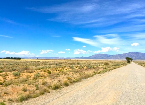
Invest in New Mexico!
NOTE: Click on the Approximate Coordinates link below to explore the area on Google Maps. Zoom in for a detailed view of local attractions, roads, etc., or zoom out for a wider perspective of the surrounding region.
Parcel ID: 1020033455115208110
Legal Description: RIO DEL ORO Lot: 11 Block: 25 Unit: 21 .25 AC
Acre: 0.25
State: New Mexico
County: Valencia
Taxes: Under $5 per month
Approximate Coordinates: 34°43'37.6"N 106°32'27.1"W
Today is a great day to invest in New Mexico land!
This lot is located just below the Rio Del Oro Loop which connects to the Manzano Expressway.
In July of 2024, approval was granted to rezone 268 acres of vacant land, primarily located between NM47 and 304, for manufacturing operations. This bodes well for the continued growth of Valencia County. Development usually breeds development, development brings jobs, and jobs bring people, usually families, who need housing!
With the opening of new Facebook (Meta) facility, manufacturing hub, and rail park, this area has become a hot bed for land buyers! It's an excellent time to invest in this prime location and the bright future of Valencia County, NM.
Tens of thousands of new jobs are coming to Los Lunas. Facebook (Meta's) new facility opened in 2019 and continues to grow and generate additional economic benefits to the surrounding areas. The White House recently provided a grant to develop infrastructure for a huge new manufacturing facility. A new rail park is also under development.
Of course, more jobs in this sizzling investment area means greater demand for land.
Facebook (Meta) announces $800M expansion plan for Los Lunas Data Center >>
Once the expansion is completed, the Facebook (Meta) Data Center will employ 400 employees and provide significant economic benefits to the local community.
Facebook (Meta) Los Lunas Data Center and Facebook (Meta) Los Lunas Data Center Drone Video >>
New Facebook (Meta) Data Center + Booming Business in Los Lunas >>
In addition, the Cibola National Forest is just to the east and covers more than 1.6 million acres in New Mexico, with elevations ranging from 2,700 feet to over 11,300 feet. If you and your family enjoy picnicking, backpacking, camping, skiing, hiking, wildlife-viewing, star-gazing, horseback-riding, hunting, or mountain biking, Cibola National Forest has plenty to offer you.
See the beautiful mountains of Valencia County >>
Another bonus: this property is located about 45 minutes from Albuquerque International Sunport (ABQ).
Why wait any longer? Place your bid today!
NOTE: Back taxes up to $100 will be the responsibility of the buyer.
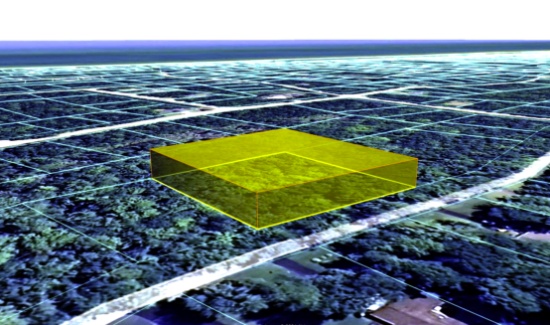
2.5-Acres in Los Angeles County, CA!
NOTE: Click on the Approximate Coordinates link below to explore the area on Google Maps. Zoom in for a detailed view of local attractions, roads, etc., or zoom out for a wider perspective of the surrounding region.
Parcel ID: 3310016028
Legal Description: TRACT NO 29990 LOT 28
Acres: 2.50
State: California
County: Los Angeles
Taxes: Under $13 per month
Approximate Coordinates: 34°44'35.0"N 117°55'29.0"W
Your dream of owning land in sunny California starts with today!
This expansive 2.50-acre parcel sits between 110th Street East and 120th Street East, conveniently situated approximately 15 minutes from renowned attractions such as the Butte Valley Wildflower Sanctuary, Saddleback Butte State Park and Campground, Antelope Valley Indian Museum State Historic Park, and Lake Los Angeles Community. Furthermore, the vibrant city of Lancaster, offering attractions like the Museum of Art and History and the breathtaking Antelope Valley California Poppy Fields, is less than a 30-minute drive away, promising endless opportunities for exploration and leisure.
What To Do in Los Angeles County >>
Explore Saddleback Butte State Park >>
Butte Valley Wildflower Sanctuary >>
Los Angeles County, the most populous county in the United States, boasts nearly 10 million residents across its expansive 4,083 square miles. Remarkably, its population surpasses that of 40 individual U.S. states. Known for its incredible diversity, it stands as one of the most ethnically varied counties in the nation.
Los Angeles County is bisected from west to east by the imposing San Gabriel Mountains, home to many of the county's tallest peaks. Lower mountain ranges dot the northern, western, and southwestern regions, such as the San Emigdio Mountains, the southernmost extension of the Tehachapi Mountains, and the Sierra Pelona Mountains.
The majority of Los Angeles County's population is concentrated in the southern and southwestern regions, where significant population hubs populate the Los Angeles Basin, San Fernando Valley, and San Gabriel Valley.
Embrace the warm, sunny climate and indulge in outdoor adventures galore. Don't miss out—this enticing lot is eagerly awaiting its new owner!
Place your bid now and make your dreams a reality!
Build in Arkansas Near a Trio of Lakes!
NOTE: Click on the Approximate Coordinates link below to explore the area on Google Maps. Zoom in for a detailed view of local attractions, roads, etc., or zoom out for a wider perspective of the surrounding region.
Parcel ID: 242-00513-000
Legal Description: Subdivision: CHICKASAW THIRD Lot: 9 Block: 16
Acre: 0.27
State: Arkansas
County: Sharp
Taxes: Under $12 per month
Approximate Coordinates: 36°17'19.6"N 91°30'50.4"W
Cherokee Village: A beautiful four-seasons serene location in the Arkansas Ozarks!
This lot sits on Hiawatha Drive and is close to three lakes and four parks!
A home may be constructed on this lot so long as the house size complies with the zoning set forth in Cherokee Village Zoning "Bill of Assurance". Chickasaw Third Addition
Considering retirement, a new start for your family, just ready for a change, or looking for a part-time retreat? Cherokee Village offers small town charm, first-class outdoor recreation amenities and affordability. Take advantage of the low taxes, low cost of living and low housing costs. Your housing dollars stretch further here.
An Airbnb is also an acceptable use! In fact, they have some in the community already and the process of registering for the license is simple and costs under $40!
Cherokee Village is the perfect backdrop for your next adventure. Come enjoy the lakes, river, golf courses, parks, trails, RV and campground. With more than 13,000 acres set among the rolling hills and pristine natural beauty of the Arkansas Ozarks, Cherokee Village has something to offer all ages.
Experience Cherokee Village >>
Soak up the sun on the private beach, hit the links on two private 18-hole golf courses, jump right into any of the six swimming pools, go RVing and camping, take a swing at pickleball and tennis, spend the day fishing, walk any of the nature trails, workout at the fitness center, meet some new friends at the senior center, cycle, hike, or just relax in a hammock!
Cherokee Village, Arkansas - Retreat, Rest and Renew >>
Boat, fish and play on any of the seven lakes. Enjoy the year-round spring-fed South Fork River that flows into the neighboring Spring River. Both rivers rank among the Ozark region’s most popular destinations for floating and trout and walleye fishing.
Add Cherokee Village to your travel plans and enjoy this unique community!
NOTE: Real estate taxes are current. The buyer will be responsible for all real estate taxes billed on March 1, 2025 that will be due October 15, 2025.
Steps from the Pacific Ocean in Washington!
NOTE: Click on the Approximate Coordinates link below to explore the area on Google Maps. Zoom in for a detailed view of local attractions, roads, etc., or zoom out for a wider perspective of the surrounding region.
Parcel ID: 782501900200
Legal Description: Lot 2, Block 19, Townsite of Moclips, as per plat recorded in Volume 3 of Plats, page 38, Grays Harbor County
Acre: 0.075
State: Washington
County: Grays Harbor
Taxes: Under $5 per month
Approximate Coordinates: 47°14'41.9"N 124°13'06.7"W
Own a piece of the Pacific Ocean coastline!
Moclips is located in Grays Harbor County, an area that blends coastal attractions with forests, rivers, and small towns. The county is known for its maritime history, with Aberdeen and Hoquiam being the most significant urban centers in the region. This beautiful county is the Gateway to the Pacific Ocean and Washington's scenic coastal wonderland!
Explore Grays Harbor County >>
Moclips is a small coastal community along the Pacific Ocean. It’s a quiet and scenic town that offers beautiful ocean views, rugged coastline, and serene beaches, making it a popular getaway spot for those seeking a peaceful retreat.
This beach property is just steps away to the Pacific Ocean and the Moclips River! Being directly on the Pacific coast, its beach is one of the key attractions. The wide, sandy beach is ideal for beachcombing, walking, and enjoying coastal sunsets. This is your chance to own a piece of the beach!
The Best Things to Do Near Moclips Beach >>
The Moclips River runs near the town, providing additional scenic views and contributing to the area’s natural beauty.
Moclips is a hidden gem for those who love tranquil beach towns with a lot of historical and natural charm. It remains off the beaten path, offering a glimpse of Washington's beautiful and rugged coastline.
Don't miss your chance to own a piece of this beautiful location!
NOTE: You are bidding only on Lot 2. Grays Harbor County has a tendency to change parcel numbers when properties are sold, so please understand that the property purchased will be the same, but the parcel number might change due to the county's accounting method.
Private Camping Lot in Missouri's Exclusive Gated Community!
NOTE: Click on the Approximate Coordinates link below to explore the area on Google Maps. Zoom in for a detailed view of local attractions, roads, etc., or zoom out for a wider perspective of the surrounding region.
Parcel ID: 07-9.0-30-001-002-030.00
Legal Description: Lot 9, Blk 8, Plat 3, TOH
Acre: 0.08
State: Missouri
County: St. Clair
Taxes: Under $3 per month
Approximate Coordinates: 38°06'56.5"N 93°35'52.8"W
Located in a rural, agricultural region of Missouri, about 120 miles southeast of Kansas City, Twin Oaks Harbor is known for its natural beauty and abundant outdoor recreation, making it an ideal destination for those seeking a peaceful lifestyle or a relaxing weekend retreat.
This gated, property-owner-managed community is nestled in St. Clair County, approximately 10 miles east of Lowry City along State Highway C. Twin Oaks Harbor sits near the scenic Truman Lake (also known as the Harry S. Truman Reservoir) and offers a quiet retreat with a variety of lot types, including residential, commercial, and camping parcels.
Twin Oaks Harbor amenities include a small lake that is stocked for fishing (non-gas-powered boats permitted), a seasonal swimming pool (open from Memorial Day to Labor Day), two bathhouses with hot showers, a playground, and a pavilion equipped with horseshoe pits, a fire pit, a basketball court, and electricity. A recreation room with a full kitchen is also available for gatherings. ATVs and golf carts are permitted on the common roads.
Activities in St. Clair County, Missouri >>
This recreational camping lot is located on Westwood Drive. It is NOT permitted to be used as a residence. Campers are allowed, however, no other structures are permitted on this lot.
Just a short drive away, Truman Lake is a haven for outdoor enthusiasts. Perfect for boating, fishing, hunting, camping, hiking, biking, or simply soaking in the natural beauty, it offers endless opportunities for adventure. Spanning 259 square miles of land and water, Truman Lake stretches across parts of Benton, Henry, Hickory, and St. Clair counties, making it one of Missouri’s premier outdoor destinations.
Plenty To Do at Truman Lake >>
Relax, rejuvenate, and reconnect under the stars in the great outdoors!
NOTE: Twin Oaks Harbor Property Owners Association imposes an annual fee of $282.00 for a single lot covering its fiscal year of May 1 – April 30. The 2024 annual POA dues are paid through April 2025. The buyer will be responsible for 2025-2026 fiscal year dues. A copy of the Covenants & Restrictions is available upon request!
Visit Bangor, Michigan: Over an Acre by the River!
NOTE: Click on the Approximate Coordinates link below to explore the area on Google Maps. Zoom in for a detailed view of local attractions, roads, etc., or zoom out for a wider perspective of the surrounding region.
Parcel ID: 80-54-407-063-00
Legal Description: A-567 7-2-15 453-285 502-302 962-461 1542-139 1585-709 1591-703 1702-418 * BEG AT NW COR OF SEC, TH S ALG W SEC L TO CEN L CEMETERY RD, TH ELY ALG SD CEN L TO N SEC L, TH W ALG SD SEC L TO HIGH WATER L OR MILL POND, TH WLY ALG SD HIGH WATER L TO N SEC L, TH W ALG SD SEC L TO BEG. EX CENTER ST AND CEMETERY RD R.O.W. UNPLATTED.
Acres: 1.14
State: Michigan
County: Van Buren
Taxes: Under $34 per month
Approximate Coordinates: 42°18'55.1"N 86°06'31.8"W
Van Buren County, Michigan, lies in the southwestern corner of the state, bordering the eastern shoreline of Lake Michigan. As part of the greater Kalamazoo-Portage metro area, it combines natural beauty with accessibility. Established in 1829, the county was named after Martin Van Buren, who was then U.S. Secretary of State and would later become the nation’s 8th president.
The region is known for its scenic nature trails, picturesque golf courses, and sparkling inland lakes. Just a short drive away, visitors can explore South Haven, a charming beach and harbor town featuring a historic lighthouse, the Michigan Maritime Museum, and a vibrant downtown filled with shops and eateries.
Plenty to do in Van Buren County >>
This 1.14-acre corner lot, located in Bagnor, sits at the intersection of Richard Beer Memorial Drive and North Center Street. Positioned near the Mill Pond, this parcel offers proximity to water features, making it potentially appealing for recreational use.
Bangor, located in Van Buren County, Michigan, is a small, rural city with a rich agricultural and railroad history. It’s nestled in the southwestern part of the state, about 10 miles inland from Lake Michigan and close to the popular lakeshore town of South Haven. Bangor is a peaceful place with a strong sense of community and is ideal for those who appreciate small-town living with access to outdoor recreation and nearby lake towns.
Located near the Black River and close to Lake Michigan, Bangor is surrounded by natural beauty. It offers access to boating, fishing, hiking, and camping. Van Buren State Park and the Kal-Haven Trail State Park are nearby.
Place your bid today!
Invest in New Mexico's Canyon Del Rio Community!
NOTE: Click on the Approximate Coordinates link below to explore the area on Google Maps. Zoom in for a detailed view of local attractions, roads, etc., or zoom out for a wider perspective of the surrounding region.
Parcel ID: 1020021050085000060
Legal Description: Subd: CANYON DEL RIO Lot: 6 Block: 30 Unit: 11
Acre: 0.59
State: New Mexico
County: Valencia
Taxes: Under $5 per month
Approximate Coordinates: 34°33'05.1"N 106°33'09.9"W
Welcome to Valencia County, New Mexico!
Valencia County Welcomes You! >>
Canyon Del Rio is a rural subdivision located in Valencia County, New Mexico, approximately 28 miles southeast of Albuquerque. Situated near the Manzano Mountains and the Cibola National Forest, this area offers expansive desert landscapes and mountain views, appealing to those seeking a remote and natural setting.
There are so many new and exciting things happening to this already charming location!
July 2024 Update: Approval was recently granted to rezone 268 acres of vacant land, primarily located between NM47 and 304, for manufacturing operations. This bodes well for the continued growth of Valencia County. Development usually breeds development, development brings jobs, and jobs bring people, usually families, who need housing!
Tens of thousands of new jobs are coming to Los Lunas. Facebook (Meta's) new facility opened in 2019 and continues to grow and generate additional economic benefits to the surrounding areas. The White House recently provided a grant to develop infrastructure for a huge new manufacturing facility. A new rail park is also under development.
Of course, more jobs in this sizzling investment area means greater demand for land!
Facebook (Meta) announces $800M expansion plan for Los Lunas Data Center >>
Once the expansion is completed, the Facebook (Meta) Data Center will employ 400 employees and provide significant economic benefits to the local community.
Facebook (Meta) Los Lunas Data Center and Facebook (Meta) Los Lunas Data Center Drone Video >>
New Facebook (Meta) Data Center + Booming Business in Los Lunas >>
In addition, the Cibola National Forest covers more than 1.6 million acres in New Mexico, with elevations ranging from 2,700 feet to over 11,300 feet. If you and your family enjoy picnicking, backpacking, camping, skiing, hiking, wildlife-viewing, star-gazing, horseback-riding, hunting, or mountain biking, Cibola National Forest has plenty to offer you.
Capitalize on the growth and secure your investment in this thriving area today!
NOTE: Approximately $200 in back taxes will be the responsibility of the buyer.
Half-Acre Lot Steps from Pencil Lake – Michigan!
NOTE: Click on the Approximate Coordinates link below to explore the area on Google Maps. Zoom in for a detailed view of local attractions, roads, etc., or zoom out for a wider perspective of the surrounding region.
Parcel ID: 072-280-000-522-00
Legal Description: LOT 522 PENCIL LAKE NORTH SEC 31 T30N R4W
Acre: 0.45
State: Michigan
County: Otsego
Taxes: Under $3 per month
Approximate Coordinates: 44°56'49.0"N 84°50'24.6"W
Experience year-round vacation-style living nestled in the heart of Otsego County, within one of Lakes of the North's enchanting subdivisions, Pencil Lake North. Just a short drive away lies the serene Pencil Lake, a 50-acre natural gem surrounded by lush greenery, offering excellent fishing opportunities and the serenity of non-motorized boating.
Your Otsego County Bucket List >>
Lakes of the North is your gateway to tranquility, a collection of 19 inviting subdivisions that straddle the picturesque Otsego-Antrim county line. Here, you'll enjoy a wealth of amenities, including camping facilities, a private airport, a clubhouse with a refreshing pool, equestrian stables for horse enthusiasts, and a dedicated winter sports area.
Welcome to Lakes of the North >>
This nearly half-acre lot is located on Northwood Drive walking distance to Pencil Lake and Beach!
Whether you're an outdoor enthusiast, a winter sports aficionado, or simply seeking a peaceful escape, this area offers an abundance of experiences. Now is your opportunity to own a piece of this remarkable land!
NOTE: The Association’s 2025 annual assessment is $380 for the primary lot and $214 for subsequent lots. This fee covers the period from April 1, 2025 to March 31, 2026. The buyer will be responsible for payment of the amount of the annual assessment in the fiscal year when the deed is recorded. The buyer must also register with the Association as a land owner by completing the required document (to be provided along with the recorded deed).
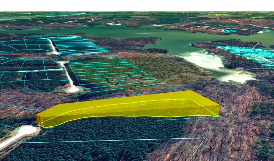
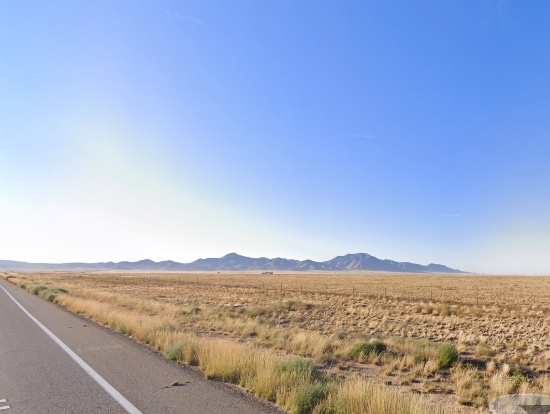
76 Acres in Navajo County, Arizona! BIDDING IS PER ACRE!
Quantity: 76
NOTE: Click on the Approximate Coordinates link below to explore the area on Google Maps. Zoom in for a detailed view of local attractions, roads, etc., or zoom out for a wider perspective of the surrounding region.
Parcel ID: 106-12-012
Legal Description: Section 12,T18N,R23E:S2 Se4Less Rr R/W & Water LineEasement
Acres: 76
State: Arizona
County: Navajo
Taxes: Under $10 per month
Approximate Coordinates: 34°58'11.7"N 109°50'54.1"W
BIDDING IS PER ACRE FOR A CASH PURCHASE!
TOTAL BID PRICE = BID PER ACRE x 76 ACRES.
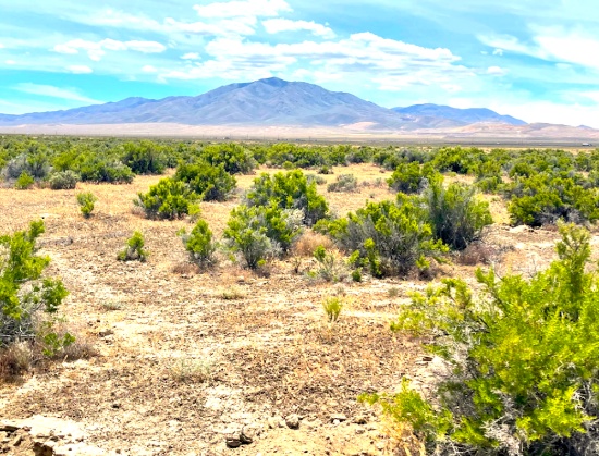
This sprawling 76-acre property sits on the edge of Petrified Forest National Park in Navajo County, Arizona. Tucked away in the wide-open desert, this land offers unmatched seclusion, raw natural beauty, and a direct connection to one of the most unique landscapes in the country.
Located just east of Joseph City and about 12 miles from Holbrook, this parcel places you right along the southern border of Petrified Forest National Park. The park is known for its colorful petrified wood, sweeping badlands, ancient petroglyphs, and deep cultural history. From this land, you can explore nearby features like the Rainbow Forest Museum, Newspaper Rock, Puerco Pueblo ruins, and the iconic Painted Desert — all just a short drive away.
The nearby town of Holbrook brings mid-century Route 66 charm, local shops, and essentials — while Flagstaff, about 90 miles west, offers a larger city experience. You also have close access to Interstate 40, making travel in either direction easy and convenient.
This property borders land once inhabited by the Navajo Nation, rich in culture and stories. Whether you're looking to invest, build off-grid, or simply own a piece of Arizona’s timeless desert, this is a rare chance to stake your claim right next to a national park.
Things To Do: Petrified Forest National Park >>
Own a piece of land that once served one of the greatest Native American tribes, the Navajo Nation. Immerse yourself in the beauty of this one of a kind, diverse culture!
Build in Antrim County, Michigan Near Lake Harold!
NOTE: Click on the Approximate Coordinates link below to explore the area on Google Maps. Zoom in for a detailed view of local attractions, roads, etc., or zoom out for a wider perspective of the surrounding region.
Parcel ID: 05-13-350-377-00
Legal Description: LOT 654 PLAT OF PINE VIEW NO 2
Acre: 0.33
State: Michigan
County: Antrim
Taxes: Under $3 per month
Approximate Coordinates: 44°57'05.6"N 84°53'17.5"W
Enjoy the four seasons from your new home in the Lakes of the North community in Antrim County. This peaceful and quiet location transforms seasonally from snow-covered white in winter, to spring green, to comfortable summer days, then magnificent shades in fall. The community is located about 20 minutes from Boyne Mountain Resort and Shanty Creek Resort; and 45 minutes from Traverse City or 25 minutes from Gaylord.
Things to See & Do in Antrim County! >>
Lakes of the North is a group of 19 subdivisions that straddles the Otsego-Antrim county line.
Amenities include an 18-Hole Golf Course, Pro-Shop, full-service Restaurant/Tavern all of which are Open to the Public. Member exclusive areas include Pencil Lake and Harold Lake beach access and beach houses, Activities Clubhouse with a Pool, Whirlpool, Water Slide, along with two outdoor Tennis/Pickleball Courts, Shuffleboard, Horseshoes and playground.
The Winter Sports area has an Ice Rink, Cross Country Ski and Snowshoe trails which serve as hiking trails in the summer.
Campers Village is an all-season facility for members to enjoy with their camper.
Throughout and surrounding Lakes of the North you will find hundreds of miles of ATV/Snowmobile Trails to ride on.
Learn About Lakes of the North Association >>
Each vacant lot in Lakes of the North is buildable and is rural in character. All building plans need approval by the association's Architectural Control Committee. Lots do not have water, septic, or electricity. Construction would require a private well and sewage disposal system. If there is electricity in the area, it can be extended to your lot.
Building restrictions include a minimum square footage that varies by subdivision. Mobile homes, trailers, camping and storage are prohibited on all vacant lots. Commercial use is also prohibited (including for rentals and short-term rentals).
For complete building information, please see Lakes of the North – Restrictive Covenants, paying particular attention to Article VI (Architectural Control Committee) and Article VII (Building and Use Limitations).
Lakes of the North is known for its picturesque landscapes, featuring serene lakes surrounded by lush forests and offering a peaceful retreat for residents and visitors alike. Bid now!
NOTE: The Association’s 2025 annual assessment is $380 for the primary lot and $214 for subsequent lots. This fee covers the period from April 1, 2025 to March 31, 2026. The buyer will be responsible for payment of the amount of the annual assessment in the fiscal year when the deed is recorded. The buyer must also register with the Association as a land owner by completing the required document (to be provided along with the recorded deed).
Valencia County Land – Minutes from Major Growth in NM!
NOTE: Click on the Approximate Coordinates link below to explore the area on Google Maps. Zoom in for a detailed view of local attractions, roads, etc., or zoom out for a wider perspective of the surrounding region.
Parcel ID: 1019035200180210620
Legal Description: Subd: RIO DEL ORO Lot: 62 Block: 32 Unit: 15 .25 AC(+/-)
Acre: 0.28
State: New Mexico
County: Valencia
Taxes: Under $5 per month
Approximate Coordinates: 34°45'27.9"N 106°33'47.8"W
Here's your chance to invest in land just minutes from Monterey Boulevard and the Rio Del Oro Loop! It's an excellent time to invest in this prime location and the bright future of Valencia County, NM.
Valencia County Welcomes You! >>
Drive the Rio Del Oro Loop! >>
July 2024 Update: Approval was recently granted to rezone 268 acres of vacant land, primarily located between NM47 and 304, for manufacturing operations. This bodes well for the continued growth of Valencia County. Development usually breeds development, development brings jobs, and jobs bring people, usually families, who need housing!
Tens of thousands of new jobs are coming to Los Lunas. Facebook (Meta's) new facility opened in 2019 and continues to grow and generate additional economic benefits to the surrounding areas. The White House recently provided a grant to develop infrastructure for a huge new manufacturing facility. A new rail park is also under development.
Of course, more jobs in this sizzling investment area means greater demand for land.
Facebook (Meta) announces $800M expansion plan for Los Lunas Data Center >>
Once the expansion is completed, the Facebook (Meta) Data Center will employ 400 employees and provide significant economic benefits to the local community.
Facebook (Meta) Los Lunas Data Center and Facebook (Meta) Los Lunas Data Center Drone Video >>
New Facebook (Meta) Data Center + Booming Business in Los Lunas >>
In addition, the Cibola National Forest covers more than 1.6 million acres in New Mexico, with elevations ranging from 2,700 feet to over 11,300 feet. If you and your family enjoy picnicking, backpacking, camping, skiing, hiking, wildlife-viewing, star-gazing, horseback-riding, hunting, or mountain biking, Cibola National Forest has plenty to offer you.
See the beautiful mountains of Valencia County >>
Additionally, this property is located about 45 minutes from the Albuquerque International Sunport (ABQ).
Don't let this lot get away from you. Bid today!
NOTE: Approximately $225 in back taxes will be the responsibility of the buyer.
Dickinson County: Lot Near the Menominee River in Michigan's Upper Peninsula!
NOTE: Click on the Approximate Coordinates link below to explore the area on Google Maps. Zoom in for a detailed view of local attractions, roads, etc., or zoom out for a wider perspective of the surrounding region.
Parcel ID: 002-481-012-00
Legal Description: LOT 12 BLK 1. FIRST ADD TO EAST BREITUNG.
Acre: 0.29
State: Michigan
County: Dickinson
Taxes: Under $8 per month
Approximate Coordinates: 45°47'22.4"N 88°03'26.7"W
If you are looking for an adventure, you can certainly find it in Michigan’s Upper Peninsula! Besides thrilling wilderness adventures, you can also enjoy natural serenity, historical attractions, and four-season beauty.
Michigan's Upper Peninsula! >>
This prime wooded lot is conveniently located in Kingsford within Dickinson County, in Michigan’s western Upper Peninsula bordering the Menominee River that serves as the state line between Michigan and Wisconsin.
Shoot down the region’s most intense rapids or see some of the country’s best athletes prepare for the Olympics!
Explore the UP Shore - Dickinson County >>
This lot is within a 15-minute drive of Fumee Lake, Pine Mountain Ski & Golf Resort, and the Golf Digest top-rated golfing destination, Timberstone, where golf and nature come together!
Enjoy horseback riding, cross country skiing, biking, hiking, bird watching, canoeing, kayaking, whitewater rafting, rock climbing, golf, fishing, snowmobiles, fascinating history attractions, craft beers and more!
Lots to Do in Dickinson County >>
Thrill seekers can shoot down the region’s most intense whitewater rafting through Piers Gorge on the Menominee River, the only Class IV rapids in the Midwest.
Whitewater Rafting in the Menominee River >>
Experience Whitewater Rafting >>
For a more relaxing time, canoe, kayak or fish on rivers or inland lakes across the county.
Take a historic journey and go back in time to visit the WWII Glider & Military Museum and learn the Ford plant in Kingsford being converted to make wooden gliders to fly reconnaissance missions over the English Channel.
In winter, visit the giant Pine Mountain Ski Jump in nearby Iron Mountain, the largest ski jumping facility in North America. You can ski the Pine Mountain ski area or its lit cross-country trails. For motorized fun, snowmobile on 120 miles of trails.
Dickinson County offers non-stop activities to please everyone! Bid today!
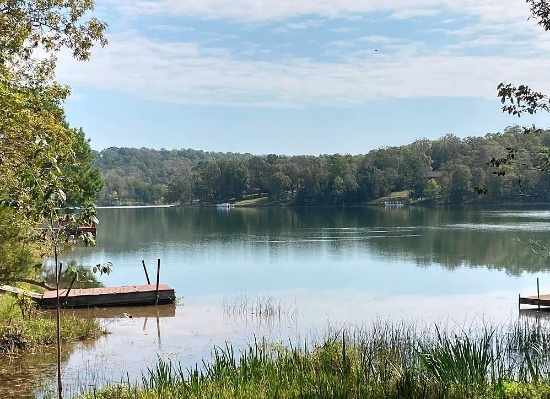
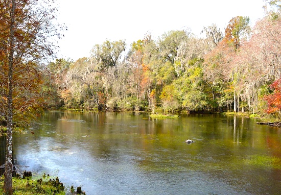
Fulton County, Arkansas: Build Your Home Close to Lake Omaha!
NOTE: Click on the Approximate Coordinates link below to explore the area on Google Maps. Zoom in for a detailed view of local attractions, roads, etc., or zoom out for a wider perspective of the surrounding region.
Parcel ID: 240-15222-000
Legal Description: Subdivision: Mohave Lot: 27 Block: 3
Acre: 0.26
State: Arkansas
County: Fulton
Taxes: Under $12 per month
Approximate Coordinates: 36°18'16.0"N 91°36'34.8"W
Cherokee Village is a scenic city located in the Ozark Mountains of northern Arkansas, spanning across Sharp and Fulton Counties. Established in 1954 by developer John Cooper, it was the state's first planned recreational community, initially covering 2,400 acres along the South Fork River. Today, it has expanded to over 13,000 acres and is home to approximately 4,780 residents, with more than 15,000 property owners.
The city boasts seven lakes, including the largest, Lake Thunderbird, which offers over seven miles of shoreline. Residents and visitors can enjoy two 18-hole golf courses, outdoor swimming pools, marinas, and various recreational activities such as fishing, hiking, and cycling
This 0.26 acre lot, located on Cheetowaga Drive, is close to Lake Omaha!
A home may be constructed on this lot so long as the house size is a minimum of 1000 square feet and complies with the zoning set forth in Cherokee Village Zoning "Bill of Assurance": Mohave Addition.
An Airbnb is also an acceptable use! In fact, they have some in the community already and the process of registering for the license is simple and costs under $40!
Cherokee Village offers small town charm, first-class outdoor recreation amenities and affordability. Take advantage of the low taxes, low cost of living and low housing costs. Your housing dollars stretch further here!
Video: Relocate to Cherokee Village >>
Cherokee Village is the ideal setting for your next adventure. Nestled in the rolling hills and unspoiled beauty of the Arkansas Ozarks, this 13,000-acre community invites you to explore, relax, and connect with nature. From families to retirees, there's something here for everyone.
Enjoy sparkling lakes and a flowing river, two private 18-hole golf courses, scenic parks and trails, and a welcoming RV and campground area. Soak up the sun on the private beach, cool off in one of six swimming pools, or test your skills at pickleball and tennis. Go fishing, take a peaceful nature walk, work out at the fitness center, connect with others at the senior center, hop on a bike, hike through the woods—or simply unwind in a hammock and take it all in.
Come see it for yourself!
NOTE: Real estate taxes are current. The buyer will be responsible for all real estate taxes billed on March 1, 2025 that will be due October 15, 2025.
Polk County: Invest in Over an Acre in Sunny Florida!
NOTE: Click on the Approximate Coordinates link below to explore the area on Google Maps. Zoom in for a detailed view of local attractions, roads, etc., or zoom out for a wider perspective of the surrounding region.
Parcel ID: 252724000000011040
Legal Description: E1/2 OF SE1/4 OF SW1/4 OF NE1/4 OF NE1/4
Acres: 1.25
State: Florida
County: Polk
Taxes: Under $5 per month
Approximate Coordinates: 28°07'30.9"N 81°45'31.8"W
This large 1.25-acre property is located in a peaceful, wooded area in southeastern Polk County, surrounded by Lake Mattie and several other lakes including, Saint Claire Lake, Grassy Lake, Lake Van, Gum Lake and Lake Alfred. It is less than 10 miles to Polk City and about 40 minutes to Orlando!
It is also driving distance to Walt Disney World, Universal Studios, SeaWorld, Busch Gardens, Gulf and Atlantic Beaches and Kennedy Space Center!
This parcel does not have frontage on a county maintained road. For this reason, the starting bid is deeply discounted, enhancing the attractiveness of this parcel as a long term investment.
Florida has surpassed New York as the third-largest state in terms of population, going from 18,801,310 residents in 2010 to 22,359,251 (and counting) in 2023. This growth pushes up demand for land needed for additional housing, facilities to serve the growing population, and so on!
The county’s location between both the Tampa and Orlando metropolitan areas has aided in the development and growth of the area. Residents and visitors alike are drawn to the unique character of the county’s numerous heritage sites and cultural venues, stunning natural landscapes, and many outdoor activities, making Polk the heart of central Florida.
Come see everything that Polk County, Florida has to offer!
NOTE: County does not permit living in RVs at any time unless a house has been constructed on the lot.
Invest in a Northern Michigan Lot With Access to This 227-Acre Wildwood Lake!
NOTE: Click on the Approximate Coordinates link below to explore the area on Google Maps. Zoom in for a detailed view of local attractions, roads, etc., or zoom out for a wider perspective of the surrounding region.
Parcel ID: 251-G01-000-028-00
Legal Description: GOLFVIEW ESTATES SUB, LOT 28. (SEC 21,T33N,R2W) 297/504
Acre: 0.34
State: Michigan
County: Cheboygan
Taxes: Under $8 per month
Approximate Coordinates: 45°14'25.7"N 84°34'03.1"W
Cheboygan County is situated in the northern part of Michigan's Lower Peninsula partly along Lake Huron's shoreline. It is known for its scenic beauty, with a mix of forests, lakes, and rivers allowing ample opportunities for boating, fishing, hiking and hunting.
Area Activities & Attractions! >>
Your Cheboygan County Bucket List! >>
This 0.34-acre lot is located on Golfcrest Drive, in the Wildwood Lakes Community in Cheboygan County, Michigan.
The surrounding area features the 227-acre Lake, residential properties, recreational areas, and amenities such as the Wildwood Lakes Golf Course. This 9-hole, par 35 golf course offers a scenic setting for both residents and visitors.
The community is known for its natural beauty, with the lake providing opportunities for fishing, boating, and other water-related activities. The area also offers hiking trails and parks, making it a desirable location for outdoor enthusiasts.
Overall, this peaceful community is enjoyed by residents and visitors alike. There is something here for everyone! Place your bid to become the new owner of this property in this beautiful location!
NOTE: This lot is located in an area where the active Wildwood Valley Property Owners Association exists. Membership is non-mandatory and the buyer can decide to join at any time if they desire. Current Annual dues are $75 and may increase in 2025.
Don't Miss Out: Invest in 20 Nevada Acres Near Route 306!
NOTE: Click on the Approximate Coordinates link below to explore the area on Google Maps. Zoom in for a detailed view of local attractions, roads, etc., or zoom out for a wider perspective of the surrounding region.
Parcel ID: 007-650-09
Legal Description: E2NW4SW4 35/30N/47E
Acres: 20
State: Nevada
County: Lander
Taxes: Under $10 per month
Approximate Coordinates: 40°25'35.0"N 116°38'35.9"W
This 20-acre investment property lies in the heart of Lander County’s rugged, scenic landscape, close to the majestic Bald Mountain. Nestled in a picturesque mountain valley, the land offers rolling hills, breathtaking views, and abundant wildlife. Its location provides the perfect balance of serene natural beauty with proximity to Crescent Valley and Battle Mountain, where you’ll find a variety of attractions and outdoor activities.
The area is renowned for being one of the world's largest gold-producing centers. A river runs through the valley, adding to the scenic beauty of the location.
For those seeking adventure, Lander County offers numerous options, including off-highway vehicle trails, landsailing, fishing, and hunting opportunities. Mountain biking enthusiasts can explore the Copper Basin Mountain Bike Trailhead, while stargazers can enjoy the unobstructed night skies of the high desert. Those looking for relaxation can visit the nearby Spencer Hot Springs and take in the stunning views of the surrounding mountain ranges.
What to Do and See in Lander County >>
The town of Battle Mountain is just a short drive away, offering a range of shopping, dining, and entertainment options. This friendly community is known for its warm hospitality, stunning natural beauty, and rich cultural heritage.
Video Tour of Battle Mountain, Nevada >>
Outdoor enthusiasts will find plenty to do in the area, with opportunities for hunting, fishing, hiking, and off-road adventures on the nearby trails. The vast, open skies make it an ideal location for stargazing, while the tranquility of the area provides a perfect escape from the hustle and bustle of city life.
This is an excellent opportunity to own a beautiful piece of land in one of the most stunning areas of Nevada!
