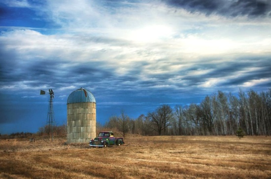
Land: The Solid Investment for a Prosperous Future
Land: The Solid Investment for a Prosperous Future
See Special Terms for additional fees
Description


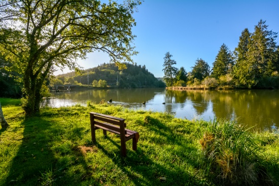
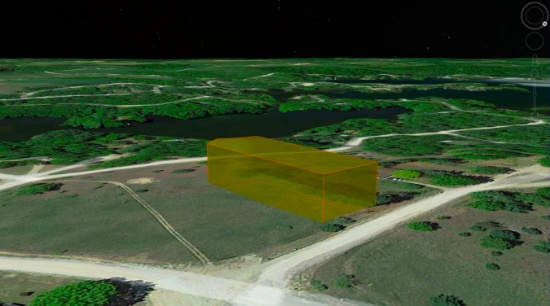
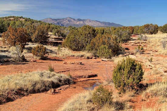
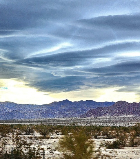
41.85 Acres in Scenic Elko County, Nevada!
Nestled in the stunning Elko County, Nevada, lies this vast parcel of land spanning 41.85 acres, offering the perfect opportunity to create a secluded retreat or invest in a promising piece of real estate.
View this Elko County Video >>
Surrounded by breathtaking mountain views and an abundance of wildlife, the property boasts natural beauty that is hard to find elsewhere. With its open expanse and varied terrain, this land is a playground for outdoor enthusiasts, providing an array of activities such as hunting, camping, hiking, and off-roading. With plenty of space to roam and soak in the peace and tranquility of nature, you'll never run out of things to explore.
Things to Do in Elko County, Nevada >>
Elko County is a hub of Wild West spirit, and this land presents an opportunity to invest in a region of rich culture and potential. The area is home to the annual National Basque Festival, a nod to the history and culture that brought sheepherding to the region. With its vast size, stunning scenery, and convenient location, this land is an ideal investment for those seeking a peaceful retreat or to develop a property according to their own vision.
Legal Description: NE4SW4; TOWNSHIP 38 NORTH, RANGE 59 EAST, MDB&M SECTION 31
Approximate Coordinates: 41°08'06.0"N 115°21'43.2"W
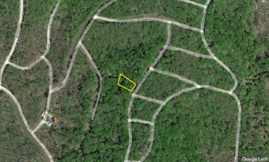
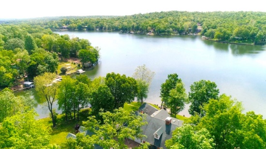
Buildable Quarter-Acre Lot in Benton County, Missouri!
Benton County is the ultimate retreat. The county has a bit of everything: the rich, German history of Cole Camp, hunting and outdoor activities in Lincoln, and the lake life in Warsaw.
Benton County is home to Mark Twain Boyhood Home & Museum, a popular tourist destination, and Civil War battlefields, including the Battle of Pea Ridge National Military Park.
What to Do and See in Benton County
This lot is located in the community of Eagle Bay, a wonderful private development with amenities and VERY low association fees. It is located only a fifteen minute stroll to Eagle Bay Fishing Park and Lake. The amenities include a swimming pool, a play area for the kids and RV services.
Eagle Bay is located less than 30 minutes from Lincoln, Warsaw and Cole Camp.
Eagle Bay is one of the few developments in the area which allow RVs and mobile homes. A single family dwelling of at least 600 square feet may be constructed on this lot.
Although there are year around homes in the Eagle Bay community, many owners find it to be the perfect spot to park their RV, giving them a wonderful (and inexpensive) summer vacation home! Plus, for ATV enthusiasts, there are over 30 miles of gravel roads and some off road trails.
Let Eagle Bay be your place at the lake, your home away from home!
NOTE: The Eagle Bay Property Owners Association maintains common areas for a fee of only $25 per month. The low monthly fee, plus the area’s low cost of living, makes the cost of owning a property and living in Eagle Bay very affordable. The buyer will be responsible for paying the monthly Property Owners Association fee beginning in the month when the deed has been recorded.
Legal Description: L 18, BLK. 62, PLAT 10 EAGLE BAY
Approximate Coordinates: 38°17'13.4"N 93°10'21.2"W
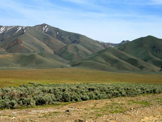
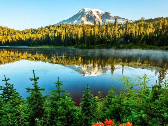
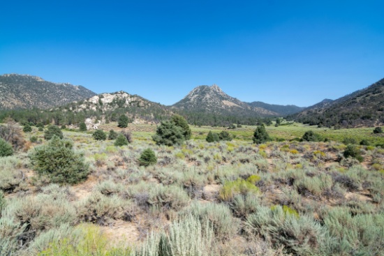
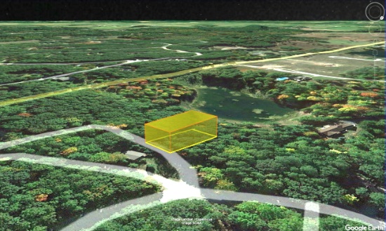
Experience the Beauty of Nevada: 10 Acres in Lander County!
This 10-acre parcel of land is located in the beautiful and rugged terrain of Lander County, Nevada, close to the majestic Bald Mountain. The property is situated in an area of natural beauty with rolling hills, expansive views, and abundant wildlife. You get the best of both worlds, in this picturesque mountain valley, yet close proximity to Crescent Valley and Battle Mountain, two locations that offer diverse attractions and outdoor activities.
The area is renowned for being one of the world's largest gold-producing centers. A river runs through the valley, adding to the scenic beauty of the location.
For those seeking adventure, Lander County offers numerous options, including off-highway vehicle trails, land sailing, fishing, and hunting opportunities. Mountain biking enthusiasts can explore the Copper Basin Mountain Bike Trailhead (about an hour away), while stargazers can enjoy the unobstructed night skies of the high desert. Those looking for relaxation can take a day trip and visit the Spencer Hot Springs (less than three hours away) and take in the stunning views of the surrounding mountain ranges.
What to Do and See in Lander County
The location is perfect for those seeking a remote and peaceful retreat while still being within easy reach of modern amenities. The town of Battle Mountain is just an hours drive away, offering a range of shopping, dining, and entertainment options. This friendly community is known for its warm hospitality, stunning natural beauty, and rich cultural heritage.
Video Tour of Battle Mountain, Nevada
Outdoor enthusiasts will find plenty to do in the area, with opportunities for hunting, fishing, hiking, and off-road adventures on the nearby trails. The vast, open skies make it an ideal location for stargazing, while the tranquility of the area provides a perfect escape from the hustle and bustle of city life.
This is an excellent opportunity to own a beautiful piece of land in one of the most stunning areas of Nevada.
Legal Description: NE4NW4NW4 29/30N/47E
Approximate Coordinates: 40°26'56.0"N 116°42'01.8"W
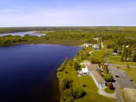
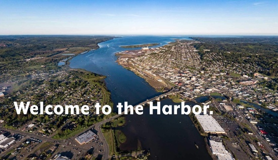
Explore Nature's Wonders in Grays Harbor County, Washington!
Grays Harbor County, Washington is located on the southwest corner of the Olympic Peninsula along the Pacific Ocean. In no other county can you stick your toe in the Pacific Ocean at a beautiful beach one hour, and the next hour be in the lush rain forest.
50 Things To Do in Grays Harbor!
This beautiful county is the "Gateway to the Pacific Ocean" and Washington's scenic coastal wonderlands. It is located on the southwest corner of the Olympic Peninsula along the Pacific Ocean.
This wooded lot is located less than a mile from Hoquiam River and less than 10 minutes from Hoquiam River RV Park. This centrally-located Hoquiam River RV Park is a gateway to the Olympic Peninsula. This RV park provides a sheltered base to explore the beaches of Ocean Shores and Westport. This Good Sam RV park is open all year for both short and long term stays.
Also nearby, you can find several parks, shopping malls, and coffee shops. Head down to the beach with just about a 40-minute drive to the Pacific Ocean. There is something here for everyone!
Grays Harbor is home to seven bodies of water: harbors, lakes, streams, channels, canals, rivers and of course, the Pacific. Aquatic activities galore, and then some! If water isn't what you want to experience, then hike into the enchanted forests to witness wildlife in their natural habitat. Or experience the Quinault Rain Forest, one of only two temperate rain forests in the Northern Hemisphere.
Camp, kayak, walk, hike, you name it! Grays Harbor is untouched and waiting for you to explore!
NOTE: You are bidding only on lot 4. This lot is the third lot from the right and specified in the photos. Grays Harbor County has a tendency to change parcel numbers when properties are sold, so please understand that the property purchased will be the same, but the parcel number might change due to the county's accounting method.
Legal Description: Lot 4 Block 102, Beacon Hill Addition to the City of Hoquiam, as per plat recorded in Volume 5 of Plats, page 23, records of Grays Harbor County, TOGETHER WITH that portion of vacated Ontario Street that would attach thereto by City Ordinance No. 2077, recorded February 27, 1959 as AuditorÄs File No. 44649, records of Grays Harbor County; Situate in the County of Grays Harbor, State of Washington.
Approximate Coordinates: 46°58'43.1"N 123°51'48.7"W
Build Your Dream Home in Presque Isle County, Michigan!
Welcome to Presque Isle, located in the Lower Peninsula of Michigan, an unspoiled environment of woods, water and other natural resources. This beautiful four seasons recreational community includes many amenities for owners to enjoy. It is located about a mile from Lake Huron, and just a short walk to Grand Lake! It is the home of two Lighthouses, the Range Light Beach, Lake Esau, Barnum Park, and of course the Harbor!
Presque Isle Lighthouses >>
This community is managed by the Presque Isle Harbor Association, with numerous amenities. The amenities include the Clubhouse with gyms, game room, conference room, locker rooms, spa and an indoor pool. The amenities also include private campgrounds for residents! The 2023-2024 Association dues, due on April 1st, are $294 annually. Water fees are $70.75 per quarter for a lot with a water hook-up, and $40.25 without hook-up. The buyer will be responsible for payment of the amount of the annual assessment for the fiscal year of the parcel purchase.
Presque Isle Harbor Association >>
Thompson Harbor is situated along seven and a half miles of Lake Huron shoreline. This undeveloped park provides a rustic retreat for hikers exploring the park's six miles of trails. The park trails are open year-round for biking, hiking, cross-country skiing and snowshoeing. Bring your binoculars for wildlife viewing. Winter camping is available in the rustic cabins.
Legal Description: LOT 327 GRAND PINES SUBD #2 NO 2 SEC 19 T34N R8E
Approximate Coordinates: 45°19'20.7"N 83°30'10.0"W
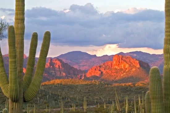
Own Your Own Piece of the Arizona Desert in Navajo County!
Settle down on a piece of land that once served one of the greatest Native American tribes, the Navajo Nation. Immerse yourself in the beauty of this one of a kind, diverse culture.
This state has some of the most breathtaking views in all the United States, bringing in visitors from all over the country, to view some of the world's most recognized landscapes, such as Monument Valley and the brilliant blue waters of Lake Powell.
You can easily get lost in the history, beauty, and culture of this wondrous city. From star gazing, hiking trails, campgrounds, national monuments, historical parks, museums, trading posts, and the Twin Arrows Casino Resort, there is definitely something for everyone!
This property is just a 30 minute drive to the Petrified Forest National Park! In its south, the Rainbow Forest is full of colorful petrified wood. It’s home to the Rainbow Forest Museum, with its paleontology exhibits and many trail access points. In the park's center are the petroglyphs of Newspaper Rock and the ruined village of Puerco Pueblo. To the north, the Painted Desert Inn, a 1930s adobe building, is a museum with Hopi murals.
Things to do Petrified Forest National Park >>
Don't miss out on the opportunity to own property in this peaceful town.
Legal Description: Vein Of Gold #Xi Lot 160
Approximate Coordinates: 34°59'36.7"N 110°00'41.1"W
2.5 Acres in Picturesque Inyo County, California!
If you enjoy outdoor adventures, then this should be your property! Situated in Inyo County, CA, this 2.5-acre plot of land is near the CA & NV border between Los Angeles and Las Vegas.
Inyo County is a land of magnificent natural diversity. Mount Whitney is the highest peak in the lower 48 states, and Death Valley is the lowest point in the US. Experts agree that Inyo County is a wonderland of magnificent natural settings to explore. In addition, Inyo County offers world-class alpine climbing, backcountry skiing, hang gliding, horse packing, and mountain biking!
This property will give you a home-base from which to set out and explore.
Close to what you want, and far away from everything you don't want. Invest in a retreat for yourself today.
Legal Description: LOT 192 IN SECTION 34, TOWNSHIP 22 NORTH, RANGE 10 EAST, SBBM IN THE COUNTY OF INYO
Approximate Coordinates: 35°57'41.3"N 115°52'55.8"W
Experience the Best of Michigan Living in Canadian Lakes, Mecosta County, Michigan!
Looking to build your dream home in a private recreational community in northern Michigan? Consider Canadian Lakes, where you can enjoy the best of both worlds – road frontage and walking distance to Lake of the Clouds and the golf course.
This idyllic location offers the perfect balance of natural beauty and modern amenities. Enjoy easy access to Lake of the Clouds, where you can indulge in swimming, fishing, or simply soaking up the stunning views. Plus, take advantage of the nearby golf course, which offers an enjoyable and challenging round of golf for players of all skill levels.
Are you ready to live your GOOD LIFE?
Owners have inclusive use of remarkable amenities, including over 730 acres of waterways for all types of water sports, six beaches, sports venues, two 9-hole and one 18-hole golf courses, outdoor and indoor swimming pools, fitness area, hot tub, sauna, snow tubing tow, cross-country skiing, outdoor ice rink, campground, and more!
Canadian Lakes is located in Mecosta County, truly "The County for Every Season!" Escape for an afternoon excursion in the county.
Explore the Big Rapids Region >>
Explore numerous trails for hiking and biking, snowshoeing or snowmobiling, or enjoy the abundant land and lakes for hunting and fishing. Enjoy over 100 lakes and streams and, of course, the mighty Muskegon River. All are perfect for fishing, tubing, canoeing, kayaking, boating, and water-skiing.
Take in the wonder of wildlife and scenic views. You'll be surrounded by numerous festivals, events, and unique hometown shops. Excite your taste buds at nearby tasty dining venues, breweries, and wineries.
Don't miss this GOOD LIFE!!
Note: The Canadian Lakes Property Owners Corporation (POC) manages this community. The annual fee for 2023 is $803.26. The buyer, upon purchase, is responsible for directly paying all outstanding fees up to $1,200 to the POC.
Legal Description: SEC 19 T14N R8W LAKE OF THE CLOUDS LOT 102
Approximate Coordinates: 43°35'30.5"N 85°19'25.1"W
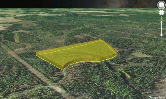
Escape to Nature at this 30.65 Acre Property in Scenic, Northern Maine!
Aroostook County is the northernmost region and the largest county in wild, rugged, and deeply beautiful Maine. The state is 90 percent forest, with a coastline that, if stretched out, would reach to California. Bordering the provinces of Quebec and New Brunswick, Canada, the county is larger than the states of Rhode Island and Connecticut combined. Known simply as "The County" or "Crown", life in this northernmost region is a grandiose fusion of old-world charm blended to perfection with contemporary appeal. Enjoy amenities that are every bit present-day, while exploring quaint villages and years-old cultures that make it seem as if you have stepped back in time.
This 30.65 acre parcel is located in the Caswell Woods, a town-approved subdivision on a private road.
From friendly local folks, rich history, storybook towns, sumptuous restaurants, shopping destinations and breathtaking outdoor amenities, Aroostook County is a peaceful borderland where time passes slower, refreshing evening breezes linger longer and sunsets sizzle for endless stretches. Step back into the way Maine used to be and take a deep breath of fresh pine and balsam-heavy air. It's a place for rejuvenating and reconnecting with life's simple pleasures.
Welcome to Aroostook County >>
Things to Do, Places to Go in Aroostook >>
The region is a water utopia, home to more than 7,000 miles of flowing rivers, including the 92-mile Allagash Wilderness Waterway, and more than 2,000 lakes, streams, and ponds.
If water is not on your to-do list, hiking, camping, bird and wildlife watching, and other recreational and sports opportunities abound as you descend upon smaller mountains, endless four-season camping areas and more.
Don't miss out on Aroostook County's 2,300 miles of groomed snowmobile trails and family skiing and snow tubing facilities. In an average season, experience over 10 feet of snow!
Bid now so you don't lose this terrific property!
Book/Page: B1426P153
Map/Lot: 9A/10
Legal Description: Lot Number Ten (10) of Caswell Woods Subdivision as subdivided for Susan K. Dernlan by Blackstone Land Surveying, P.A. and recorded on September 7, 2006 in the Northern Aroostook Registry of Deeds in Plan Files 726 and 727, said parcel containing 30.65 acres, more or less. Subject to, and with the benefit of, all subdivision easements, restrictions, covenants and reservations of record and to taxes for the year 2021 and thereafter. Being a portion, and only a portion, of the property conveyed to Susan K. Dernlan by Warranty Deed of Lakeville Shores, Inc. dated October 28, 2004 and recorded at the Northern Aroostook Registry of Deeds in Book 1426, Page 153.
Approximate Coordinates: 47°00'36.7"N 67°48'58.5"W
Build in this Peaceful Pine Forest Location in Northern California!
Modoc County, located in the far northeast corner of California, is often called the “place where the west still lives” and is frequently compared to the beautiful expanses of Montana.
The warm, dry summers encourage camping, hiking, fishing, and water sports against the backdrop of the uniquely beautiful Warner Mountains, with their clear alpine streams and a high desert dotted with serene lakes. An ideal habitat for diverse wildlife, the area is home to bald eagles, peregrine falcons, goshawks, golden eagles, Rocky Mountain mule deer and elk, wild horses, burros and pronghorn antelope.
What to Do and See in Modoc County >>
This lot is located in the California Pines, a beautiful community located just 10 miles southwest of the City of Alturas. California Pines covers 15,000 acres surrounded by 2 million acres of the Modoc National Forest.
California Pines is a peaceful and uncrowded retreat with green meadows, towering pines and trickling streams. If you want a place to escape and become part of a tranquil and laid-back community, then come to California Pines and escape to this outdoor paradise.
The Lake Units are located at an elevation of 4,300 feet in mostly meadow pastureland type of property. The California Pines Lake is 256 acres and next to it sits the California Pines Lodge, a 4,400 foot airstrip, and campground.
Escape to California Pines! Camp or build a getaway in this paradise!
The California Pines Property Owners Association maintains common areas for the benefit of the property owners, residents and the general public. The annual POA fee of $95 is the responsibility of the buyer.
RVs and camping are permissible for up to 30 days of a calendar year. If you are considering constructing a home there, please note that the living space must be no less than 1,000 sq. ft., you must drill a well and install a septic system, and you can extend electric lines or install solar power. Please review the following links for detailed information:
Things to do before building in California Pines! >>
The California Pines Lodge sits on a small peninsula surrounded by California Pines Lake, right next to Donavan Reservoir, which is a haven for Canadian Snow Geese, White Pelicans, Cranes, and many other wild birds and animals of all kinds. The 8,000 square foot lodge features guest rooms, a restaurant, lounge, banquet room and activity room. The grounds of the lodge include a swimming pool and two paddle-tennis courts.
See the California Pines Lodge >>
Don’t let this opportunity pass you by!!
Legal Description: Lot 28, Block 12, California Pines Unit Lake 2, a subdivision of the County of Modoc according to the official Plat thereof, filed in Book 2 of Maps in Modoc County Records.
Approximate Coordinates: 41°24'47.4"N 120°37'43.9"W
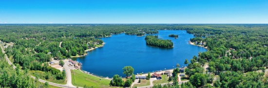
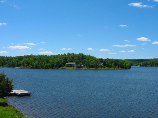
Lakeside Living in Osceola County, Michigan!
This wooded lot is located in the Lake Miramichi community, a minute stroll to the Little Miramichi Lake, in Osceola County, Michigan.
Lake Miramichi is a private, well planned, waterfront community with an active Property Owners Association that manages the private lake and is responsible for upkeep of the roads, parks, clubhouse, and dams, which are between the larger lake and “little” Lake Miramichi. Lake Miramichi is in Evart Township.
Learn All About the Lake Miramichi Community >>
Miramichi Lake and the smaller quiet Little Miramichi Lake each have boat launches and park areas. Relax at the sandy swimming beach, playground, beach house and pavilion. Dock your boat at the full service marina available if your lot is without lake frontage. Enjoy a nice four mile hike, walk, jog, or bike ride around the lake.
The homes, approximately 160, vary between simple seasonal cabins to beautiful year-round homes with great views of the hilly countryside or the many fantastic views of the lake.
Scenic Miramichi Lake, covering 210 acres, offers all sports activities and great fishing for bass, bluegill, perch, crappie, walleye and catfish. Little Miramichi Lake is a 30 acre fishing and swimming lake with no motors allowed. It is known for its beautiful natural setting, wooded surroundings, peace, serenity and excellent fishing.
Osceola County contains the highest point in Michigan’s Mid-Western Lower Peninsula and is also known for trout fishing. Yet, Osceola County still retains its tradition, and gives its residents the opportunity to enjoy the benefits of small community living while at the same time having access to the amenities found in larger urban areas.
Learn More About Osceola County, Michigan >>
Don’t pass this up!
Note: The Miramichi Lakes Property Owners Association (LMPOC) manages this community. Buyers, upon purchase, are responsible for directly paying outstanding fees to the POA. The annual fee for this lot in 2023 is $322.88. In addition, new owners are required to pay a one-time Transfer Fee of $200.00.
Legal Description: LOT 900 LAKE MIRAMICHI SUBD #5
Approximate Coordinates: 43°49'08.3"N 85°16'06.3"W
Retreat to Cherokee Village in Sharp County, Arkansas!
Imagine living in this beautiful four-seasons serene location in the Arkansas Ozarks!
Considering retirement, a new start for your family, just ready for a change, or looking for a part-time retreat? Cherokee Village offers small town charm, first-class outdoor recreation amenities and affordability. Take advantage of the low taxes, low cost of living and low housing costs. Your housing dollars stretch further here.
A home may be constructed on this lot so long as the house size is a minimum of 800 square feet and complies with the zoning set forth in Cherokee Village Zoning "Bill of Assurance": Shawnee Addition
Experience Cherokee Village >>
Cherokee Village Information >>
This lot sits less than a quarter mile from Lake Thunderbird, and is only a few miles from Cherokee Village North Golf Course and South Fork Spring River!
Cherokee Village is the perfect backdrop for your next adventure. Come enjoy the lakes, river, golf courses, parks, trails, RV and campground. With more than 13,000 acres set among the rolling hills and pristine natural beauty of the Arkansas Ozarks, Cherokee Village has something to offer all ages.
Cherokee Village, Arkansas - Retreat, Rest and Renewal >>
Soak up the sun on our seven lakes, hit the links on our two private 18-hole golf courses, jump right into any of our six swimming pools, go RVing and camping, take a swing at pickleball and tennis, spend the day fishing, walk any of our nature trails, workout at our fitness center, meet some new friends at our senior center, cycle, hike, or just relax in a hammock.
Boat, fish and play on our seven lakes. Enjoy the year-round spring-fed South Fork River that flows into neighboring Spring River. Both rivers rank among the Ozark region’s most popular destinations for floating and trout and walleye fishing.
Legal Description: Subdivision: SHAWNEE Lot: 131 Block: 4
Approximate Coordinates: 36°17'48.3"N 91°33'38.1"W
Beautiful Private Hunt Club Community in Michigan!
Alcona County is located in the northeastern Lower Peninsula, in the heart of the “Sunrise Side”. The county borders the Lake Huron coastline and has about 60 lakes and 3 major rivers. Residents and visitors enjoy the Quilt Trail, historical sites, local shops, over 825 campsites and multitudes of activities during every season.
This lot is located in the Lost Lake Woods Subdivision, nestled between Hubbard Lake and Lake Huron.
Video of Lost Lake Woods Club >>
Lot owners are eligible to apply for membership in the exclusive, private 10,000-acre Lost Lake Woods Club, founded in 1926 as a private hunting and fishing club. Club members now enjoy a variety of recreational activities, including hunting, fishing, golfing, hiking, and snowmobiling. The 18-hole golf course was designed by renowned golf course architect Tom Bendelow. The community also has a clubhouse, tennis courts, and a private beach on nearby Lake Huron.
The residential consists of about 1,000 lots, many of which are nestled among the trees and offer scenic views of the surrounding nature.
Please note: Only owners of lots in the Lost Lake Woods community are eligible to apply for membership in the Lost Lake Woods Club. There is a $500 application fee, a $2,000 initiation fee and $145 per month thereafter.
Lost Lake Woods Subdivision offers a tranquil and natural setting for those who enjoy outdoor activities and the beauty of northern Michigan.
Come see what Lost Lake Woods in Alcona County has to offer!
Legal Description: T28N R8E SECS 35&36 LOT 37 BLK 6 LOST LAKE WOODS SUB.
Approximate Coordinates: 44°46'25.8"N 83°25'01.5"W
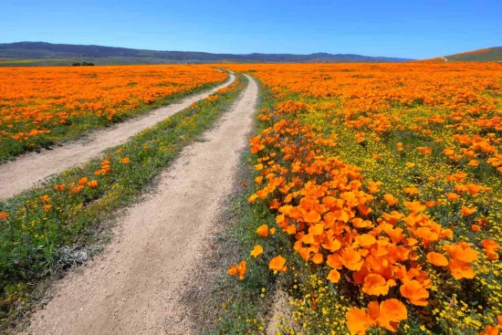
Over 2.5 Acres in Los Angeles County, California!
The County of Los Angeles is the most populous county in the United States with nearly 10 million residents covering 4,083 square miles. Its population is greater than that of 40 individual U.S. states. It is one of the most ethnically diverse counties in the United States.
The county is divided west-to-east by the San Gabriel Mountains, where most of the county's highest peaks are located. Several lower mountains are in the northern, western, and southwestern parts of the county, including the San Emigdio Mountains, the southernmost part of Tehachapi Mountains and the Sierra Pelona Mountains.
Most of the population of Los Angeles County resides in the south and southwest, with major population centers in the Los Angeles Basin, San Fernando Valley, and San Gabriel Valley.
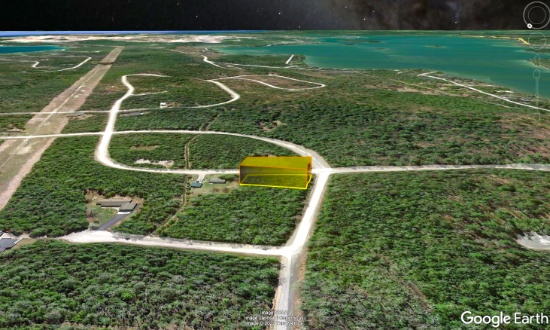
This lot is located close to Avenue D-4 in Hi Vista, and there is an unpaved road that runs along the northern and western front of the parcel, coming North from Avenue D-6 and 230th St E.
Just a few miles away is the Phacelia Wildlife Sanctuary, measuring up to 160 acres, where you can spend the day hiking or horseback riding. Traveling further southwest, you will find Butte Valley Wildflower Sanctuary, Saddleback Butte State Park and Campground, Antelope Valley Indian Museum State Historic Park and Lake Los Angeles Community. From there, about 15 minutes West, is the city of Lancaster, where you can spend the day visiting the Museum of Art and History and the beautiful Antelope Valley California Poppy Fields.
Legal Description: TRACT NO 29427 LOT 203
Approximate Coordinates: 34°46'27.3"N 117°43'24.9"W
The Ultimate Retreat in the Eagle Bay Community, in Missouri!
Benton County is the ultimate retreat. The county has a bit of everything: the rich, German history of Cole Camp, hunting and outdoor activities in Lincoln, and the lake life in Warsaw.
Benton County is home to Mark Twain Boyhood Home & Museum, a popular tourist destination, and Civil War battlefields, including the Battle of Pea Ridge National Military Park.
What to Do and See in Benton County
This lot is located in the community of Eagle Bay, a wonderful private development with amenities and VERY low association fees. It is located only a fifteen minute stroll to Eagle Bay Fishing Park and Lake. The amenities include a swimming pool, a play area for the kids and RV services.
Eagle Bay is located less than 30 minutes from Lincoln, Warsaw and Cole Camp.
Eagle Bay is one of the few developments in the area which allow RVs and mobile homes. A single family dwelling of at least 600 square feet may be constructed on this lot.
Although there are year around homes in the Eagle Bay community, many owners find it to be the perfect spot to park their RV, giving them a wonderful (and inexpensive) summer vacation home! Plus, for ATV enthusiasts, there are over 30 miles of gravel roads and some off road trails.
Let Eagle Bay be your place at the lake, your home away from home!
NOTE: The Eagle Bay Property Owners Association maintains common areas for a fee of only $25 per month. The low monthly fee, plus the area’s low cost of living, makes the cost of owning a property and living in Eagle Bay very affordable. The buyer will be responsible for paying the monthly Property Owners Association fee beginning in the month when the deed has been recorded.
Legal Description: L 19, BLK. 62, PLAT 10 EAGLE BAY
Approximate Coordinates: 38°17'12.6"N 93°10'21.5"W
Own Land in Valencia County, New Mexico!
This warm-weather location has the country buzzing about it!
Valencia County Welcomes You! >>
In addition to being rich in culture and a great place to raise a family, Valencia County is experiencing a great deal of economic prosperity. There are so many new and exciting things happening to this already charming location, you cannot miss the chance to buy your land in Valencia County today!
Tens of thousands of new jobs are coming to Los Lunas. Facebook (Meta's) new facility opened in 2019 and continues to grow and generate additional economic benefits to the surrounding areas. The White House recently provided a grant to develop infrastructure for a huge new manufacturing facility. A new rail park is also under development.
Of course, more jobs in this sizzling investment area means greater demand for land.
Facebook (Meta) announces $800M expansion plan for Los Lunas Data Center
Once the expansion is completed, the Facebook (Meta) Data Center will employ 400 employees and provide significant economic benefits to the local community.
Facebook (Meta) Los Lunas Data Center and Facebook (Meta) Los Lunas Data Center Drone Video
New Facebook (Meta) Data Center + Booming Business in Los Lunas
In addition, the Cibola National Forest covers more than 1.6 million acres in New Mexico, with elevations ranging from 2,700 feet to over 11,300 feet. If you and your family enjoy picnicking, backpacking, camping, skiing, hiking, wildlife-viewing, star-gazing, horseback-riding, hunting, or mountain biking, Cibola National Forest has plenty to offer you.
See the beautiful mountains of Valencia County!
Note: Approximately $200 in back taxes per lot will be the responsibility of the buyer.
Legal Description: RIO DEL ORO Lot: 14 Block: 52 Unit: 26 .25 AC
Approximate Coordinates: 34°44'45.7"N 106°31'01.0"W
Build Your Dream Home on this Wooded Lot in Ogemaw County, Michigan!
Living in Mills Township, Ogemaw County offers residents a suburban/rural feel. The community has lakes galore, including the spectacular Skidway Lake. Take a leisurely stroll along the beautiful boardwalk or go fishing off one of the fishing platforms at Skidway Lake. If you are looking for a day out, check out the beautiful pavilion, beach, picnic area with grills, playground, and paved walkway at Elbow Lake.
Walking Distance to Skidway Lake! >>
Improvements Happening at Elbow Lake >>
Lake Huron's Saginaw Bay is less than 25 miles away! And there are several other smaller lakes in the area, including Black Lake, Bush Lake, Feeding Ground Lake and Lost Lake.
This lot is located on David Road. Building a home there will require a well and septic system as well as electricity. Modular homes are fine as long as they meet building codes (with approved foundation).
There are numerous additional opportunities for both outdoor and indoor adventures in Mills Township. Whether you enjoy historical museums, camping, bowling, golfing, or miniature golf, there is something for everyone. They have a robust selection of local county parks and great recreational areas for those who love the outdoors. Even when the Ogemaw County Fair is not in town, the local fairgrounds always have amazing things to do. From livestock auctions to flea markets, rodeos, and festivals, you are sure to find something to enjoy.
Learn about the Annual County Fair! >>
There are also a number of widely recognized historical markers in the area, such as the Ogemaw County Historical Museum, the Steiner Museum, and the Arenac County Historical Society Museum. Take some time to do one of Ogemaw County’s driving tours and you are sure to be impressed with the county’s rich history.
Great Getaways in Ogemaw County, Michigan! >>
Ogemaw County Historical Society >>
Don't miss this opportunity to build your dream home!
Legal Description: HEDLEY L. AND DOROTHY M. TURNER SUBD NO. 10 LOT 96.
Approximate Coordinates: 44°10'40.4"N 84°02'34.7"W
Four-Seasons Serene Location in Arkansas Ozarks!
Imagine living in this beautiful four-seasons serene location in the Arkansas Ozarks!
Considering retirement, a new start for your family, just ready for a change, or looking for a part-time retreat? Cherokee Village offers small town charm, first-class outdoor recreation amenities and affordability. Take advantage of the low taxes, low cost of living and low housing costs. Your housing dollars stretch further here.
A home may be constructed on this lot so long as the house size is a minimum of 800 square feet and complies with the zoning set forth in Cherokee Village Zoning "Bill of Assurance": SENECA SECOND ADDITION
Experience Cherokee Village >>
Cherokee Village Information >>
This lot sits less than a quarter mile from Lake Thunderbird, and is only a few miles from Cherokee Village North Golf Course and South Fork Spring River!
Cherokee Village is the perfect backdrop for your next adventure. Come enjoy the lakes, river, golf courses, parks, trails, RV and campground. With more than 13,000 acres set among the rolling hills and pristine natural beauty of the Arkansas Ozarks, Cherokee Village has something to offer all ages.
Cherokee Village, Arkansas - Retreat, Rest and Renewal >>
Soak up the sun on the private beach, hit the links on two private 18-hole golf courses, jump right into any of the six swimming pools, go RVing and camping, take a swing at pickleball and tennis, spend the day fishing, walk any of the nature trails, workout at the fitness center, meet some new friends at the senior center, cycle, hike, or just relax in a hammock!
Boat, fish and play on any of the seven lakes. Enjoy the year-round spring-fed South Fork River that flows into neighboring Spring River. Both rivers rank among the Ozark region’s most popular destinations for floating and trout and walleye fishing.
Add Cherokee Village to your travel plans and enjoy this unique community!
Legal Description: Subdivision: SENECA SECOND Lot: 45 Block: 10
Approximate Coordinates: 36°16'46.1"N 91°33'10.2"W
Catch the Sunrise From Your Home in Michigan!
This lot with road frontage sits on Center Street in Berlin Charter Township, Michigan in the Village of Estral Beach. Just a five-minute walk to Great Lake Erie! Take advantage of the lake, the shore, nearby cities, parks and a multitude of recreational activities.
Monroe County is a historical and beautiful community set in the southeastern corner of Michigan, bordering Ohio to the south and Lake Erie to the east.
The city of Monroe has impressive parks and recreation land – around 300 acres, in addition to the non-motorized River Raisin Heritage Trail. Parks contain a wide variety of recreation amenities, including picnic facilities, hiking, athletic fields, concert venues, war memorials, fishing, kayaking, boat launch, open space, and historical sites.
There are activities for everyone in Monroe County!
What to Do and See in Monroe County
The River Raisin Battlefield, Sterling State Park, Cabela's, and many other areas of interest make Monroe County a great place to live. Monroe’s location on the shore of Lake Erie provides opportunities for swimming, boating, and fishing.
Explore the county’s numerous parks, trails, and recreational facilities.
Sterling State Park is the only Michigan park on Lake Erie. The park’s 1,300 acres include more than a mile of sandy beach, boating and shore fishing, a fishing lagoon, lakefront camping, wildlife viewing and seven miles of trails.
Pointe Mouillee State Game Area is one of the most respected waterfowl locations in Michigan. Consisting of over 4,000 acres, it offers exceptional waterfowl hunting. And, its numerous bird species and habitat diversity make it an important birding site for Bald Eagles, Black Billed Plovers, Glossy Ibises, Osprey, and Whimbrels.
Things to Do in Pointe Mouillee
Don’t miss this opportunity to enjoy Monroe County, the cornerstone of Michigan!
Legal Description: STEVENS ESTRAL SUBDIVISION W 60 FT OF THE E 120 FT OF LOT 136
Property Address: 7116 Center St, Newport, MI 48166
Increase Your Land Portfolio with this Piece of Washington!
Grays Harbor County, Washington is located on the southwest corner of the Olympic Peninsula along the Pacific Ocean. In no other county can you stick your toe in the Pacific Ocean at a beautiful beach one hour, and the next hour be in the lush rain forest.
50 Things To Do in Grays Harbor!
This beautiful county is the "Gateway to the Pacific Ocean" and Washington's scenic coastal wonderlands. It is located on the southwest corner of the Olympic Peninsula along the Pacific Ocean.
This wooded lot is located less than a mile from Hoquiam River and less than 10 minutes from Hoquiam River RV Park. This centrally-located Hoquiam River RV Park is a gateway to the Olympic Peninsula. This RV park provides a sheltered base to explore the beaches of Ocean Shores and Westport. This Good Sam RV park is open all year for both short and long term stays.
Also nearby, you can find several parks, shopping malls, and coffee shops. Head down to the beach with just about a 40-minute drive to the Pacific Ocean. There is something here for everyone!
Grays Harbor is home to seven bodies of water: harbors, lakes, streams, channels, canals, rivers and of course, the Pacific. Aquatic activities galore, and then some! If water isn't what you want to experience, then hike into the enchanted forests to witness wildlife in their natural habitat. Or experience the Quinault Rain Forest, one of only two temperate rain forests in the Northern Hemisphere.
Camp, kayak, walk, hike, you name it! Grays Harbor is untouched and waiting for you to explore!
NOTE: You are bidding only on lot 3. This lot is the third lot from the right and specified in the photos. Grays Harbor County has a tendency to change parcel numbers when properties are sold, so please understand that the property purchased will be the same, but the parcel number might change due to the county's accounting method.
Legal Description: Lot 3 Block 102, Beacon Hill Addition to the City of Hoquiam, as per plat recorded in Volume 5 of Plats, page 23, records of Grays Harbor County, TOGETHER WITH that portion of vacated Ontario Street that would attach thereto by City Ordinance No. 2077, recorded February 27, 1959 as Auditors File No. 44649, records of Grays Harbor County; Situate in the County of Grays Harbor, State of Washington.
Approximate Coordinates: 46°58'43.0"N 123°51'47.3"W
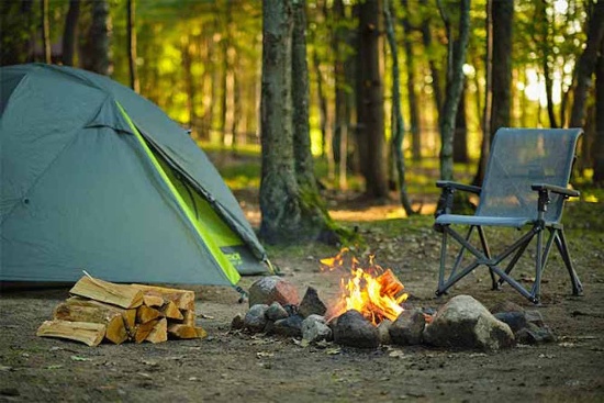
Calling All Missouri Camping Enthusiasts!
This 0.43 acre “Camping Lot” is located in Twin Oaks Harbor, a gated community in Jackson Township, St. Clair County, Missouri. This community features “camping lots” with favorable rules for camping enthusiasts.
The community is located about 120 miles southwest of Kansas City. St. Clair County is a peaceful, rural, agricultural county with a population of under 10,000 but offers a myriad of outdoor opportunities. Appleton City and Osceola are the largest towns in the county.
Activities in St. Clair County, Missouri >>
The Harry S Truman Reservoir, also known as Truman Lake, offers exceptional outdoor recreational opportunities. It is great for boating, fishing, hunting, camping, hiking/biking and just exploring nature at its finest. Truman Lake encompasses 259 square miles of land and water covering portions of four counties: Benton, Henry, Hickory and St. Clair.
Plenty To Do at Truman Lake >>
Twin Oaks Harbor community amenities include a small lake that is stocked for fishing (boats are allowed as long as they are not gas-powered), an in-ground pool, a playground with new equipment, two bath houses with hot and cold running showers, trash dumpsters and road maintenance. ATVs, golf carts, etc. are permitted on the common roads.
Navigate the Twin Oaks Harbor POA Website >
This “Camping Lot” is for recreational use but is NOT permitted to be used as a residence (so no one can live there). Campers are allowed. No other structures are permitted on this lot.
Twin Oaks Harbor Restrictive Covenants >>
Fresh air, a warm fire & a starry night are waiting for you!
NOTE: Twin Oaks Harbor Property Owners Association imposes an annual fee of $232.00 for a single lot covering its fiscal year of May 1 – April 30. Dues are paid through April 30, 2024.
10 Lot Package in Valencia County, New Mexico!
Great Things Happening in Valencia County, New Mexico! >>
This package of 10 lots is available in beautiful Valencia County, New Mexico. The lots are scattered throughout the Rio Del Oro subdivision and are not contiguous. You'll get 2.5 total acres of land to immerse yourself in the excitement and sizzling hot investment activity of Los Lunas and Valencia County! This area is experiencing tremendous economic growth with a new Facebook Meta Data Center, manufacturing hub, and pipeline project.
Rail Park in Los Lunas to bring 5,000 jobs to the area! >>
You can also enjoy numerous hiking and exploring opportunities nearby including the Whitfield Wildlife Conservation Area, Cibola National Forest, and the Manzano Mountains State Park. And you'll be only an hour away from Albuquerque International Airport (ABQ).
Valencia County, New Mexico Desert Mountains! >>
Check out Manzano Mountains! >>
In mid-March of 2021, Facebook announced a doubling of its Facebook Meta Data Center, adding six additional buildings totaling over two million square feet by 2023. Los Lunas’ government will provide nearly $40 billion in industrial revenue bonds and other economic development funding!
LATEST UPDATE: Facebook announces $800M expansion plan for Los Lunas Data Center
Facebook Los Lunas Data Center! >>
Note: Back taxes of up to $300 per lot will be the responsibility of the buyer.
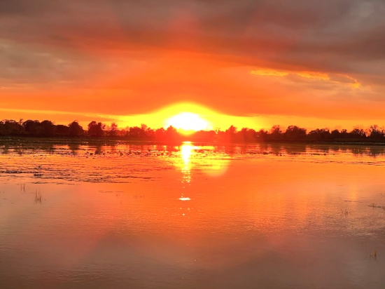
Grab Your Paddle & Head to Shell Creek, Charlotte County, Florida!
This wooded lot is just a short walk to Shell Creek, which empties into the Peace River. The river is more than 100 miles long, originating between Tampa and Orlando and emptying into Charlotte Harbor estuary at Punta Gorda in Charlotte County.
Learn about Shell Creek Preserve!
Charlotte County is a water lover's paradise, kissing the Gulf Coast and delivering an incredible variety of activities for everyone!
Experience a Florida Camping and Canoe Adventure on the Peace River! >>
Port Charlotte, FL Video Tour: Affordable Resort - Town Living! >>
Top 19 Things To Do in Port Charlotte, Florida! >>
Check out Charlotte County Recreation Programs! >>
This peaceful location is near the Peace River Nature Preserve and its ample nature trails. Be sure to visit one of the nearby county parks for bird watching.
See the Florida Birding Trail >>
The lot is zoned environmentally sensitive. Homes are a permitted use.
See the Environmentally Sensitive Zoning District Permitted Uses! >>
Enjoy the serenity of this little-known river with appealing scenery and wildlife — Shell Creek!
NOTE: The county does not permit living in RVs at any time unless a house has been constructed on the lot.
Legal Description: RIDGE HARBOR SHORES LT 514 & N/LY 37.76 FT OF LOT 541 AND VAC ELMHURST RDB ADJ THERETO 3994/1053
Approximate Coordinates: 26°59'22.4"N 81°55'46.3"W
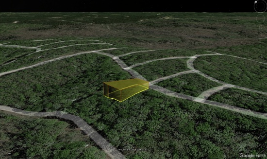
10 Acres Surrounded by California Adventure!
Bring your jeep, dune buggy or other off-road vehicle to explore the diverse surroundings in Southern California!
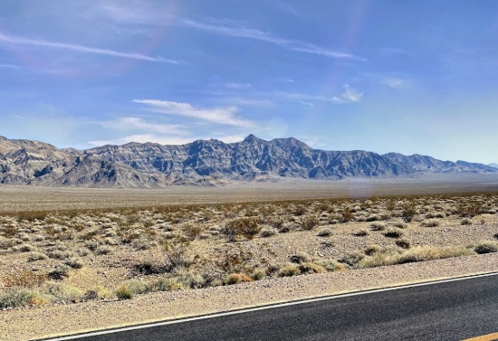
This remote 10-acre parcel is located in the rolling hills of Imperial County, located between the city of Brawley 70 miles to the west; the Colorado River and the Cibola National Wildlife Refuge 35 miles to the east; and the Algodones Sand Dunes 48 miles to the south.
So much adventure is awaiting you here! If you are looking for a large, remote piece of land to get away from it all, this is for you! This parcel is not too far from Hauser Geode Beds, which yields crystal-filled geodes and beautiful agate nodules.
Enjoy Geode Searching at Hauser Geode Beds! >>
Imperial County shares borders with Mexico to the south, Riverside County to the north, San Diego County to the west, and the State of Arizona to its east.
The Imperial Sand Dunes Recreation Area, the largest dune complex in California, extends more than 40 miles along the eastern edge of the Imperial Valley, split by Highway 78. Off-road vehicles are permitted. To the north, (the green section on the map), you are free to walk but there’s no sign and no trailhead.
See the Algodones Sand Dunes >>
Cibola National Wildlife Refuge straddles the border of California and Arizona. It has an abundance of wildlife watching and nature trail opportunities. Take the Canada Goose Drive for an excellent opportunity for wildlife viewing and photography. On the accessible walking trail, you might see song birds, bobcats, quail, and mule deer. Anglers can fish for largemouth bass, smallmouth bass, striped bass, channel catfish, flathead catfish, crappie, sunfish, tilapia, and common carp. Public hunting on Cibola National Wildlife Refuge is permitted in specified areas.
Experience the Cibola National Wildlife Refuge >>
Head to the city of Brawley, ranked in the top 10 fastest growing cities in California, for provisions, food and entertainments!
Learn about the City of Brawley >>
Explore your adventurous spirit!
Legal Description: SW1/4 OF SW1/4 OF SE1/4 SEC 35 T9S R18E 10 AC
Approximate Coordinates: 33°20'28.6"N 115°03'08.0"W
Welcome to Wadena, Minnesota!
Live in a beautiful community in Sebeka, Minnesota! Rejoice in the friendly atmosphere of residents who treat others as friends, and who believe that a community worth living in is a community worth improving.
This lot is located right off of W Minnesota Street, next to the Redeye River. There are plenty of nearby parks and other recreational activities to do in closeby Wadena, Minnesota.
Wadena County has an abundance of parks with varied recreation experiences that inspire people to pass along the love for the outdoors to the next generation. Wadena is known as the City of Parks, and maintains many acres of beautiful parks and picnic areas.
Annual events include Wadena's signature summer celebration June Jubilee, the unique Halloween-season Wadena Zombie Run, and the long-running annual holiday showcase, the Christmas Festival!
The City of Wadena Public Works Department maintains publicly-owned places and facilities that offer many ways to enjoy an active life in Wadena. This includes over a dozen parks and open spaces, pedestrian and bicycle paths and paved trails.
With over 100 hand-painted murals decorating downtown buildings, Wadena depicts 1,000 years of Minnesota history known as the "Largest Puzzle in the World".
Enjoy the small-town atmosphere with the attractions of a larger community!
NOTE: Up to $100 in back taxes due for this property will be the responsibility of the buyer.
Legal Description: PT OF LOT 7 BLK 1; COM AT NE COR OF LT 7 TH IN WTLY DIR 80' ALG NTLY LI OF LT 7; TH STLY 80' TH ETLY 80' TO E LI OF LT 7 TH NTLY ALG E LI OF LT 7 TO PT OF BG; EXC A PERPETUAL EASE OVER & ACROSS TH ETLY 20' OF SD TR FOR ACCESS TO SEWER & WATER
Approximate Coordinates: 46°37'47.0"N 95°05'53.0"W
