Beat Inflation with Land!
Beat Inflation with Land!

See Special Terms for additional fees
Description


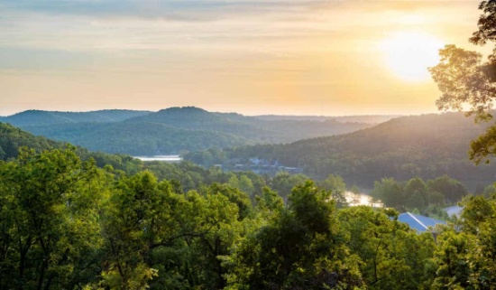
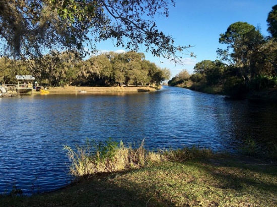
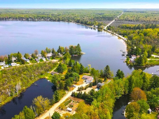
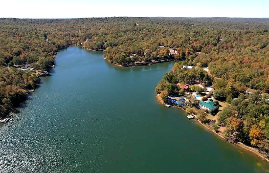
Explore Harbour Heights: Florida Lot Near Golf & the Peace River!
NOTE: Click on the Approximate Coordinates link below to explore the area on Google Maps. Zoom in for a detailed view of local attractions, roads, etc., or zoom out for a wider perspective of the surrounding region.
Parcel ID: 402310410006
Legal Description: HARB HTS SEC 11 PT 3 BLK 228 LT 10 348/963 415/58 524/510 532/720-1 604/188-93 COR1346/1205 2319/2155 CONSV/E2329/705 TD3461/1113 TD3493828
Acre: 0.11
State: Florida
County: Charlotte
Taxes: Under $3 per month
Approximate Coordinates: 27°00'27.4"N 81°59'48.1"W
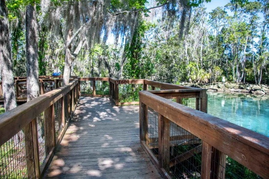
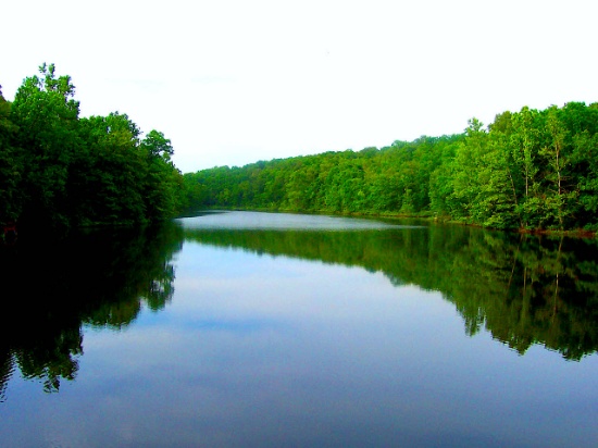
Located in Charlotte County, Florida, Harbour Heights is an unincorporated waterfront community situated along the scenic Peace River. It offers a laid-back, residential atmosphere with a focus on outdoor activities, especially boating and fishing, making it attractive to retirees, seasonal residents, and families seeking a peaceful lifestyle.
Port Charlotte, FL Video Tour: Affordable Resort - Town Living! >>
This lot is located between Deep Creek Golf Club and the Peace River!
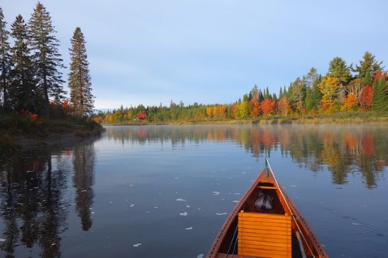
Experience a Florida Camping and Canoe Adventure on the Peace River! >>
While Harbour Heights is primarily residential, nearby Punta Gorda and Port Charlotte provide access to more extensive shopping, dining, and healthcare services. The area is quiet, and the community tends to be close-knit, with an emphasis on outdoor living.
Harbour Heights shares the typical warm, subtropical climate of Southwest Florida, with hot summers and mild winters. It’s ideal for outdoor activities year-round.
The peaceful atmosphere makes it a perfect place for anyone looking for a tranquil and relaxing retreat. Come and explore all that Charlotte County has to offer!
NOTE: County does not permit living in RVs at any time unless a house has been constructed on the lot.
Experience the Small-Town Charm of Lapeer County, Michigan!
NOTE: Click on the Approximate Coordinates link below to explore the area on Google Maps. Zoom in for a detailed view of local attractions, roads, etc., or zoom out for a wider perspective of the surrounding region.
Parcel ID: 042-220-003-00
Legal Description: VILLAGE OF CLIFFORD PEARSON'S ADDITION LOT 3 BLK 20.
Acre: 0.19
State: Michigan
County: Lapeer
Taxes: Under $12 per month
Approximate Coordinates: 43°18'52.4"N 83°10'48.9"W
Lapeer County is situated in the eastern part of Michigan's Lower Peninsula.
Many of the communities within Lapeer County have a small-town feel, with friendly neighbors and a strong sense of community. This can create a welcoming environment for newcomers and foster a tight-knit community spirit.
This buildable lot is located within the Village of Clifford. Located in the heart of Michigan’s thumb, Clifford is a small rural community that was established in 1862. There have been many changes over the years since the Village of Clifford came into existence. The modern day village is much smaller than the original version. The Village includes: a Baptist & Catholic church, post office, restaurant, a small convenience store, car wash, laundry mat, an exercise facility, a fire hall and the village hall. The school house is now a library with a room available for rent. There is a very nice park which includes a skate park & playground equipment.
Lapeer County is known for its natural beauty & scenic landscapes, with several parks, lakes, forests, and recreational areas. Holloway Reservoir Regional Park (about 40 minutes away) offers opportunities for camping, fishing, and boating. Other parks like Lapeer's Rotary Park and Torzewski County Park (both about 30 minutes away) offer opportunities for hiking, biking, and wildlife viewing.
Apart from its natural beauty, Lapeer County offers various attractions and community events throughout the year, including festivals, fairs, and community gatherings. Lapeer County celebrats everything from local art and culture to seasonal holidays. Events like the Lapeer Days Festival, Winterfest, and various farmers markets provide entertainment and opportunities to connect with the community.
Golf enthusiasts can enjoy a round of golf at one of the county's golf courses, such as Castle Creek Golf Club or Rolling Hills Golf Club (both about 30 minutes away).
Explore the shops, boutiques, and restaurants in downtown areas like Lapeer and Imlay City. From locally-owned stores to national retailers, you'll find a variety of options for shopping and dining.
In addition, Lapeer County is accessible by several major highways, including Interstate 69, which runs east-west through the county, connecting it to larger cities like Flint and Port Huron.
While the county offers a peaceful rural setting, it's still within a reasonable distance of larger urban centers like Flint and Detroit. This allows residents to enjoy the amenities and employment opportunities of city life while residing in a quieter, more relaxed environment.
Overall, Lapeer County offers a blend of rural charm, outdoor recreation, affordability, community spirit, and access to urban amenities, making it a desirable and appealing place to live for many residents.
NOTE: Back taxes of approximately $270 are due by May 31, 2025.
Join the Future of Investment in LA County, CA!
NOTE: Click on the Approximate Coordinates link below to explore the area on Google Maps. Zoom in for a detailed view of local attractions, roads, etc., or zoom out for a wider perspective of the surrounding region.
Parcel: 3307004047
Legal Description: TRACT NO 1181 LOT 23 BLK 10
Acre: 0.17
State: California
County: Los Angeles
Taxes: Under $9 per month
Approximate Coordinates: 34°45'39.1"N 117°58'02.3"W
Welcome to vibrant and diverse Los Angeles County, California! This iconic destination is known for its rich cultural tapestry, stunning landscapes, and a plethora of attractions!
This lot is located just north of E Ave E-4 in Redman.
Los Angeles County holds the distinction of being the most populous county in the United States, boasting nearly 10 million residents across its expansive 4,083 square miles. Notably, its population surpasses that of 40 individual U.S. states, making it a demographic powerhouse. Renowned for its remarkable ethnic diversity, the county stands out as one of the most culturally varied regions in the nation.
Geographically, the county is divided west-to-east by the imposing San Gabriel Mountains, hosting the majority of its highest peaks. Additionally, various lower mountain ranges adorn the northern, western, and southwestern areas, including the San Emigdio Mountains, the southernmost segment of the Tehachapi Mountains, and the Sierra Pelona Mountains.
Most of the population of Los Angeles County resides in the south and southwest, with major population centers in the Los Angeles Basin, San Fernando Valley, and San Gabriel Valley.
Situated nearby is the city of Lancaster, offering opportunities for a day filled with exploration at attractions such as the Museum of Art and History, Antelope Valley California Poppy Fields, and Elizabeth Lake. The area is surrounded by various Wildlife Sanctuaries, including Phacelia Wildlife Sanctuary, Alpine Butte Wildlife Sanctuary, and Carl O Gehardy Wildlife Sanctuary, among others. Los Angeles County also hosts numerous parks, including Branch Memorial Park, Saddleback Butte State Park, and Stephen Sorensen Park.
This piece of California is waiting for you!
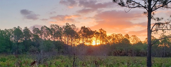
Adventure Starts Here: Homosassa in Citrus County, Florida!
NOTE: Click on the Approximate Coordinates link below to explore the area on Google Maps. Zoom in for a detailed view of local attractions, roads, etc., or zoom out for a wider perspective of the surrounding region.
Parcel ID: 17E19S320010 01340 0010
Legal Description: TOWN OF HOMOSASSA PB 1 PG 6 LOT 5 BLK 134
Acre: 0.30
State: Florida
County: Citrus
Taxes: Under $5 per month
Approximate Coordinates: 28°47'18.0"N 82°36'12.0"W
Discover the essence of Florida in Citrus County, where the warm Gulf waters blend with crystal-clear, spring-fed rivers. Enjoy championship golf courses, charming local shops, a rich historical heritage, and endless opportunities for aquatic adventures. This area is ideal for outdoor enthusiasts, offering kayaking, paddleboarding, fishing, boating, and more.
A Visit to Citrus County Florida >>
This parcel is located in Homosassa, a small charming community in Citrus County. Homosassa is known for its natural beauty, wildlife, and outdoor recreational activities. Located along the Gulf Coast, it has a rich history and is particularly famous for its springs and as a haven for manatees.
Flowing through the community, the Homosassa River is a popular spot for boat tours, kayaking, and fishing. The river is connected to the Gulf of Mexico and provides access to both freshwater and saltwater fishing.
In addition to the Homosassa River, this property is located close to Bluebird Springs Park, Ellie Schiller Homosassa Springs Wildlife State Park, and several campgrounds and resorts.
Go hiking, swim with the manatees, birdwatch and picnic at Ellie Schiller Homosassa Springs Wildlife State Park!
Homosassa Springs State Park >>
Overall, Homosassa in Citrus County is a laid-back, nature-rich destination that offers visitors a mix of outdoor adventures, wildlife encounters, and a small-town atmosphere.
Come grab your piece of paradise in Citrus County!
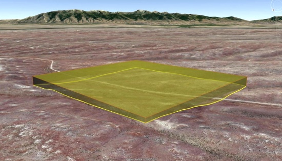
Modoc County, California: 10 Lot Package! BIDDING IS PER LOT!
Quantity: 10
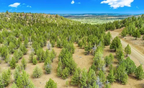
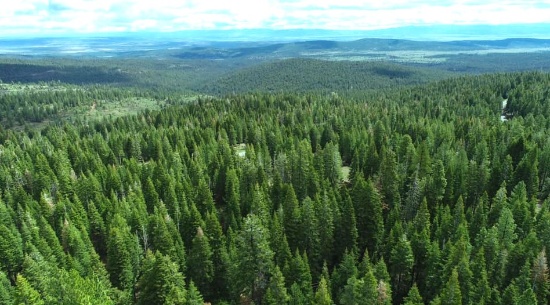
These ten lots are located in the Hill Unit #5 of California Pines, an off-the-grid community located about 30 miles southwest of the one square-mile city of Alturas. The hill units are almost all covered with four different kinds of pine trees. The lots are scattered throughout charming California Pines. While they may not be contiguous, each lot boasts its own unique allure and distinctive dimensions. The elevation in the hill units varies from 5,000 to 6,400 feet. All the roads are gravel roads.
View the 10 Lots on a Map Here! >>
What to Do and See in Modoc County >>
The California Pines Lake is 256 acres and next to it sits the California Pines Lodge, a 4,400 feet airstrip, and campground. The 8,000 square foot lodge features guest rooms, a restaurant, lounge, banquet room and activity room. The grounds of the lodge also include a swimming pool.
See the California Pines Lodge >>
RVs and camping are permissible for up to 30 days of a calendar year.
If you are considering constructing a home, please note that the living space must be no less than 500 square feet.
Construction in the hill units will require a private well and septic system. If there is electricity in the area, it can be extended to your lot. Power is obtained through Surprise Valley Electric. Solar & wind turbine are also allowed.
Development Restrictions for Hill Unit 5 >>
Building in California Pines! >>
The warm, dry summers encourage camping, hiking, fishing, and water sports against the backdrop of the uniquely beautiful Warner Mountains, with their clear alpine streams and a high desert dotted with serene lakes.
The California Pines Property Owners Association maintains common areas for the benefit of the property owners, residents and the general public.
Don’t miss this incredible opportunity to own ten properties in California Pines and enjoy the peace, beauty, and adventure that Modoc County has to offer!
BIDDING IS PER LOT FOR A CASH PURCHASE!
TOTAL BID PRICE = BID PER LOT x 10 LOTS.
NOTE: The California Pines Property Owners Association maintains common areas for the benefit of the property owners, residents and the general public. The 2025 annual POA fee is $105 per lot and will become the responsibility of the buyer.

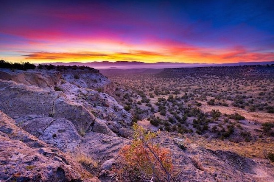
Invest in Growth in Valencia County, New Mexico!
NOTE: Click on the Approximate Coordinates link below to explore the area on Google Maps. Zoom in for a detailed view of local attractions, roads, etc., or zoom out for a wider perspective of the surrounding region.
Parcel ID: 1023031030110110510
Legal Description: RIO DEL ORO Lot: 3 Block: 32 Unit: 31 (+/-) AC
Acre: 0.25
State: New Mexico
County: Valencia
Taxes: Under $5 per month
Approximate Coordinates: 34°41'54.7"N 106°30'03.9"W
Here's your chance to invest in land just minutes from Monterey Boulevard and the Rio Del Oro Loop! It's an excellent time to invest in this prime location and the bright future of Valencia County, NM.
Valencia County Welcomes You! >>
Drive the Rio Del Oro Loop! >>
July 2024 Update: Approval was recently granted to rezone 268 acres of vacant land, primarily located between NM47 and 304, for manufacturing operations. This bodes well for the continued growth of Valencia County. Development usually breeds development, development brings jobs, and jobs bring people, usually families, who need housing!
Tens of thousands of new jobs are coming to Los Lunas. Facebook (Meta's) new facility opened in 2019 and continues to grow and generate additional economic benefits to the surrounding areas. The White House recently provided a grant to develop infrastructure for a huge new manufacturing facility. A new rail park is also under development.
Of course, more jobs in this sizzling investment area means greater demand for land.
Facebook (Meta) announces $800M expansion plan for Los Lunas Data Center >>
Once the expansion is completed, the Facebook (Meta) Data Center will employ 400 employees and provide significant economic benefits to the local community.
Facebook (Meta) Los Lunas Data Center and Facebook (Meta) Los Lunas Data Center Drone Video >>
New Facebook (Meta) Data Center + Booming Business in Los Lunas >>
In addition, the Cibola National Forest is just to the east and covers more than 1.6 million acres in New Mexico, with elevations ranging from 2,700 feet to over 11,300 feet. If you and your family enjoy picnicking, backpacking, camping, skiing, hiking, wildlife-viewing, star-gazing, horseback-riding, hunting, or mountain biking, Cibola National Forest has plenty to offer you.
See the beautiful mountains of Valencia County >>
Additionally, this property is located about 45 minutes from the Albuquerque International Sunport (ABQ).
Don't let this lot get away from you. Bid today!
NOTE: Approximately $200 in back taxes will be the responsibility of the buyer.
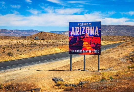
Explore the Wild Beauty of Arizona - 5 Scenic Acres in Navajo County!
NOTE: Click on the Approximate Coordinates link below to explore the area on Google Maps. Zoom in for a detailed view of local attractions, roads, etc., or zoom out for a wider perspective of the surrounding region.
Parcel ID: 104-95-031H
Legal Description: Section 21,T19N,R20E: S2 Sw4 Of Tract 48, Pueblo Mesa Ranches Out Of 104-95-031D For2006Roll
Acres: 4.98
State: Arizona
County: Navajo
Taxes: Under $5 per month
Approximate Coordinates: 35°01'32.5"N 110°13'29.0"W
This nearly five-acre parcel is located in Navajo County's Joseph City, a small, historic town located in northern Arizona along the iconic Route 66. Founded in 1876 by Mormon pioneers, it is the oldest Mormon settlement in Arizona that is still in existence. Surrounding this property, there are many attractions such as Lee Mountain, Marcou Mesa, Painted Hills and Minute Co-Sunsky Ranch.
Joseph City has a place in American history as part of the legendary highway. Although it's a small stop, it retains a sense of nostalgia for road trippers exploring the historic route. Also, it’s conveniently located near Interstate 40, making it easy to reach larger cities like Flagstaff (about 90 miles west) and Holbrook (just 12 miles east).
It’s hard to say what takes center stage in Holbrook. It’s a canvas painted with mid-century Route 66 kitsch, Wild West characters, and unforgettable landscapes. Cherished for its roadside Americana charm, Holbrook sits within the Painted Desert, a remarkable area of rocky badlands that stretches from the Grand Canyon to the Navajo Nation. It’s one of Arizona’s most dazzling and lonesome landscapes, with layered bands that change color seemingly every hour.
You can easily get lost in the history, beauty, and culture of this wondrous city. From star gazing, hiking trails, campgrounds, national monuments, historical parks, museums, trading posts, and the Twin Arrows Casino Resort, there is definitely something for everyone!
This parcel is also about an hour drive to the Petrified Forest National Park! In its south, the Rainbow Forest is full of colorful petrified wood. It's home to the Rainbow Forest Museum, with its paleontology exhibits and many trail access points. In the park's center are the petroglyphs of Newspaper Rock and the ruined village of Puerco Pueblo. To the north, the Painted Desert Inn, a 1930s adobe building, is a museum with Hopi murals.
Things To Do: Petrified Forest National Park >>
Own a piece of land that once served one of the greatest Native American tribes, the Navajo Nation. Immerse yourself in the beauty of this one of a kind, diverse culture!
Jackson County: Own Land in Magnificent Michigan!
NOTE: Click on the Approximate Coordinates link below to explore the area on Google Maps. Zoom in for a detailed view of local attractions, roads, etc., or zoom out for a wider perspective of the surrounding region.
Parcel ID: 5-122500000
Legal Description: LAND COM 72 FT E OF NE COR OF HIGH ST & ADRIAN AVE TH N 90 FT TH E 51.75 FT TH S 90 FT TH W 51.75 FT TO BEG SE 1/4 SW 1/4 SEC 2 T3S R1W'
Acre: 0.11
State: Michigan
County: Jackson
Taxes: Under $5 per month
Approximate Coordinates: 42°13'59.2"N 84°23'54.8"W
Jackson County, named after President Andrew Jackson, is situated in South Central Michigan. It’s approximately 40 minutes south of Lansing and 35 minutes west of Ann Arbor. In just an hour and a half, you can reach Lake Erie or Toledo, Ohio!
Jackson County is home to the Grand River, Michigan's longest river, stretching 260 miles. In addition to the river, the area offers numerous restaurants, schools, golf courses, lakes, parks, and plenty of recreational activities.
This lot is situated on E High Street in Jackson Township, about ten minutes from Center Lake, Ella Sharp Park, Museum, and Golf Course! There are several other parks, golf courses and lakes nearby to enjoy.
Residents appreciate the suburban, conservative atmosphere, access to above-average schools, and the low cost of living.
Your next great day starts in Jackson County, Michigan!
Polk County: Come Bask in the Florida Sun!
NOTE: Click on the Approximate Coordinates link below to explore the area on Google Maps. Zoom in for a detailed view of local attractions, roads, etc., or zoom out for a wider perspective of the surrounding region.
Parcel ID: 313118000000031200
Legal Description: W1/2 OF SW1/4 OF NW1/4 OF NE1/4 OF NW1/4 LESS 1/2; INT IN OIL GAS AND MINERAL RIGHTS
Acre: 1.26
State: Florida
County: Polk
Taxes: Under $2 per month
Approximate Coordinates: 27°47'22.7"N 81°15'48.5"W
Here is your chance to own a piece of Florida!
This 1.26 acre plat of land is located in a peaceful, wooded area in southeastern Polk County, surrounded by Lakes Kissimmee, Weohyakapka, and Arbuckle, among others. It is located about 50 miles south of Orlando and 75 miles east of Tampa.
This parcel does not have frontage on a county maintained road. For this reason, the starting bid is deeply discounted, enhancing the attractiveness of this parcel as a long term investment.
With over 2,000 square miles of land and water, Polk County is Florida’s fourth largest county. Polk County is located in the geographic center of Florida and along Central Florida’s I-4 corridor.
Florida has surpassed New York as the third-largest state in terms of population, going from 18,801,310 residents in 2010 to 22,359,251 (and counting) in 2023. This growth pushes up demand for land needed for additional housing, facilities to serve the growing population, and so on!
See why Polk County is one of the fastest growing counties! >>
With millions of visitors each year to its beaches, major amusement parks centered around Orlando and cruise ships departing from ports on both coasts, tourism is a major contributor to Florida's robust economy.
Purchasing this piece of Florida will diversify your investment portfolio. Don’t miss this opportunity!
NOTE: Polk County does not permit living in RVs at any time.
NOTE: This property is located in the vicinity of the Avon Park Air Force Range Military Training Facility and may be subject to potential day and night low level aircraft overflight and military training noise during training exercises.
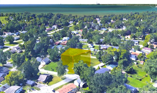
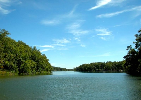
Michigan's Lake Erie Awaits - Secure Your Corner Lot Today!
NOTE: Click on the Approximate Coordinates link below to explore the area on Google Maps. Zoom in for a detailed view of local attractions, roads, etc., or zoom out for a wider perspective of the surrounding region.
Parcel ID: 07 927 543 00
Legal Description: SEC 29 T6S R10E STONY POINTE BEACH SUBDIVISION LOT 543.
Acre: 0.13
State: Michigan
County: Monroe
Taxes: Under $13 per month
Approximate Coordinates: 41°56'35.2"N 83°15'52.0"W
Live the lake life in beautiful Monroe County, Michigan!
Monroe County is a historical and beautiful community set in the southeastern corner of Michigan, bordering Ohio to the south and Lake Erie to the east.
This corner lot is ten miles East of the city of Monroe in La Salle Township, that borders the Lake Erie shore. It is in the Stony Point Subdivision, just steps away to the shore! Take advantage of the lake, shore, nearby cities, parks and a multitude of recreational activities.
The city of Monroe has impressive parks and recreation land – around 300 acres, in addition to the non-motorized River Raisin Heritage Trail. Parks contain a wide variety of recreation amenities, including picnic facilities, hiking, athletic fields, concert venues, war memorials, fishing, kayaking, boat launch, open space, and historical sites.
A Tour of the City of Monroe >>
There are activities for everyone in Monroe County.
Explore the county’s numerous parks, trails, and recreational facilities.
The River Raisin Battlefield, Sterling State Park, Cabela's, and many other areas of interest make Monroe County a great place to live. Monroe’s location on the shore of Lake Erie provides opportunities for swimming, boating, and fishing.
Sterling State Park is the only Michigan park on Lake Erie. The park’s 1,300 acres include more than a mile of sandy beach, boating and shore fishing, a fishing lagoon, lakefront camping, wildlife viewing and seven miles of trails.
Pointe Mouillee State Game Area is one of the most respected waterfowl locations in Michigan. Consisting of over 4,000 acres, it offers exceptional waterfowl hunting. And, its numerous bird species and habitat diversity make it an important birding site for Bald Eagles, Black Billed Plovers, Glossy Ibises, Osprey, and Whimbrels.
Things to Do in Pointe Mouillee >>
Don’t miss this opportunity to enjoy Monroe County, the cornerstone of Michigan!
NOTE: A $130 assessment fee is due on or before June 30, 2025.
Build Near Spring Lake in Beautiful Ozark Acres!
NOTE: Click on the Approximate Coordinates link below to explore the area on Google Maps. Zoom in for a detailed view of local attractions, roads, etc., or zoom out for a wider perspective of the surrounding region.
Parcel ID: 444-00058-000
Legal Description: Subdivision: EAST LAKE SHORE Lot: 13 Block: 3
Acre: 0.25
State: Arkansas
County: Sharp
Taxes: Under $8 per month
Approximate Coordinates: 36°18'07.6"N 91°23'31.9"W
Escape to nature with this beautiful Arkansas lot!
Discover a wonderful opportunity to own a picturesque buildable lot in the enchanting community of Ozark Acres, located in the heart of Sharp County, Arkansas. Nestled amidst the beauty of the Ozarks, this property offers an idyllic setting for creating your dream retreat or permanent residence.
Ozark Acres is surrounded on all sides by thousands of acres of virgin timberland in which wildlife of many kinds can be observed purely for enjoyment or hunting.
It is an unincorporated community governed under a Suburban Improvement District (SID) with benefits similar to HOA communities but without the fees!
This prime buildable lot is located on Red Oak Drive, walking distance to Spring Lake! A residential structure may be constructed on this lot as long as the house size complies with the zoning set forth in the Ozark Acres Bill of Assurance: East Lake Shore Addition.
Set within a friendly and well-established neighborhood, this location provides the perfect blend of rural tranquility and easy access to modern conveniences. With ample space to accommodate your vision, you can design your ideal home, whether it be a cozy cabin or a spacious abode.
The natural beauty surrounding the property is truly captivating, featuring lush greenery, gentle rolling hills, and a diverse array of wildlife. Nature enthusiasts and outdoor lovers will relish in the abundant recreational opportunities, from hiking trails to fishing spots and nearby lakes for water sports.
Whether you're seeking a peaceful retreat or a solid investment opportunity, this property in Ozark Acres promises to fulfill your desires. Escape the hustle and bustle of urban life and immerse yourself in the serene beauty of Sharp County, Arkansas. Embrace the chance to build the haven you've always envisioned and relish the simple joys of a life well-lived in harmony with nature.
Don’t miss your chance to own a piece of the Ozarks!
NOTE: Real estate taxes are current. The buyer will be responsible for all real estate taxes billed on March 1, 2025 that will be due October 15, 2025.
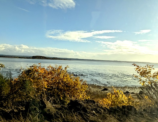
Your Piece of the Pacific Northwest Awaits in Grays Harbor!
NOTE: Click on the Approximate Coordinates link below to explore the area on Google Maps. Zoom in for a detailed view of local attractions, roads, etc., or zoom out for a wider perspective of the surrounding region.
Parcel ID: 012204300100
Legal Description: S ABER BROADWAY LOT 7 BLK 43
Acre: 0.07
State: Washington
County: Grays Harbor
Taxes: Under $9 per month
Approximate Coordinates: 46°57'37.4"N 123°47'02.7"W
Beach, forest, and fun—your lot awaits!
Situated on the southwestern edge of the Olympic Peninsula along the Pacific Ocean, Grays Harbor County, Washington offers a unique experience. Nowhere else can you enjoy the beauty of a pristine beach along the Pacific Ocean one hour and find yourself immersed in the lush rainforest the next.
Explore Grays Harbor County >>
Grays Harbor County is a haven for nature lovers, outdoor adventurers, and coastal explorers alike. This enchanting county serves as the Gateway to the Pacific Ocean and Washington's picturesque coastal wonderland!
This lot is located about a half mile to the Chehalis River. Enjoy river views, Highland Golf Course, several local parks, Grays Harbor National Wildlife Refuge, Johns River Walking Trails, and Bottle Beach State Park!
Grays Harbor boasts an impressive array of bodies of water, including harbors, lakes, streams, channels, canals, rivers, and, of course, the vast Pacific. Dive into a myriad of aquatic activities and more! If water adventures aren't your preference, embark on hikes into enchanting forests to observe wildlife in their natural habitat. Alternatively, explore the Quinault Rain Forest, one of just two temperate rainforests in the Northern Hemisphere.
Visit Grays Harbor: Bucket List! >>
Camp, kayak, walk, hike, you name it, Grays Harbor is untouched and waiting for you to explore!
NOTE: You are bidding only on Lot 7 within the parcel. Grays Harbor County has a tendency to change parcel numbers when properties are sold, so please understand that the property purchased will be the same, but the parcel number might change due to the county's accounting method.
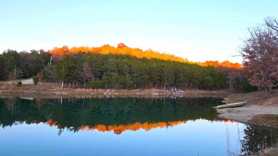
Michigan Lot Near Manistee Lake!
NOTE: Click on the Approximate Coordinates link below to explore the area on Google Maps. Zoom in for a detailed view of local attractions, roads, etc., or zoom out for a wider perspective of the surrounding region.
Parcel ID: 005-141-003-00
Legal Description: LOT 5 BLOCK B SECOND ADD TO CHIPPEWA BEACH SEC 35 T28N-R6W
Acre: 0.37
State: Michigan
County: Kalkaska
Taxes: Under $14 per month
Approximate Coordinates: 44°46'32.0"N 85°00'22.7"W
Kalkaska County is a scenic and rural area located in the northern part of Michigan’s Lower Peninsula. Known for its outdoor recreational opportunities, natural beauty, and rich local culture, the county offers a peaceful escape for residents and visitors alike.
Learn More About the County! >>
The county is home to over 80 inland lakes, including Torch Lake, Starvation Lake, and Bear Lake. These lakes provide ample opportunities for boating, fishing, swimming, and other water-related activities. Sleeping Bear Dunes National Lakeshore is about an hour away. One of the county's major natural features, the Manistee River, is a popular destination. The river is known for its clean, clear water and is especially famous for trout fishing.
Kalkaska County has miles of trails that are perfect for hiking, mountain biking, and horseback riding. Many of these trails wind through state forests, offering scenic views and wildlife sightings.
This lot is located in Coldsprings Township, just a short distance to Manistee Lake! The 800+ acre lake is a popular recreational location known for fishing, boating, water sports and more!
Kalkaska County is only about a 25-minute drive from Traverse City, one of Michigan’s top tourist destinations. Traverse City offers shopping, dining, and entertainment, along with its well-known wineries and proximity to Lake Michigan.
Overall Kalkaska County, Michigan, is a hidden gem in northern Michigan, offering natural beauty, a welcoming small-town atmosphere, and a wide variety of outdoor activities. With its forests, lakes, and rivers, the county is perfect for those who love fishing, hiking, snowmobiling, and simply enjoying nature. The affordable cost of living, rich history, and close proximity to Traverse City and other northern Michigan destinations make it an attractive place to live, visit, or invest in property. Whether you’re seeking adventure in the great outdoors or looking for a peaceful rural lifestyle, Kalkaska County offers something for everyone.
Elko County Beauty- 40 Acres of Open Land and Mountain Views!
NOTE: Click on the Approximate Coordinates link below to explore the area on Google Maps. Zoom in for a detailed view of local attractions, roads, etc., or zoom out for a wider perspective of the surrounding region.
Parcel ID: 007-13G-001
Legal Description: SE4NE4; TOWNSHIP 38 NORTH, RANGE 58 EAST, MDB&M SECTION 25
Acres: 40
State: Nevada
County: Elko
Taxes: Under $5 per month
Approximate Coordinates: 41°09'13.0"N 115°22'20.0"W
Elko County, in northeast Nevada, brings the drama of the high desert into vivid reality with its unspoiled nature, breathtaking vistas of the ruggedly beautiful Ruby Mountains, and its rich western history.
There are no shortages of activities to enjoy here: trips up Lamoille Canyon, boating or bird-watching at the Ruby Lake National Wildlife Refuge, down-and-dirty ATVing, out-of-this-world heli-skiing, rock climbing, mountain biking, hunting, fishing, backpacking, or hiking the rocky trails.
The city of Elko, the county seat, is known as "Nevada with Altitude". It is bordered by the towering, snow-capped Ruby Mountains, often called the Alps of Nevada, and the lush, glacier-carved Lamoille Canyon. The Ruby Mountains are flush with wildlife, mountain scenery, lakes, streams, and valleys.
Elko is where Nevada's real cowboys work and play, and the Wild West spirit is contagious. Elko is ranked as one of the Top True Western Towns, but the events in Elko go beyond its western roots. Every July is the annual National Basque Festival, a nod to the rich Basque history and culture that brought sheepherding to the area.
Today, visitors to Elko can explore Nevada's roots in mining, ranching, and native culture with a stop at the Northeastern Nevada Museum, Western Folklife Center, or the Sherman Station Visitor's Center. Don't forget to take a tour to see firsthand one of the area's many gold rush ghost towns.
View this Elko County Video >>
Learn about the history of Elko County >>
This is an excellent opportunity to own a beautiful piece of land in one of the most stunning areas of Nevada!
Invest in Charlotte County, Florida!
NOTE: Click on the Approximate Coordinates link below to explore the area on Google Maps. Zoom in for a detailed view of local attractions, roads, etc., or zoom out for a wider perspective of the surrounding region.
Parcel ID: 402536327001
Legal Description: DEL VERDE SEC O BLK 1 LT 15 DC645/341-350 DC646/1086
Acre: 0.13
State: Florida
County: Charlotte
Taxes: Under $3 per month
Approximate Coordinates: 26°57'10.8"N 81°46'14.8"W
This partially wooded lot is close to Shell Creek, which empties into the Peace River. The river is more than 100 miles long, originating between Tampa and Orlando and emptying into Charlotte Harbor estuary at Punta Gorda in Charlotte County.
Learn about Shell Creek Preserve >>
Charlotte County is a water lover's paradise, kissing the Gulf Coast and delivering an incredible variety of activities for everyone!
Experience a Florida Camping and Canoe Adventure on the Peace River >>
Port Charlotte, FL Video Tour: Affordable Resort - Town Living >>
Top 19 Things To Do in Port Charlotte, Florida >>
Check out Charlotte County Recreation Programs >>
This peaceful location is near the Peace River Nature Preserve and its ample nature trails. Be sure to visit one of the nearby county parks for bird watching.
See the Florida Birding Trail >>
The lot is zoned Agriculture. Homes are a permitted use.
See the Agriculture Zoning District Permitted Uses >>
NOTE: The county does not permit living in RVs at any time unless a house has been constructed on the lot.
Ozark Acres Opportunity: 11 Adjacent Lots - Build, Invest, Thrive!
Parcel ID/Legal Description: See Photo for Property Details
Acres: 3.03 Acres in Total
State: Arkansas
County: Sharp
Taxes: Under $110 per month
Welcome to the enchanting community of Ozark Acres, surrounded by beautiful lakes, rivers and rolling hills! Ozark Acres is surrounded on all sides by thousands of acres of virgin timberland in which wildlife of many kinds can be observed purely for enjoyment or hunting.
A residential structure may be constructed on these lots as long as the house sizes are a minimum of 500 square feet and complies with the zoning set forth in the Ozark Acres Bill of Assurance: Highland Addition.
Escape the hustle and bustle of urban life and immerse yourself in the serene beauty in harmony with nature. The natural beauty surrounding the property is truly captivating, featuring lush greenery, gentle rolling hills, and a diverse array of wildlife. Nature enthusiasts and outdoor lovers will relish in the abundant recreational opportunities, from hiking trails to fishing spots and nearby lakes for water sports. The community contains multiple parks, two lakes, as well as a beach with great views of the larger Lake Vagabond. And the Spring River is only a few miles away!
The Clubhouse conducts many activities throughout the year, as well as group activities monthly.
The quaint town of Hardy built on the banks of the Spring River, a popular tourist spot since the early 1900’s is only six miles from Ozark Acres. This is an ideal location for having the best of both worlds…far enough from larger towns to enjoy the quaint rural living but close enough for additional conveniences.
The Spring River is a couple of miles from Ozark Acres. The river itself is formed from the enormous Mammoth Spring, located within a stone’s throw from Hardy. The Spring River is a great trout fishing spot, it’s a very popular floating and party river in the warmer swimming months. It’s stocked by a nearby hatchery, so the locals freely come and usually keep their catch. The river is crystal-clear, with long pools and whitewater falls. The scenery is mostly hardwood forest with some rocky bluffs. Access is from U.S. 63, which parallels much of the river.
Whether you're seeking a peaceful retreat or a solid investment opportunity, these properties in Ozark Acres promises to fulfill your desires. Escape the hustle and bustle of urban life and immerse yourself in the serene beauty of Sharp County, Arkansas. Embrace the chance to build the haven you've always envisioned and relish the simple joys of a life well-lived in harmony with nature.
NOTE: Real estate taxes are current. The buyer will be responsible for all real estate taxes billed on March 1, 2025 that will be due October 15, 2025.
Fulton County's Hidden Gem: Cherokee Village Awaits!
NOTE: Click on the Approximate Coordinates link below to explore the area on Google Maps. Zoom in for a detailed view of local attractions, roads, etc., or zoom out for a wider perspective of the surrounding region.
Parcel ID: 260-16036-000
Legal Description: Subdivision: Omaha Lot: 1 Block: 5
Acre: 0.30
State: Arkansas
County: Fulton
Taxes: Under $12 per month
Approximate Coordinates: 36°18'50.2"N 91°36'08.2"W
Imagine living in this beautiful four seasons serene location in the Arkansas Ozarks!
A home may be constructed on this lot as long as the house size is a minimum of 1,000 square feet and complies with the zoning set forth in Cherokee Village Zoning "Bill of Assurance": Omaha Addition
In addition, Airbnbs are also an acceptable use! In fact, this community has some already and the process of registering for the license is simple and costs under $40.
Considering retirement, a new start for your family, just ready for a change, or looking for a part-time retreat? Cherokee Village offers small town charm, first-class outdoor recreation amenities and affordability. Take advantage of the low taxes, low cost of living and low housing costs. Your housing dollars stretch further here.
Experience Cherokee Village >>
Cherokee Village is the perfect backdrop for your next adventure. Come enjoy the lakes, river, golf courses, parks, trails, RV and campground. With more than 13,000 acres set among the rolling hills and pristine natural beauty of the Arkansas Ozarks, Cherokee Village has something to offer all ages.
Soak up the sun on the private beach, hit the links on two private 18-hole golf courses, jump right into any of the six swimming pools, go RVing and camping, take a swing at pickleball and tennis, spend the day fishing, walk any of the nature trails, workout at the fitness center, meet some new friends at the senior center, cycle, hike, or just relax in a hammock!
Boat, fish and play on any of the seven lakes. Enjoy the year-round spring-fed South Fork River that flows into neighboring Spring River. Both rivers rank among the Ozark region’s most popular destinations for floating and trout and walleye fishing.
Don’t miss your chance to own a piece of this hidden gem in the heart of the Arkansas Ozarks!
NOTE: Real estate taxes are current. The buyer will be responsible for all real estate taxes billed on March 1, 2025 that will be due October 15, 2025.
Retreat to Michigan's Scenic Lake Miramichi Community!
NOTE: Click on the Approximate Coordinates link below to explore the area on Google Maps. Zoom in for a detailed view of local attractions, roads, etc., or zoom out for a wider perspective of the surrounding region.
Parcel ID: 03 384 552 00
Legal Description: LOT 552 LAKE MIRAMICHI SUBD #4
Acre: 0.39
State: Michigan
County: Osceola
Taxes: Under $2 per month
Approximate Coordinates: 43°49'39.6"N 85°16'51.4"W
This wooded lot is located off of Pawnee Trail in the Lake Miramichi community, a short stroll to Miramichi Lake, in Osceola County, Michigan.
Learn All About the Lake Miramichi Community >>
Lake Miramichi is a private, well planned, waterfront community with an active Property Owners Association that manages the private lake and is responsible for upkeep of the roads, parks, clubhouse, and dams, which are between the larger lake and “little” Lake Miramichi. Lake Miramichi is in Evart Township.
Miramichi Lake and the smaller, quiet Little Miramichi Lake each have boat launches and park areas. Relax at the sandy swimming beach, playground, beach house and pavilion. Dock your boat at the full service marina available, if your lot is without lake frontage. Enjoy a nice four mile hike, walk, jog, or bike around the lake.
The homes, approximately 160, vary between simple seasonal cabins to beautiful year-round homes with great views of the hilly countryside or the many fantastic views of the lake.
Scenic Miramichi Lake, covering 210 acres, offers all sport activities and great fishing for bass, bluegill, perch, crappie, walleye and catfish. Little Miramichi Lake is a 30 acre fishing and swimming lake with no motors allowed. It is known for its beautiful natural setting, wooded surroundings, peace, serenity and excellent fishing.
Osceola County contains the highest point in Michigan’s Mid-Western Lower Peninsula and is also known for trout fishing. Yet, Osceola County still retains its tradition, and gives its residents the opportunity to enjoy the benefits of small community living, while at the same time having access to the amenities found in larger urban areas.
Learn More About Osceola County, Michigan >>
Don’t pass this up!
NOTE: The Lake Miramichi Property Owners Association (LMPOC) manages this community. The annual fee for 2025 is $238 and will become the responsibility of the buyer.
Secure Your Stake in New Mexico's Growing Market!
NOTE: Click on the Approximate Coordinates link below to explore the area on Google Maps. Zoom in for a detailed view of local attractions, roads, etc., or zoom out for a wider perspective of the surrounding region.
Parcel ID: 1020033060217304110
Legal Description: RIO DEL ORO Lot: 11 Block: 18 Unit: 22 .25 AC
Acre: 0.25
State: New Mexico
County: Valencia
Taxes: Under $5 per month
Approximate Coordinates: 34°43'48.3"N 106°33'10.6"W
This warm-weather location has the country buzzing about it!
July 2024 Update: Approval was recently granted to rezone 268 acres of vacant land, primarily located between NM47 and 304, for manufacturing operations. This bodes well for the continued growth of Valencia County. Development usually breeds development, development brings jobs, and jobs bring people, usually families, who need housing!
Valencia County Welcomes You! >>
Drive the Rio Del Oro Loop! >>
In addition to being rich in culture and a great place to raise a family, Valencia County is experiencing a great deal of economic prosperity. There are so many new and exciting things happening to this already charming location, you cannot miss the chance to buy your land in Valencia County today!
Tens of thousands of new jobs are coming to Los Lunas. Facebook (Meta's) new facility opened in 2019 and continues to grow and generate additional economic benefits to the surrounding areas. The White House recently provided a grant to develop infrastructure for a huge new manufacturing facility. A new rail park is also under development.
Of course, more jobs in this sizzling investment area means greater demand for land.
Facebook (Meta) announces $800M expansion plan for Los Lunas Data Center >>
Once the expansion is completed, the Facebook (Meta) Data Center will employ 400 employees and provide significant economic benefits to the local community.
Facebook (Meta) Los Lunas Data Center and Facebook (Meta) Los Lunas Data Center Drone Video >>
New Facebook (Meta) Data Center + Booming Business in Los Lunas >>
In addition, the Cibola National Forest covers more than 1.6 million acres in New Mexico, with elevations ranging from 2,700 feet to over 11,300 feet. If you and your family enjoy picnicking, backpacking, camping, skiing, hiking, wildlife-viewing, star-gazing, horseback-riding, hunting, or mountain biking, Cibola National Forest has plenty to offer you.
See the Beautiful Mountains of Valencia County >>
Don't miss your opportunity to invest in the future of Valencia County!
NOTE: Approximately $90 in back taxes will be the responsibility of the buyer.
Tranquil Buildable Michigan Lot Near Townline Lake, Montcalm County.
NOTE: Click on the Approximate Coordinates link below to explore the area on Google Maps. Zoom in for a detailed view of local attractions, roads, etc., or zoom out for a wider perspective of the surrounding region.
Parcel ID: 004-230-506-00
Legal Description: 639-876 LOTS 506 & 507 HONEYMOON HEIGHTS NO 3.
Acre: 0.33
State: Michigan
County: Montcalm
Taxes: Under $14 per month
Approximate Coordinates: 43°27'41.4"N 85°12'46.8"W
Nature, lake, and space to build—welcome to Montcalm County!
This community is in Cato Township, Montcalm County, Michigan, a small, rural community situated in the west-central part of Michigan's Lower Peninsula.
The township is predominantly rural, with large areas of farmland, forests, and small lakes. Its peaceful, open spaces make it an ideal location for those who appreciate a slower pace of life and a connection to nature.
Home to several small lakes, it provides opportunities for fishing, boating, and other water-related activities. These lakes are popular for both residents and visitors looking for quiet, recreational water experiences.
This lot is on Birch Drive within the Honeymoon Heights Owners Association. Members have access to the lake, clubhouse, and parks! Docks at the parks were recently installed in 2023! A recreational trailer, motor home, or camper may be placed on any lot for a period of time not to exceed 14 consecutive days in any one calendar year. If your plan is to build, all residential buildings shall have a minimum ground floor living area of 750 square feet and will require a well and septic system. An RV can be parked on your lot for three months while a structure is being constructed.
Montcalm County offers various hiking trails and outdoor spaces to enjoy Michigan’s natural beauty and wildlife. This area is a popular spot for hunting and fishing, with local wildlife including deer, turkey, and small game, along with well-stocked lakes for fishing.
The county benefits from proximity to Lakeview, a small village with basic services such as schools, shops, healthcare, and restaurants. Lakeview offers the conveniences of a larger town while maintaining a small-town feel. It is also about an hour's drive from Grand Rapids, one of Michigan’s largest cities, and about 90 minutes from Lansing, Michigan.
Overall, this area is an idyllic rural community that offers the charm of small-town living with a strong connection to nature and agriculture. Its scenic landscapes, affordable cost of living, and proximity to lakes and outdoor activities make it a desirable place for those who enjoy quiet, peaceful living. Whether you’re looking for a place to raise a family, retire, or simply get away from the city, Montcalm County provides a relaxing and inviting rural environment in the heart of Michigan.
Don’t miss your chance to own a peaceful piece of Pure Michigan!
NOTE: Honeymoon Heights Owners Association's annual dues are just $25. An additional $50 of outstanding dues will become the buyer's responsibility.
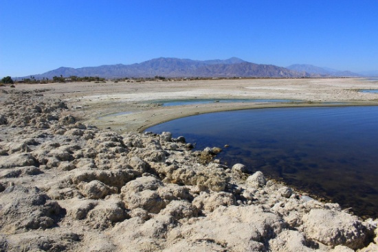
California Sand, Sun & Serenity - 0.22 Acre Lot Near the Salton Sea!
NOTE: Click on the Approximate Coordinates link below to explore the area on Google Maps. Zoom in for a detailed view of local attractions, roads, etc., or zoom out for a wider perspective of the surrounding region.
Parcel ID: 017-380-032-000
Legal Description: LOT 148 DESERT HILLS TRACT NO 1 T11S R10E
Acre: 0.22
State: California
County: Imperial
Taxes: Under $3 per month
Approximate Coordinates: 33°10'36.2"N 115°56'32.2"W
Your adventure starts here with this 0.22-acre lot near California's top outdoor spots!
This parcel is located about 40 minutes from the Salton Sea and Bombay Beach, which has been turned into a beautiful artist hub. Park your RV and camp out at Salt Creek!
Salton Sea Camping at Salt Creek >>
The Imperial Sand Dunes Recreation Area, the largest dune complex in California, extends more than 40 miles along the eastern edge of the Imperial Valley, split by Highway 78. Off-road vehicles are permitted. To the north, (the green section on the map), you are free to walk but there’s no sign or trailhead.
See the Algodones Sand Dunes >>
Cibola National Wildlife Refuge straddles the border of California and Arizona. It has an abundance of wildlife watching and nature trail opportunities. Take the Canada Goose Drive for an excellent opportunity for wildlife viewing and photography. On the accessible walking trail, you might see song birds, bobcats, quail, and mule deer. Anglers can fish for largemouth bass, smallmouth bass, striped bass, channel catfish, flathead catfish, crappie, sunfish, tilapia, and common carp. Public hunting on Cibola National Wildlife Refuge is permitted in specified areas.
Experience the Cibola National Wildlife Refuge >>
Head to the city of Brawley, ranked in the top 10 fastest growing cities in California, for provisions, food and entertainment!
Learn about the City of Brawley >>
Explore your adventurous spirit!
Your Missouri Camping Escape Near Truman Lake!
NOTE: Click on the Approximate Coordinates link below to explore the area on Google Maps. Zoom in for a detailed view of local attractions, roads, etc., or zoom out for a wider perspective of the surrounding region.
Parcel ID: 07-9.0-29-002-017-049.00
Legal Description: Lot 34, Blk 51 Plat 13, TOH
Acre: 0.41
State: Missouri
County: St. Clair
Taxes: Under $3 per month
Approximate Coordinates: 38°06'54.0"N 93°35'05.6"W
Discover your perfect getaway with this 0.41-acre camping lot!
This lot is located in Twin Oaks Harbor, a gated community in Jackson Township, St. Clair County, Missouri. This community features camping lots with favorable rules for camping enthusiasts.
The community is located about 120 miles southwest of Kansas City. St. Clair County is a peaceful, rural, agricultural county with a population of under 10,000 but offers a myriad of outdoor opportunities. Appleton City and Osceola are the largest towns in the county.
Activities in St. Clair County, Missouri >>
The Harry S Truman Reservoir, also known as Truman Lake, offers exceptional outdoor recreational opportunities. It is great for boating, fishing, hunting, camping, hiking/biking and just exploring nature at its finest. Truman Lake encompasses 259 square miles of land and water covering portions of four counties: Benton, Henry, Hickory and St. Clair.
Plenty To Do at Truman Lake >>
Twin Oaks Harbor community amenities include a small lake that is stocked for fishing (boats are allowed as long as they are not gas-powered), an in-ground pool, a playground with new equipment, two bath houses with hot and cold running showers, trash dumpsters and road maintenance. ATVs, golf carts, etc. are permitted on the common roads.
This camping lot is for recreational use but is NOT permitted to be used as a residence (so no one can live there). Campers are allowed. No other structures are permitted on this lot.
Fresh air, a warm fire & a starry night are waiting for you!
NOTE: Twin Oaks Harbor Property Owners Association imposes an annual fee of $282.00 for a single lot covering its fiscal year of May 1 – April 30. The 2024 annual POA dues are paid through April 2025. The buyer will be responsible for 2025-2026 fiscal year dues. A copy of the Covenants & Restrictions is available upon request!
Build Here in California & Discover its Beauty!
NOTE: Click on the Approximate Coordinates link below to explore the area on Google Maps. Zoom in for a detailed view of local attractions, roads, etc., or zoom out for a wider perspective of the surrounding region.
Parcel ID: 038-102-021-000
Legal Description: Lot 16, Block 14, California Pines Unit 4, a subdivision of the County of Modoc according to the official Plat thereof, filed in Book 2 of Maps in Modoc County Records.
Acres: 1.15
State: California
County: Modoc
Taxes: Under $28 per month
Approximate Coordinates: 41°15'41.4"N 120°44'04.2"W
Escape to nature with this 1.15-acre lot in the peaceful California Pines community!
Tucked in the northeast corner of California, Modoc County borders Oregon to the north and Nevada to the east. It is one of California's least populous but largest counties. Picturesque landscapes, including mountains, forests, and lakes await you here!
The Modoc National Forest, Lava Beds National Monument, Bly Tunnel Tree, Glass Mountain, Medicine Lake, Lassen Volcanic National Park, Tule Lake National Wildlife Refuge & Modoc National Wildlife Refuge are among the region's popular destinations for outdoor enthusiasts.
What to Do and See in Modoc County >>
Modoc County is relatively isolated, and transportation options are limited. State Route 299 is the primary road connecting the county to the rest of California.
This lot is located in the Hill Unit #4 of California Pines, an off-the-grid community located about 30 miles southwest of the one square-mile city of Alturas. The elevation in the hill units varies from 5,000 to 6,400 feet. All the roads are gravel roads.
RVs and camping are permissible for up to 30 days of a calendar year. If you are considering constructing a home, please note that the living space must be no less than 500 square feet.
Construction in the hill units will require a private well and septic system. If there is electricity in the area, it can be extended to your lot. Power is obtained through Surprise Valley Electric. Solar & wind turbine are also allowed.
Development Restrictions for Hill Unit 4 >>
Things to Do Before Building in California Pines! >>
California Pines covers 15,000 acres surrounded by 2 million acres of the Modoc National Forest. California Pines is primarily a residential community, offering a small mix of permanent residences and vacation homes. Many people are drawn to the area for its rural and natural surroundings. California Pines is a peaceful, uncrowded forested retreat with pine trees, meadows, and several small lakes allowing for relaxation & recreational water activities; a place to escape and become part of a tranquil and laid-back community. The community is also served by a 4,400 foot airstrip.
See the California Pines Lodge >>
California Pines allows you to bask in peace & solitude. Put your phone down, leave your doors unlocked & become one with nature here in California Pines!
NOTE: The California Pines Property Owners Association maintains common areas for the benefit of the property owners, residents and the general public. The 2025 annual POA fee is $105 and will become the responsibility of the buyer.
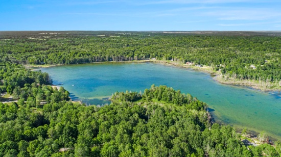
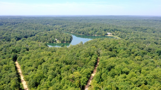
Invest in 3 Buildable Lots in Lakes of the North, MI!
Parcel IDs/Legal Descriptions:
05-13-325-120-00: LOT 127 PLAT OF PINE VIEW NO 1
05-13-325-136-00: LOT 143 PLAT OF PINE VIEW NO 1
05-13-325-157-00: LOT 164 PLAT OF PINE VIEW NO 1
Enjoy the four seasons in the Lakes of the North community in Antrim County. This peaceful and quiet location transforms seasonally from snow-covered white in winter, to spring green, to comfortable summer days, then magnificent shades in fall. The community is located about 30 minutes from Boyne Mountain Resort and Shanty Creek Resort; and 60 minutes from Traverse City or 25 minutes from Gaylord.
Things to See & Do in Antrim County! >>
Lakes of the North is a group of 19 subdivisions that straddles the Otsego-Antrim county line.
Learn About Lakes of the North Association >>
Amenities include an 18-Hole Golf Course, Pro-Shop, full-service Restaurant/Tavern all of which are Open to the Public. Member exclusive areas include Pencil Lake and Harold Lake beach access and beach houses, Activities Clubhouse with a Pool, Whirlpool, Water Slide, along with two outdoor Tennis/Pickleball Courts, Shuffleboard, Horseshoes and playground.
The Winter Sports area has an Ice Rink, Cross Country Ski and Snowshoe trails which serve as hiking trails in the summer.
Campers Village is an all-season facility for members to enjoy with their camper.
Throughout and surrounding Lakes of the North you will find hundreds of miles of ATV/Snowmobile Trails to ride on.
This package of three buildable lots, totaling 0.99 acre, is located in the Pine View No 1 subdivision.
Each vacant lot in Lakes of the North is buildable and is rural in character. All building plans need approval by the association's Architectural Control Committee. Lots do not have water, septic, or electricity. Construction would require a private well and sewage disposal system. If there is electricity in the area, it can be extended to your lot.
Building restrictions include a minimum square footage that varies by subdivision. Mobile homes, trailers, camping and storage are prohibited on all vacant lots. Commercial use is also prohibited (including for rentals and short-term rentals).
For complete building information, please see Lakes of the North Restrictive Covenants, paying particular attention to Article VI (Architectural Control Committee) and Article VII (Building and Use Limitations).
Lakes of the North is known for its picturesque landscapes, featuring serene lakes surrounded by lush forests and offering a peaceful retreat for residents and visitors alike. Bid now!
NOTE: The Association’s 2025 annual assessment is $380 for the primary lot and $214 for subsequent lots. This fee covers the period from April 1, 2025 to March 31, 2026. The buyer will be responsible for payment of the amount of the annual assessment in the fiscal year when the deed is recorded. The buyer must also register with the Association as a land owner by completing the required document (to be provided along with the recorded deed).
Ozark Acres, Arkansas - Your Dream Starts Here!
NOTE: Click on the Approximate Coordinates link below to explore the area on Google Maps. Zoom in for a detailed view of local attractions, roads, etc., or zoom out for a wider perspective of the surrounding region.
Parcel ID: 448-00090-000
Legal Description: Subdivision: HIGH LAKE ADDN Lot: 7 Block: 5
Acre: 0.26
State: Arkansas
County: Sharp
Taxes: Under $8 per month
Approximate Coordinates: 36°18'15.1"N 91°23'48.1"W
Build your dream in the heart of the Ozarks!
Discover a wonderful opportunity to own a picturesque buildable lot in the enchanting community of Ozark Acres, located in the heart of Sharp County, Arkansas. Nestled amidst the beauty of the Ozarks, this property offers an idyllic setting for creating your dream retreat or permanent residence.
A home may be constructed on this lot as long as the house size complies with the zoning set forth in Ozark Acres Bill of Assurance. High Lake Addition
Set within a friendly and well-established neighborhood, this location provides the perfect blend of rural tranquility and easy access to modern conveniences. With ample space to accommodate your vision, you can design your ideal home, whether it be a cozy cabin or a spacious abode.
The natural beauty surrounding the property is truly captivating, featuring lush greenery, gentle rolling hills, and a diverse array of wildlife. Nature enthusiasts and outdoor lovers will relish in the abundant recreational opportunities, from hiking trails to fishing spots and nearby lakes for water sports.
Whether you're seeking a peaceful retreat or a solid investment opportunity, this property in Ozark Acres promises to fulfill your desires. Escape the hustle and bustle of urban life and immerse yourself in the serene beauty of Sharp County, Arkansas. Embrace the chance to build the haven you've always envisioned and relish the simple joys of a life well-lived in harmony with nature.
Your peaceful retreat is waiting!
NOTE: Real estate taxes are current. The buyer will be responsible for all real estate taxes billed on March 1, 2025 that will be due October 15, 2025.
